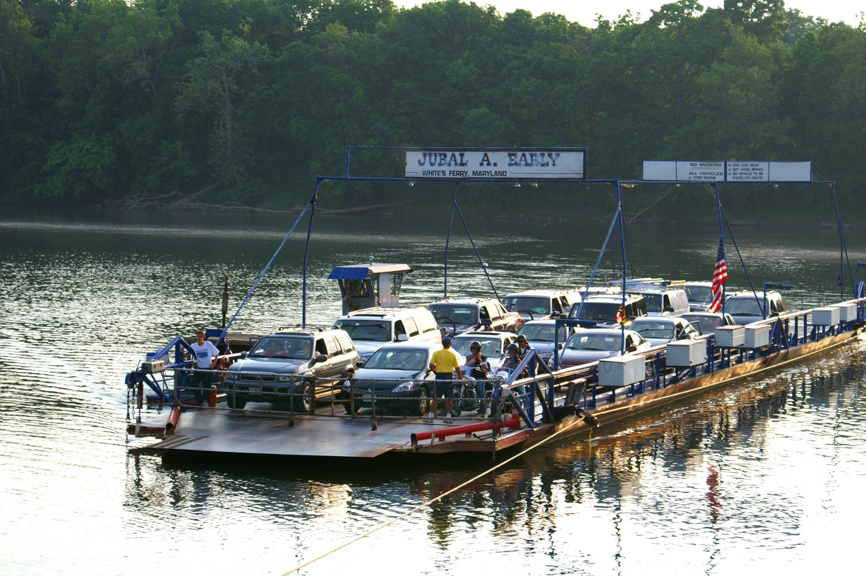
 White's Ferry is a great landmark to shoot for if you want to do an 80 mile bike ride from D.C. to
Leesburg and back. This little fifteen car ferry
makes you feel that you have travelled back into an earlier, simpler, quieter time.
White's Ferry is a great landmark to shoot for if you want to do an 80 mile bike ride from D.C. to
Leesburg and back. This little fifteen car ferry
makes you feel that you have travelled back into an earlier, simpler, quieter time.
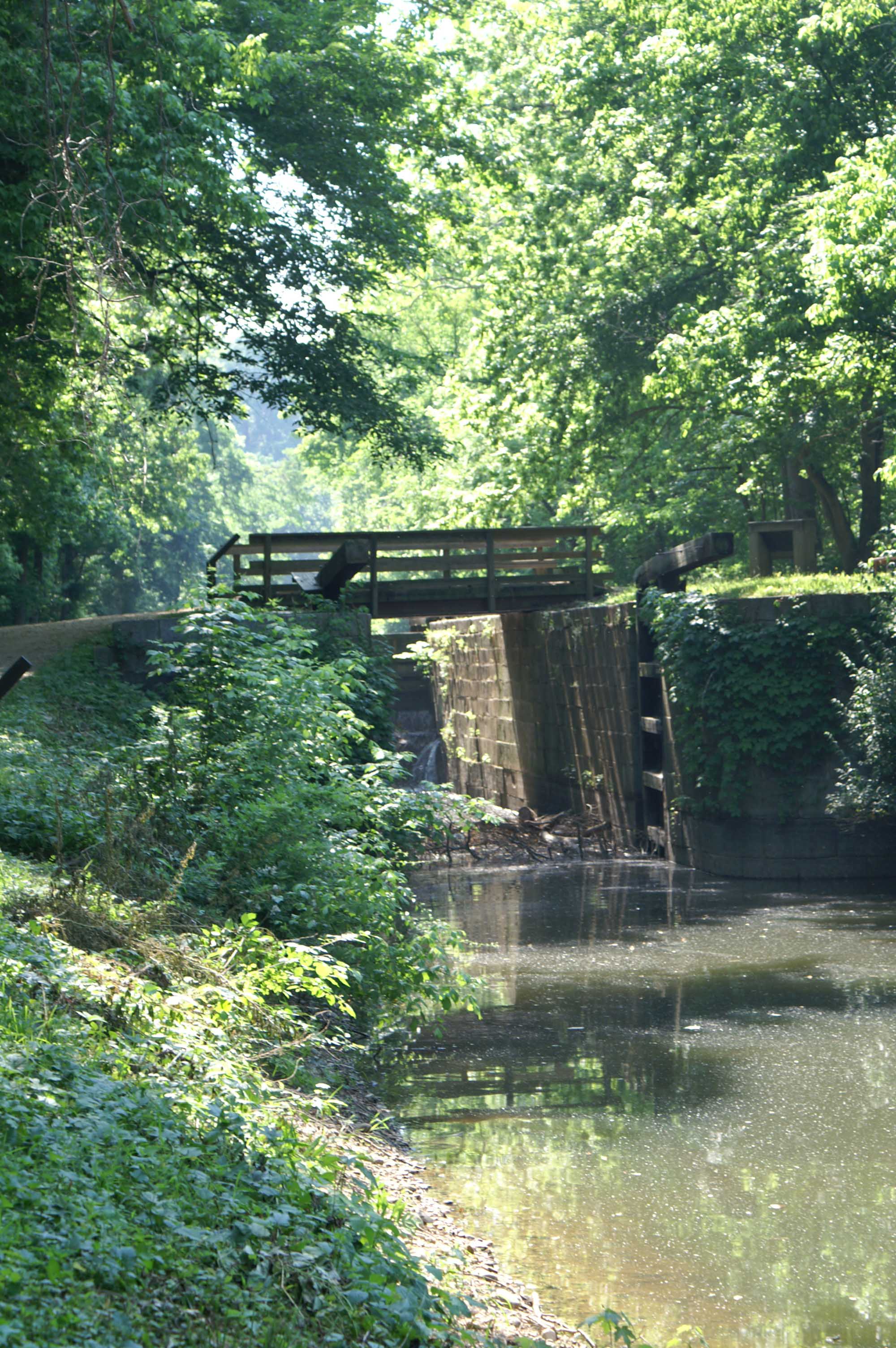
The C & O Canal
Where It All Began
About 1969
184 miles
This trip is where it all began.
The Cheasapeake and Ohio Canal travels 184 miles from the Georgetown section of Washington, D.C. to Cumberland, Maryland. It never reached the Ohio River. The canal tow path, a ribbon of green, generally follows the Potomac River. Sections of the canal (including the first 15 miles from Georgetown to Great Falls and a section in Cumberland) are still watered. In the late 1950's, Supreme Court Justice William Douglas hiked the tow path and recruited influential people of the day to walk with him. This hike helped turn the canal into a national park rather than the right of way for a freeway out of D.C. Travelling the canal offers a rare combination of woods, Potomac River views, the sound of tumbling water, wildlife, history, civil engineering (aqueducts, tunnels, guard locks, etc.), and physical exercise.
When I was in Boy Scouts, my troop, Troop 32, went on a bike trip along the C and O. It was my first long distance bike trip. Maybe it took place in 1969 or 1970, I don't remember. My dad was one of the Scout Masters that came on the trip.
I remember a few annectdotes about this first trip. Once, several of us scouts were exploring a farm near our evening campsite. We found a big fat pig in a field, and threw a little stone at it. The big pig (turns out it was a sow) ran over and killed some of her baby pigs (we found this out later). We scrambled up a steep bank to escape the approaching farmer and at the top we all grabbed onto an electrified fence. Thoroughly energized by then, we got away. Our uniforms gave us away, though, and soon the farmer found our camp. Much to our surprise, we didn't get in trouble. Instead the farmer told us a story about stealing watermelons when he was young, and how he often was found floating down the Potomac, holding onto a watermelon, with buckshot showering down into the river around him. Well, at least we learned not to throw stones at sows. (Bad as the stone throwing incident was, I don't think any of us has turned into serial killers later in life.)
I also remember that one night on this trip, it got cold and started to snow. We were near Paw Paw, West Virginia, site of the longest tunnel on the C and O (~MP 157). Faced with a group of young, cold, wet scouts, one of the scout masters talked a gas station owner into letting us spend the night above the gas station. We thought that was pretty cool.
We didn't finish the entire 184 miles that trip, but a few months later Troop 32 returned to complete the rest of the C and O Canal.
Since that first trip, the C & O remains an important place for me, and I return often to run and bike. And
I've continued to enjoy being outdoors and biking ever since.
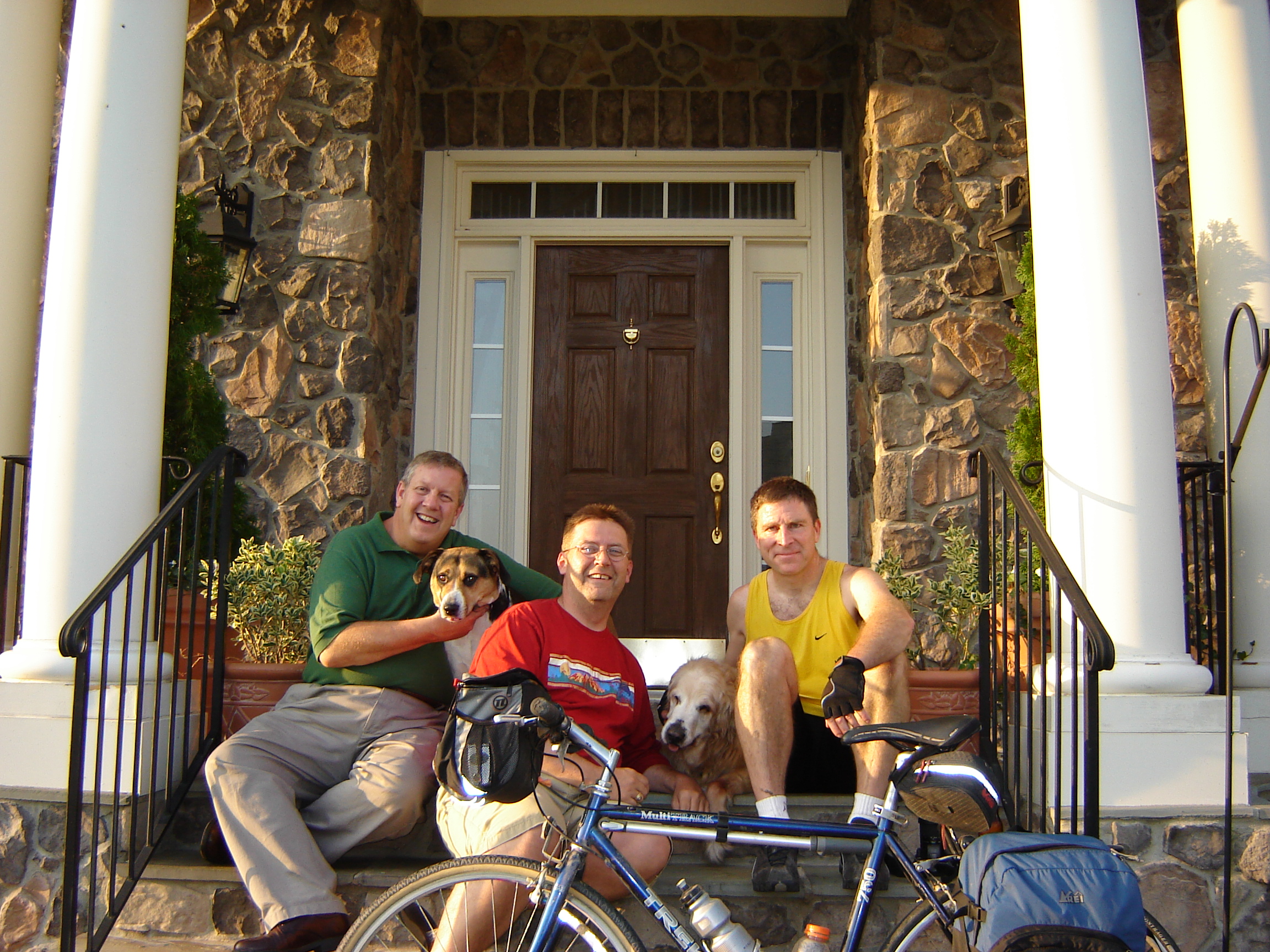 Kelly, Joe, Trooper, Little Bit and me at Kelly and Joe's house north of Leesburg, Va.
My most recent trip on the C & O was from my house in Arlington, Virginia to the canal in Georgetown, and out the
canal to White's Ferry. I crossed the Potomac on White's Ferry and finished up with dinner and a place to sleep
at the house of my friends, Kelly and Joe,
just north of Leesburg, Va. (42 miles, May 29, 2006)
White's Ferry is a great landmark to shoot for if you want to do an 80 mile bike ride from D.C. to
Leesburg and back. This little fifteen car ferry
makes you feel that you have travelled back into an earlier, simpler, quieter time.
Once, my friend Ralph and I decided to ride from Harpers Ferry to Washington, D.C. We were training for
an AIDS Ride. I told Ralph it would be fun to ride the 40 miles from Harpers Ferry to D.C.
The first sign of
trouble was the 62 mile post marker we saw just outside of Harpers Ferry. (Just a slight
underestimate of the distance.) Plus, we didn't exactly bring that much
food for a 40 mile trip much less a 62 mile trip. Ralph generously shared
what little food he had (I think it was a
single power bar.) "Not to worry, Ralph, we can get food at the little store at White's Ferry (MP 35)," I said
confidently.
Except that when we arrived at White's Ferry, the store was shuttered. A drink machine stood next to the closed
store. I remember Ralph and I debating which soft drink would have the most sugar/calories. Between us,
we only had
enough change to buy one drink. We settled on grape soda as the most likely to give us new strength. "Not to
worry, there is a snack shop at Great Falls (MP 15) that's open til 5," I offered.
Well we didn't
really get worried until it was about ten to five and we still weren't at Great Falls. We
made it to the snack shop just
seconds before it closed, and that the only things left for sale that day were a couple of hot dogs. Not a
fan of sauerkraut, I think we got everything, including sauerkraut, on those dogs; we needed food; we
needed every calorie we could get.
The good news is that Ralph survived and still is a great friend -- though I assume he always feels
nervous when I mention biking on
the C and O!!!
I was training for the Boston New York AIDS Ride in 1995. Herb dropped me off in Harpers Ferry (MP 62), and I was going to
ride to Brunswick (~MP 125), while Herb drove out to Brunswick. The plan was for us to meet a friend, Linda, in
Colfant, a rustic mountain resort
just south of Brunswick. Well, a flat tire slowed things down. And one thing lead to another. I wasn't making
much
progress. The sun went down. No sweat. I can use the light from the stars and moon to navigate. Then it got cloudy.
And pitch black dark. If I rode fast, I faced hitting
a fallen branch (a recent series of strong thunderstorms had left trees and limbs across the trail),
bump, or missing the trail. If I rode slowly, I would never get to
Brunswick. I began steering by sound.
If I was hearing the sound of wheels crunching on crushed rocks,
I was in one of the two parallel tracks on the towpath. If I heard muffled sound, I was on the
grass between the parrallel
tracks or ready to ride off the edge of the towpath into the canal.
By a stroke of luck I saw a lantern and two fisherman walking along the canal. I
asked them how far to Brunswick. "You just passed it"! What luck, otherwise I'd probably have ridden
miles and miles further.
Once into Brunswick, I went to the convenience store to get something to eat and leave a phone message
saying I was alright.
At that moment Herb and Linda drove up in their car, to rescue me. Everyone was smiling broadly.
Then Herb and Linda called the National Park Service requesting that they not send a ranger down the canal to find me.
For information on the Chesapeake and Ohio Canal, visit the
Combining the C and O canal tow path, crossing the Potomac at White's Ferry, and then taking the Washington
and Old Dominion Rail Trail back to Washington, D.C. also makes a great 80 mile round trip. See my page on the
Last Update: June 16 2006
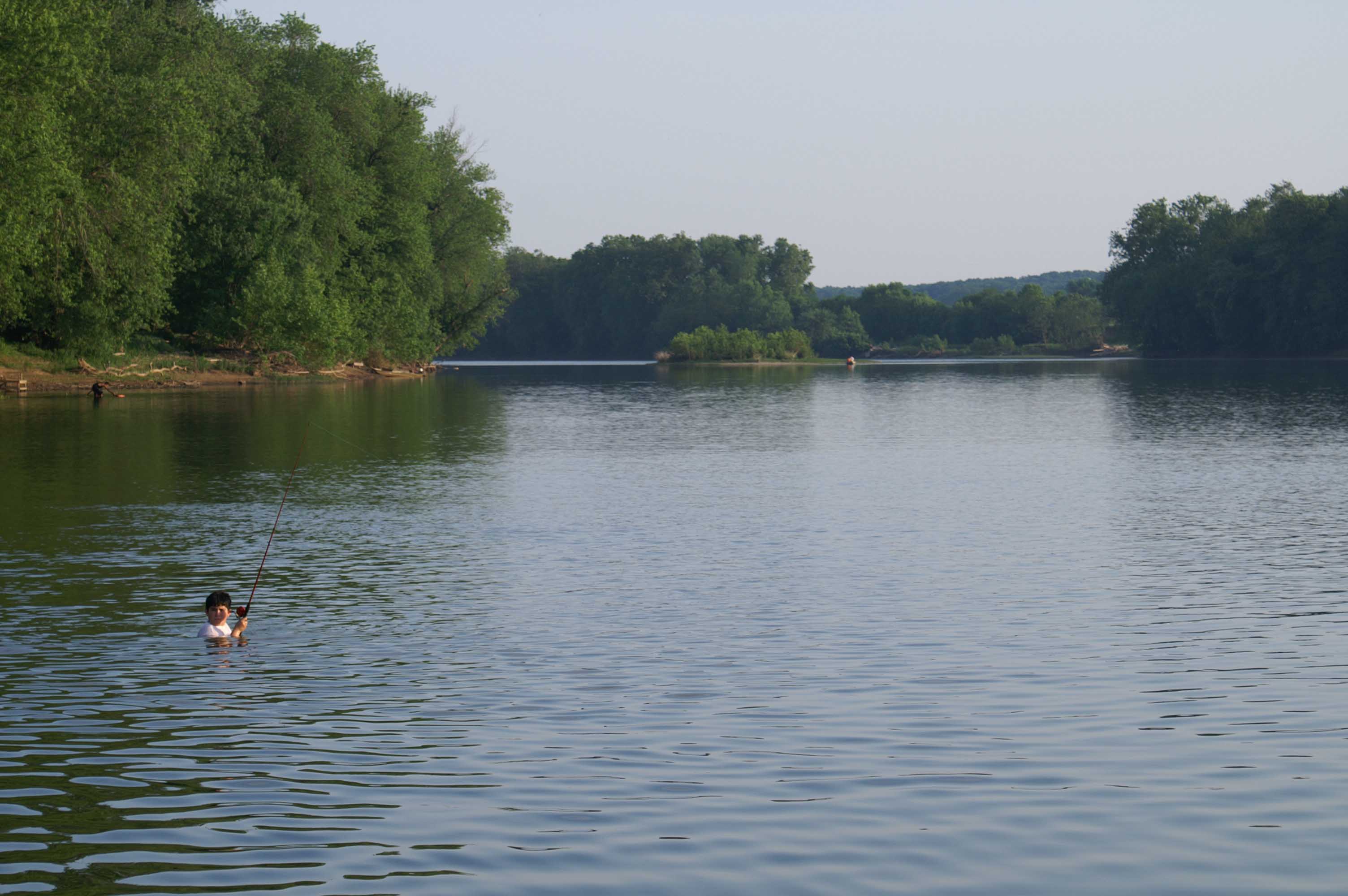 A view of the Potomac River from the ferry boat, the Jubal A. Early. Washington is blessed with little industrial
history and large sections of the middle Potomac River are held by government agencies as parks or refuges. Within a short distance
of leaving georgetown, you can feel you are miles away from the city.
A view of the Potomac River from the ferry boat, the Jubal A. Early. Washington is blessed with little industrial
history and large sections of the middle Potomac River are held by government agencies as parks or refuges. Within a short distance
of leaving georgetown, you can feel you are miles away from the city.
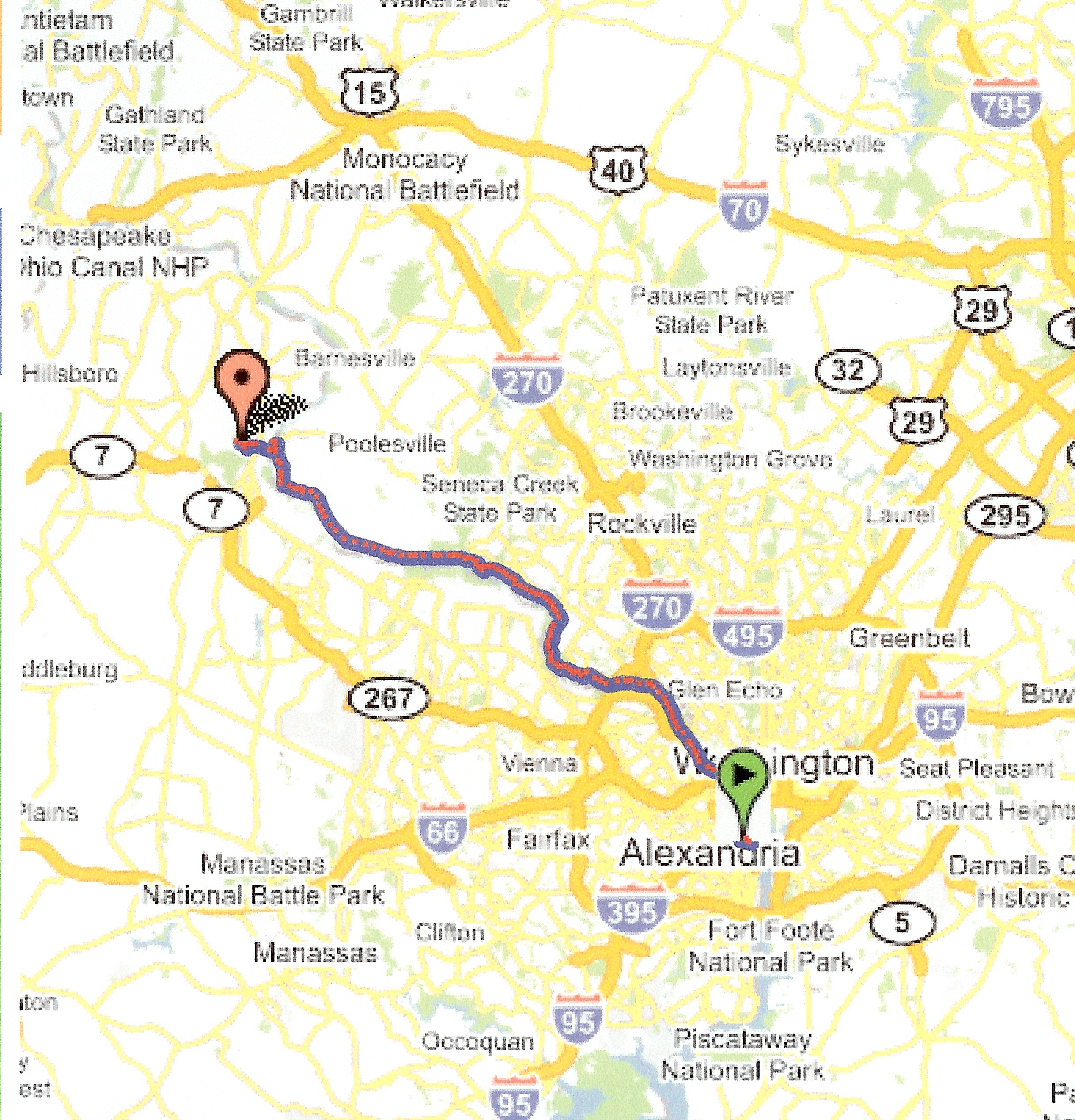 A map of my May 29, 2006 ride from D.C. to Kelly and Joe's house.
It's a Long Way to Tipperary. And Ralph Still Talks to Me.
Pitch Dark, Lost, and Rescued