
Great Falls, MT to Missoula, MT
Trip # 19
The Lewis and Clark Trail - Up the
Missouri Headwaters and Down the Bitteroot Valley
August 18 - 25, 2007
494 miles

I arrived yesterday early in the afternoon, and grabbed a taxi to the hotel, where I quickly settled in for a snooze. Thursday was my last day at my job as EPA's Sustainable Facilities Branch Chief, and I worked late, of course, and I had a 6:30am departure from National Airport Friday morning.
After breakfast this morning, I assembled my bike, rode passed the "Sip and Dip" (slept through my chance to see "Piano Pat" last night) to Schell's to get a rain jacket. Pumping up a soft tire in front of Schell's, I broke a valve so I had my first and only flat of the trip before I really started.
I spent the rest of the morning at the Lewis and Clark Interpretive Center and Giant Springs State Park, which are both north and east of Missoula on the Missouri River. Giant Springs is noted in the Lewis and Clark journals. It's a huge freshwater spring. A Giant Springs park ranger took my picture: he was a crazy biker like me and recounted (with a smile of warm remembrance and pride) his wide ranging bike tour many years ago that included Seattle, Glacier National Park, Colorado, New Mexico and Oklahoma, before he eventually arrived back at his home in Pennsylvania.
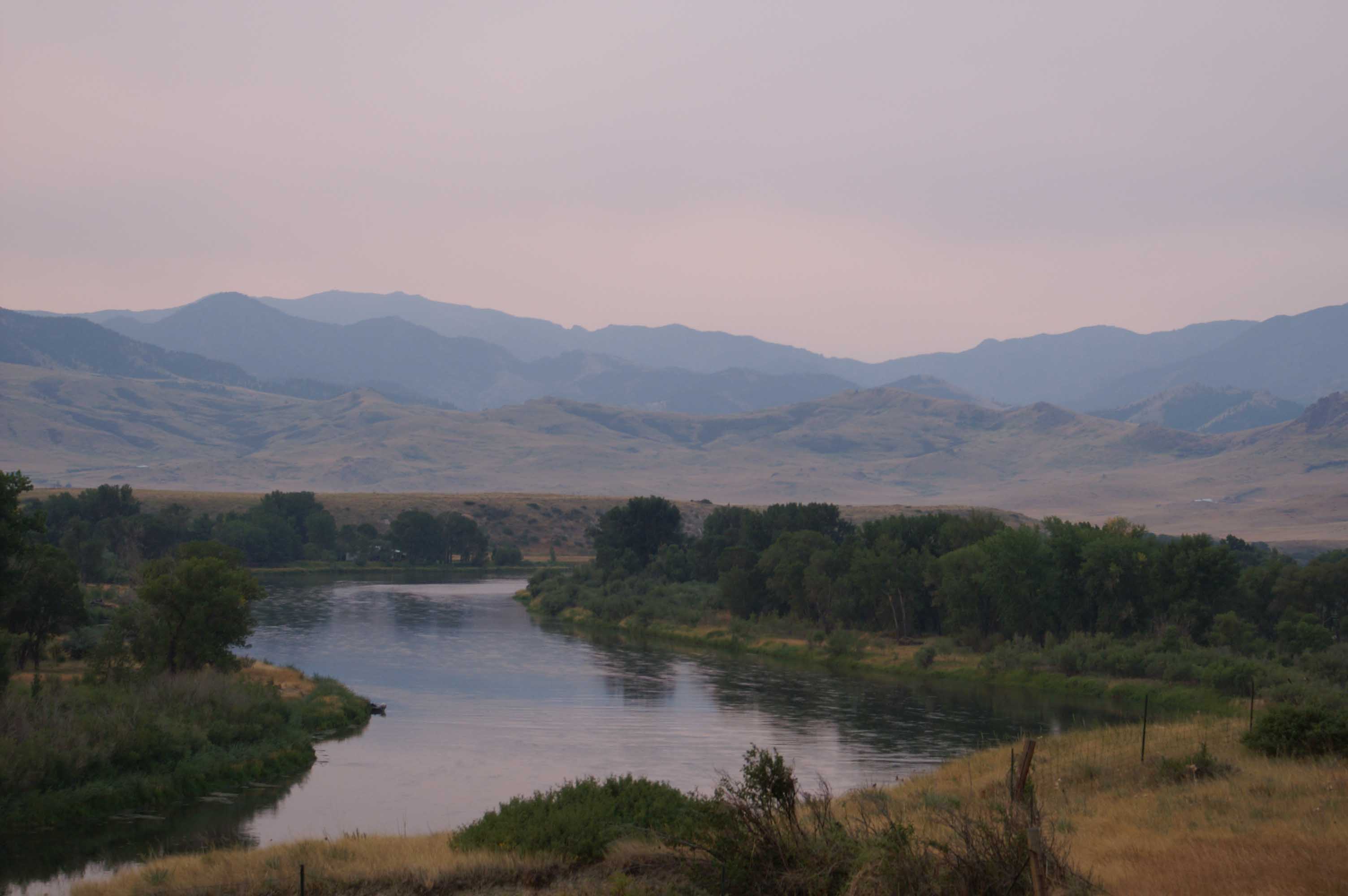
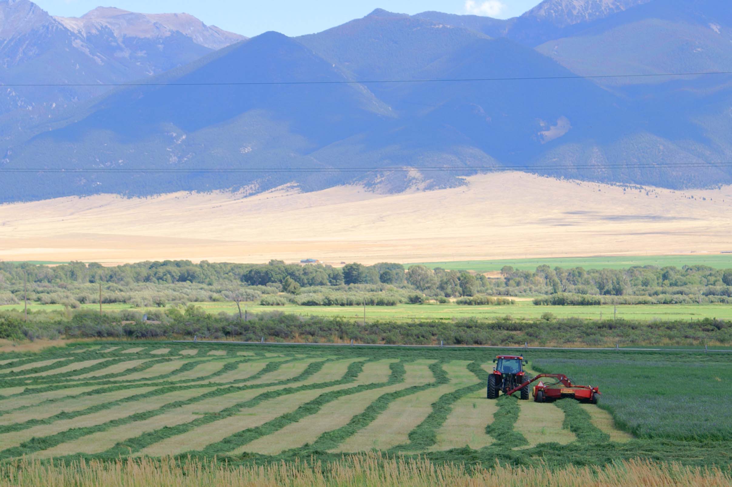
I finally make an early afternoon start south. I follow a frontage road generally paralleling I-15 to Ulm and then along what was probably old Route 91 to Cascade. This is gently rolling dry wheat country. There are lots of smoke from grass fires around Ulm. The steady headwinds slow my progress as well as the fact that I have done absolutely no training for this trip.
I camp/overnight in Cascade City Park.
The weather today was lightly overcast and comfortable, with some moderate headwinds from the southwest.
On June 13th, 1805, Lewis, travelling overland, sees the first of five large falls in the Missouri River in the Great Falls area. Lewis and Clark spend the next days reconnoitering both sides of the Missouri and preparing for their inevitable portage. The actual portage begins on June 21, 1805 and lasts through July 15, 1805. An extremely difficult undertaking. Lewis and Clark must have felt the route today very easy after their month long portage.
Distance: 25 miles today (plus 13 miles to Schells/Giant Springs and back). 38 miles total.
Carefully leaving my bike and gear in a designated campsite last night to avoid the park's sprinkler system.
I wake up, dry, in the "unsafe" area I chose to sleep in listening to the sound of a sprinkler system
running. It has soaked my bike and belongings. Good Morning!!!
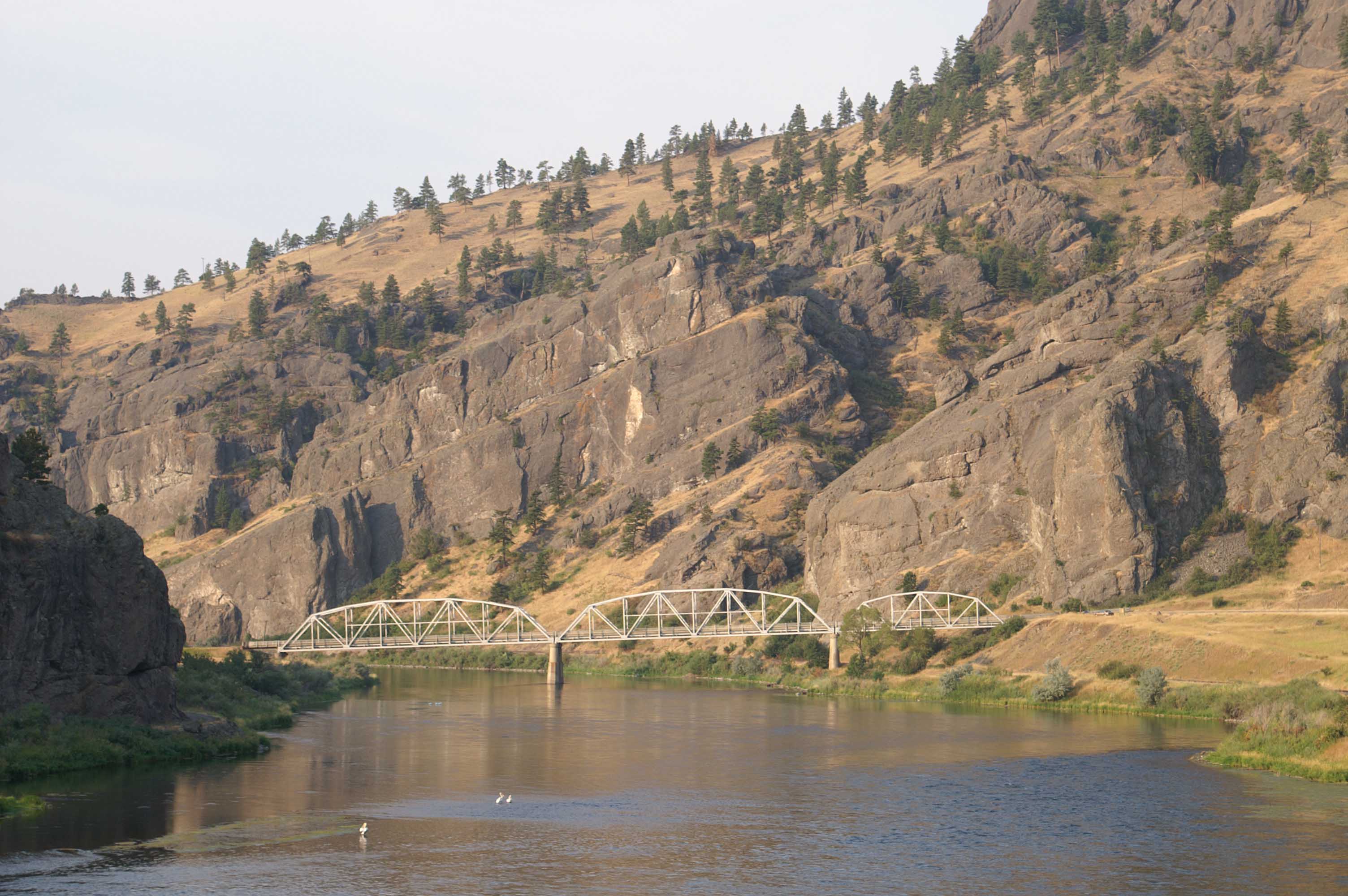
Today, I follow old Route 91 and a frontage road roughly paralleling I-15 along the Missouri River
down to the town of Wolf Creek. Just before Holter Lake Dam, I turn away from the Missouri, up Prickly Pear Creek.
At the head of Prickly Pear Creek, I join the I-15 shoulder for approximately 18 miles. I have strong headwinds across the plateau before "Helena" Mountain, pass the turn off to Gates of the Mountain*, grind through a steep climb up "Helena" mountain, also with strong headwinds, and finally downhill into the northern edge of Helena with the twapt, twapt, twapt of huge thunderstorm raindrops and extremely high winds. I take refuge in a Gas and Go and call Samantha S. At the time of the call, I am at least four hours late for a planned noon arrival, re-planned for 2pm, and then find I have 8 more miles before I really hit the developed part of Helena and Samantha S's house at 802 Madison.
* Named by Lewis in his journal entry of July 19, 1805, "Gates of the Mountain" is a tall rocky canyon that the
Missouri River squeezes into after more than
a hundred miles of flowing through flat benchlands. Obviously, a geologic change like this
would have been welcome for anyone seeking the "Stony Mountains".
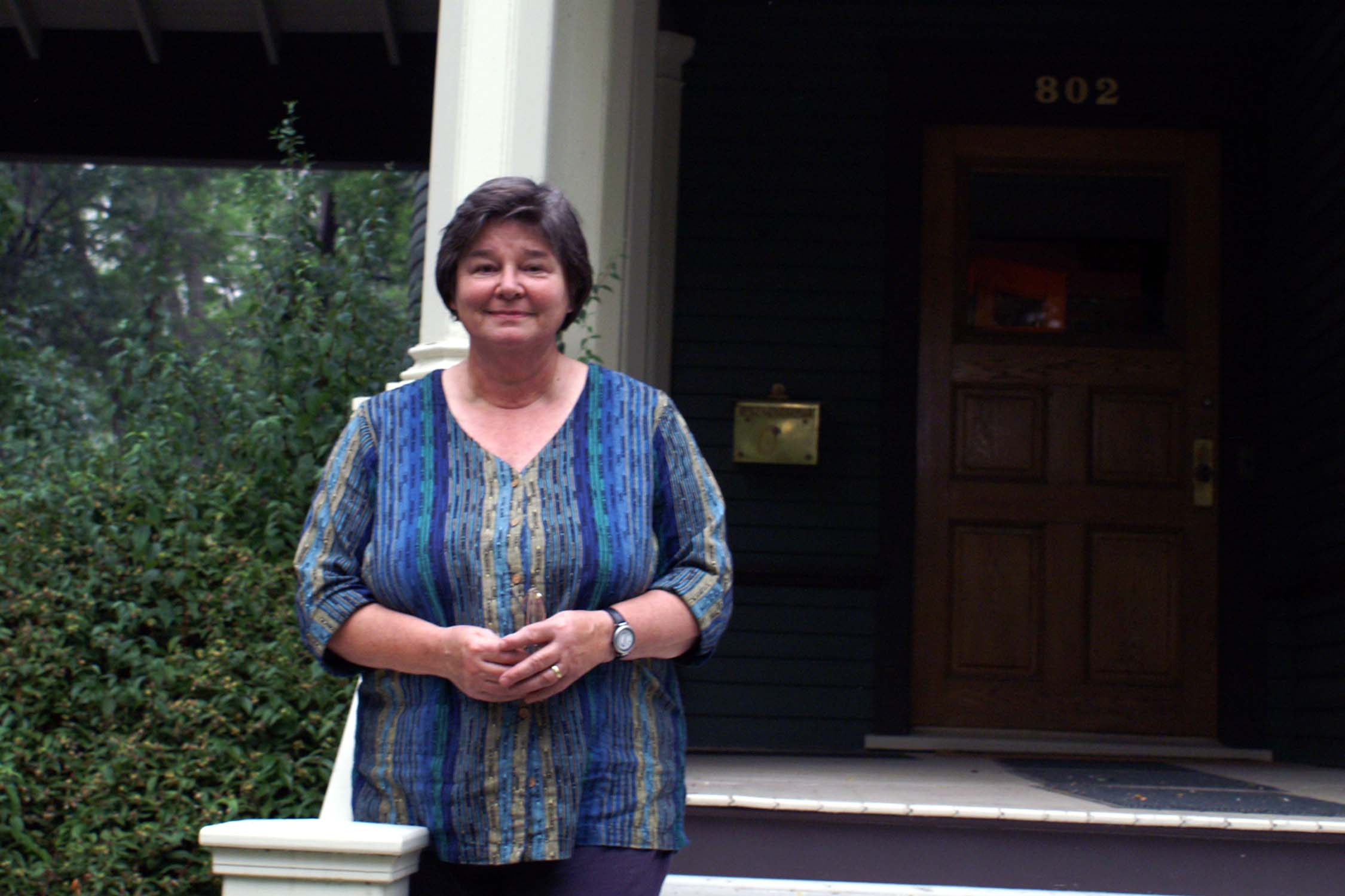
I meet Samantha for the first time, but know of her from stories I have heard from my friend Ralph W. I tour Samantha and Tim's beautifully restored house, enjoy a diet coke on her front porch, a kitchen conversation as she cooks, and a great dinner on the back porch - grass feed hamburgers et. al. Delicious. Samantha is a generous, glorious, and forgiving host to a late, slightly dirty, biking stranger from the East.
There is no smoke when I arrive in Helena, but by dinner, heavy smoke shrouds and scents the city. From our conversations, I learn that Sam and Tim have a cabin outside Augusta, next to the Bob Marshall wilderness area, threatened by the Ahorn fire. Clearly there is a lot of "Sam and Tim" history connected with the cabin and a lot of hard work and fond memories. I will be keeping my fingers crossed that somehow the fires stay away.
After dinner, I ride to East Helena, eventually find the RV park, clean up, and bed down in the tent for the night.
The "Gates of the Mountains" must have given Lewis and Clark the feeling they were getting close to the crest of Stony Mountains and that they were making significant progress to the headwaters of the Missouri. I'm sure they were disappointed to see the broad floodplain valleys after Helena with big brown grass-covered hills, but nothing looking like rocky mountain ranges.
Biking teaches you a lot about geography. Lesson #1: everytime you see a dam on a map, in this case Lake Holter Dam, you know your travel route will be pushed away from any river/floodplain you have been following. You will be travelling up, over, and down the drainage divides/watersheds that feed the main river behind the dam. You don't get any relief until you return to the river/floodplain you were following. The diversion away from the river and over the divide into Helena was quite a challenge.
Today the weather was temperate, light overcast most of the day, but with strong headwinds, especially passing up and over into Helena.
Distance: 72.5 miles today. 110.5 miles total.
This morning's ride is a slow upgrade to Winston, where I pause for a drink at a small tackle shop/Gas and Go with a very talkative clerk. After Winston, I cover a long downgrade to Townsend.
After this well-watered section to Winston, the next stretch to Townsend is the driest stretch of today's route.
I rejoin the Missouri River floodplain and cross the Missouri River at Townsend. (The
route this morning is back away from the Missouri River because of Canyon Ferry Lake/Canyon
Ferry Dam).
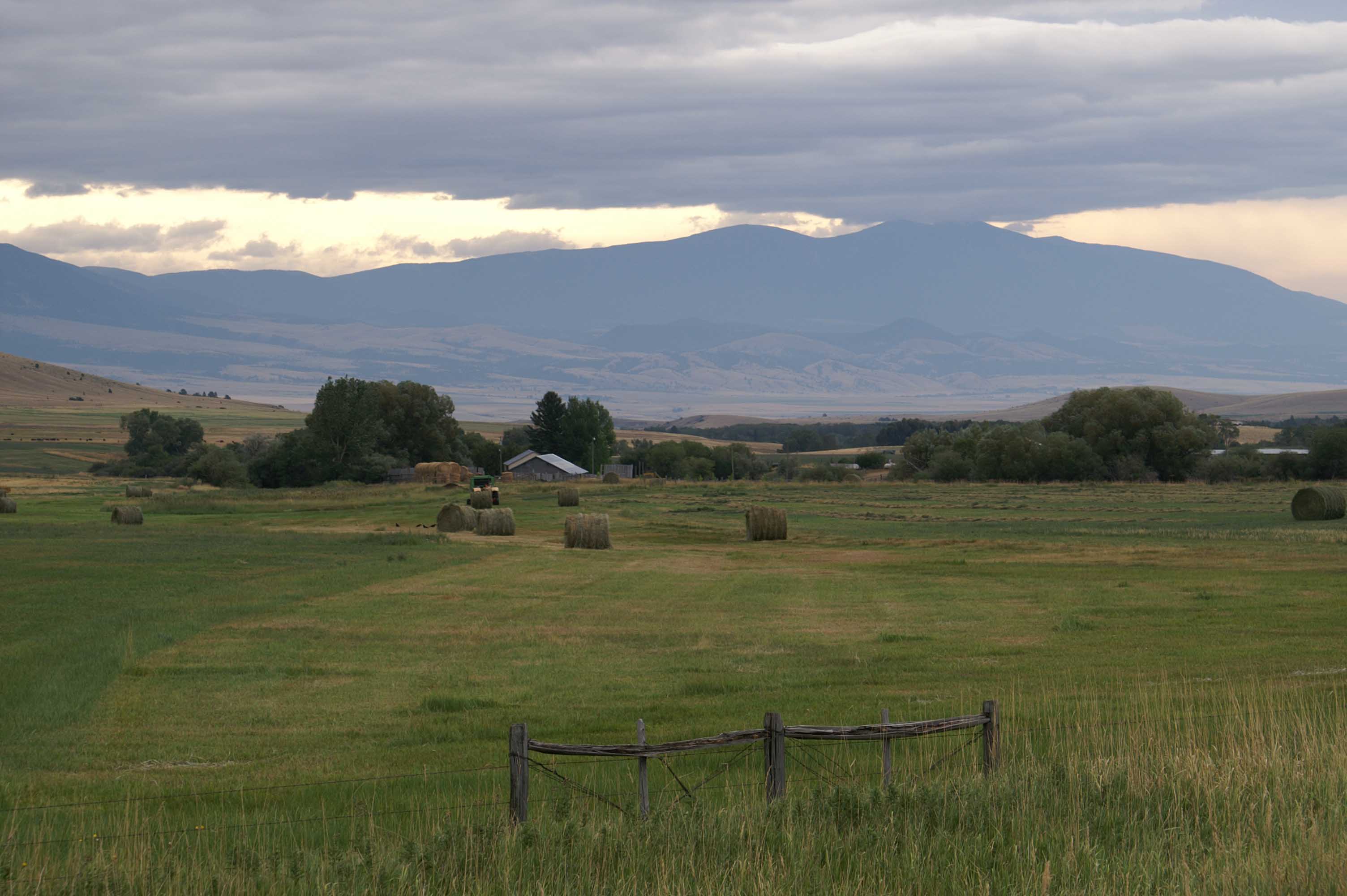
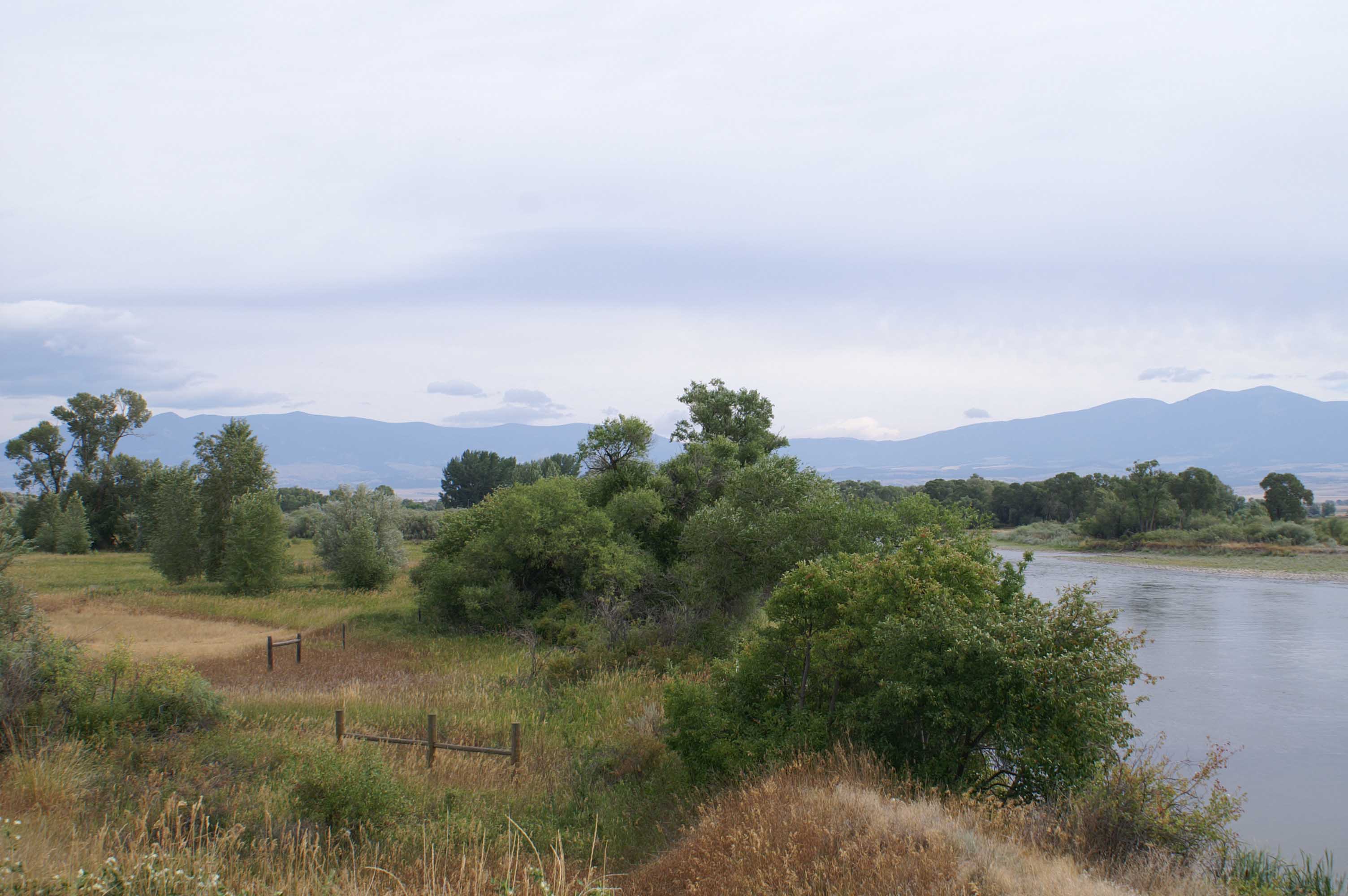
Continuing on to the southwest along the Missouri River to Three Forks, I am
riding through a broad green treed floodplain. Three Forks, at the junction of the
winding Jefferson, Madison, and Gallatin Rivers, seems to be where the rich wet
floodplain is at its widest.

I set up camp at the Three Forks KOA, on a nice soft green corner of the campground. I ride the three miles into Three Forks, crossing the Jefferson River, for a very nice dinner at the Historic Hotel Sacagawea, an old imposing white clapboard building near the old train depot.
Riding tempuratures were comfortable all day, with alternating sunny and partly cloudy periods. I am sure that modern irrigation has made the floodplain greener than it was 200 years ago, but feel comfortable that the large groves of Cottonwoods edged the river banks then as now. The Missouri River continues to get smaller, and while there are large brown grass covered hills/mountains in the distance, there are no big Stony Mountains or mountain ranges to be seen. This must have been frustrating for the Corps.
Clark, travelling overland, reaches Three Forks on July 25, 1805. Lewis arrives with the boat party on July 27, 1805. Lewis and Clark did not leave Three Forks until July 30, 1805 as Clark was ill. This is also the place where Sacagawea was kidnapped in 1800.
Distance: 64 miles today. 174.5 miles total.
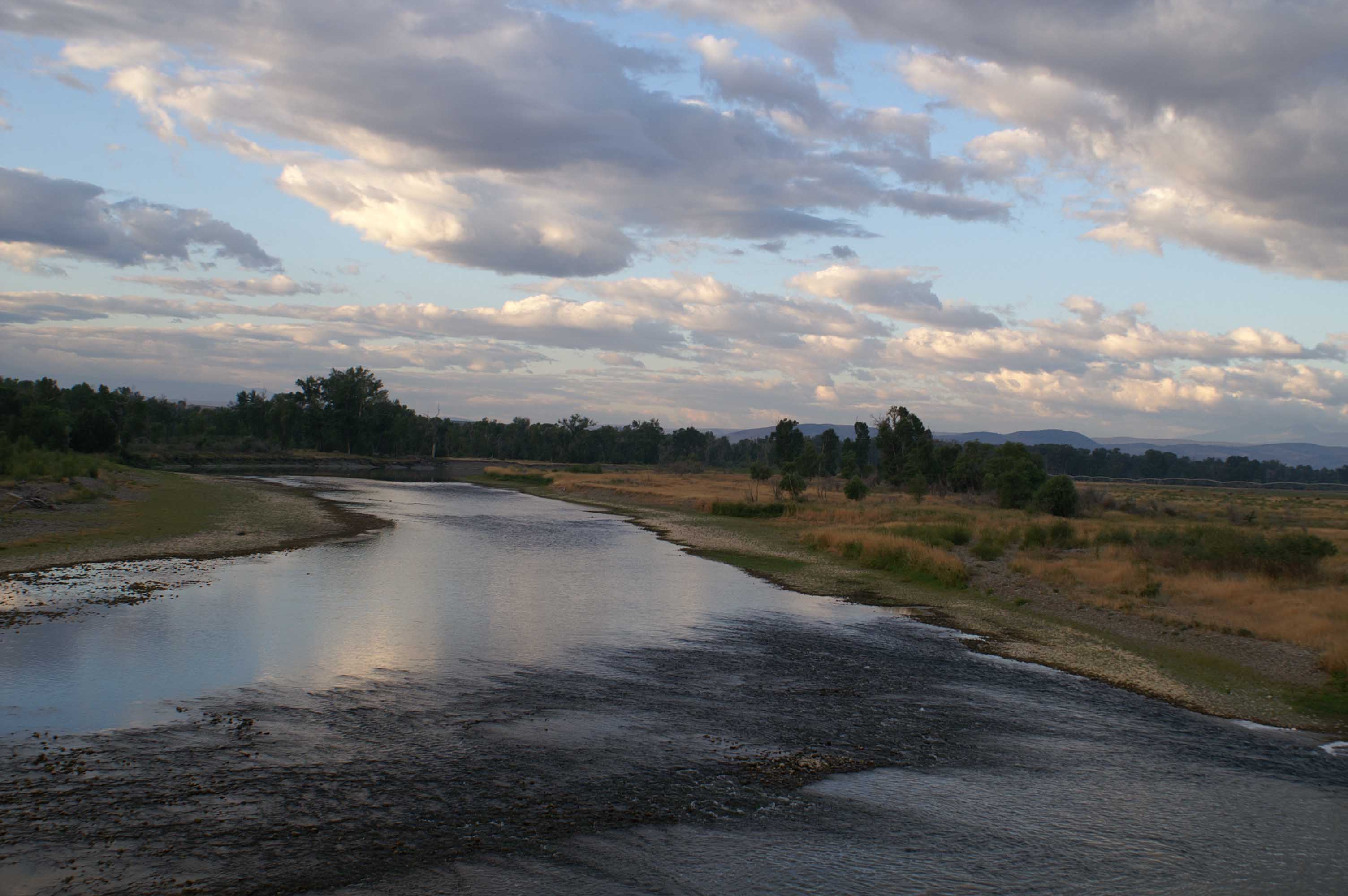
This morning I continue to follow the Missouri, now called the Jefferson, River upstream.
I see a wolf entering a riverbank den early on. (I guess it's a wolf, it seems to be too big
to be a fox and not skinny enough to be a coyote).

It is a beautiful day for riding, blue sky, billowing clouds, and generally well-irrigated green floodplain, dry uplands, and brown grassy mountains in the distance. I have flat terrain all day.
At one point this morning the road squeezes into narrow a rock canyon for the five miles downriver from LaHood.
Again I wonder if Lewis and Clark got excited seeing these rocks, only to be let down again when the
canyon again molts back into a broad floodplain with distant brown peaks.

There are always nice days, but this is a really nice day!

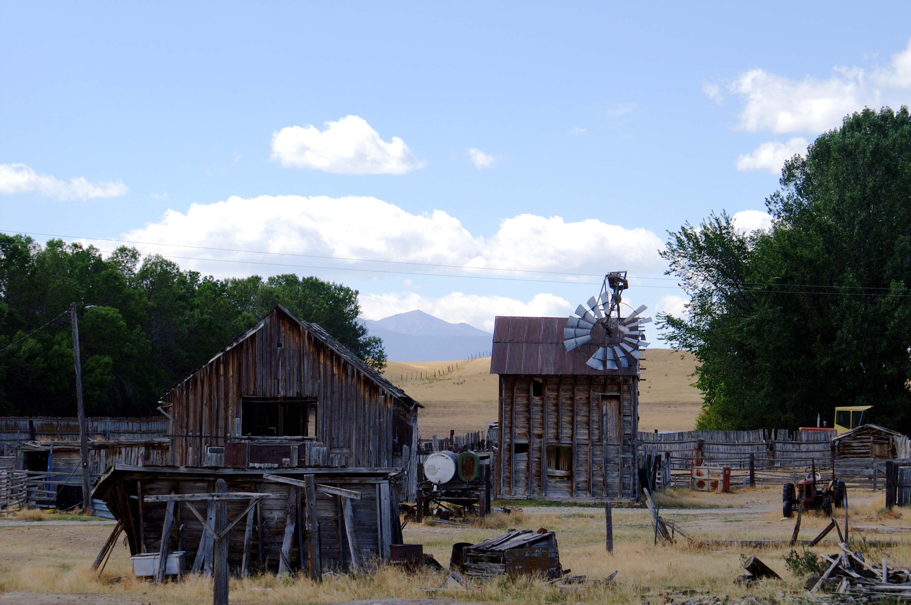
The octagonal barn in this picture was rebuilt by the CCC during the 1930's. It had always been a hall for the county fair.
August 1, 1805 - Lewis leads a group overland to Twin Bridges and heads west/turns right up the Big Hole
River. He decides it is not the main stem, returns and leaves a note for Clark and the canoe group
to follow his contingent up the Beaverhead River. The pole holding the note is eaten by a beaver. Not
getting the note, Clark and his canoe company travel up the Big Hole, their canoes overturn
in rapids, and they are delayed. The two teams don't find each other and reunite until August 7, 1805.
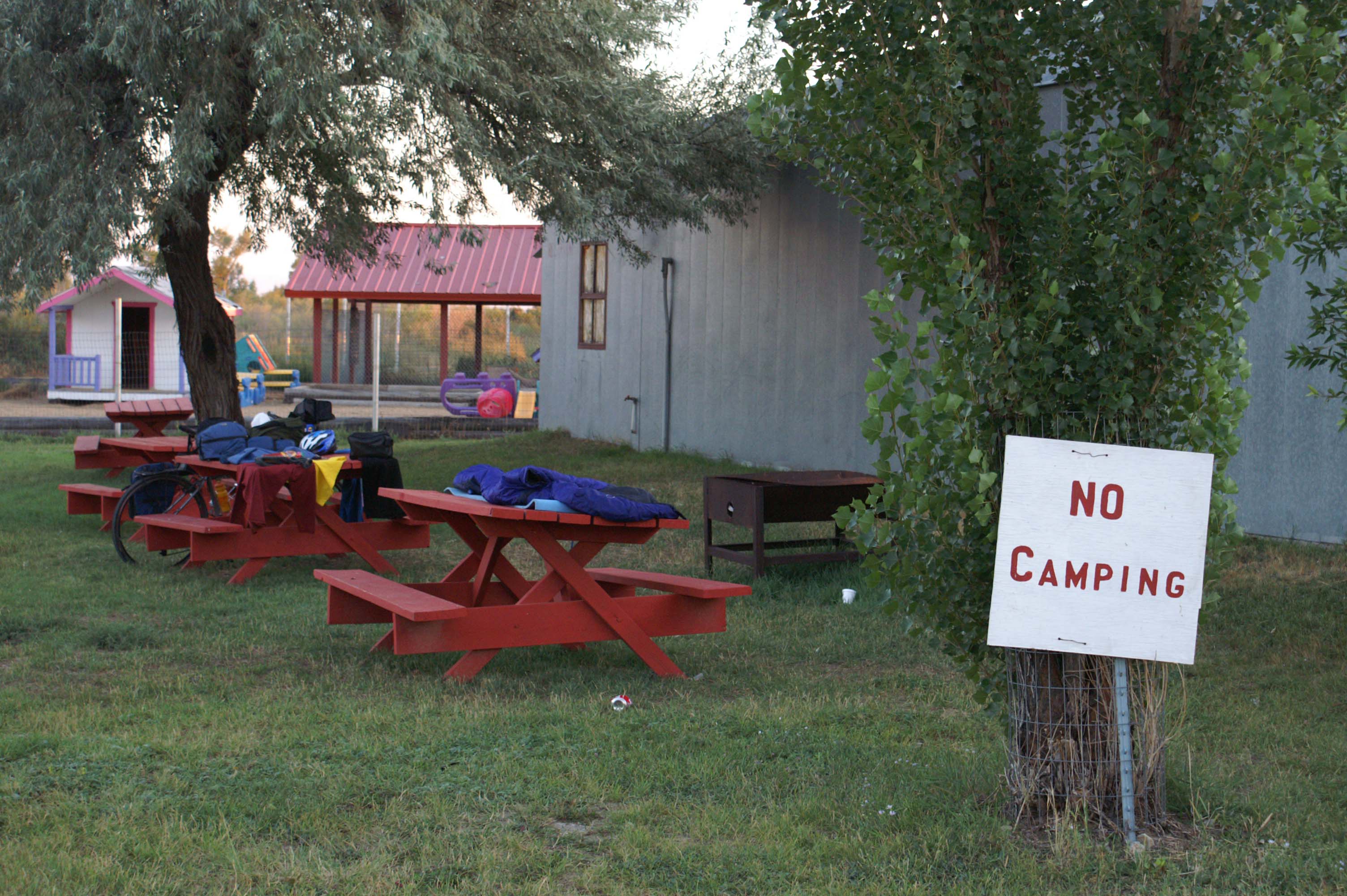
My end point today is the Twin Bridges, specifically the County Fair Grounds behind the octagonal barn pictured above. Camping is allowed even if there is a "No Camping" sign posted. I meet an old "local" here, fishing, and he gives me the scoop that it's OK to camp.
After a hose shower, I have a nice dinner down the street with sweet potato fries, and sleep well on my picnic bench.
Distance: 58 miles today. 232.5 miles total.
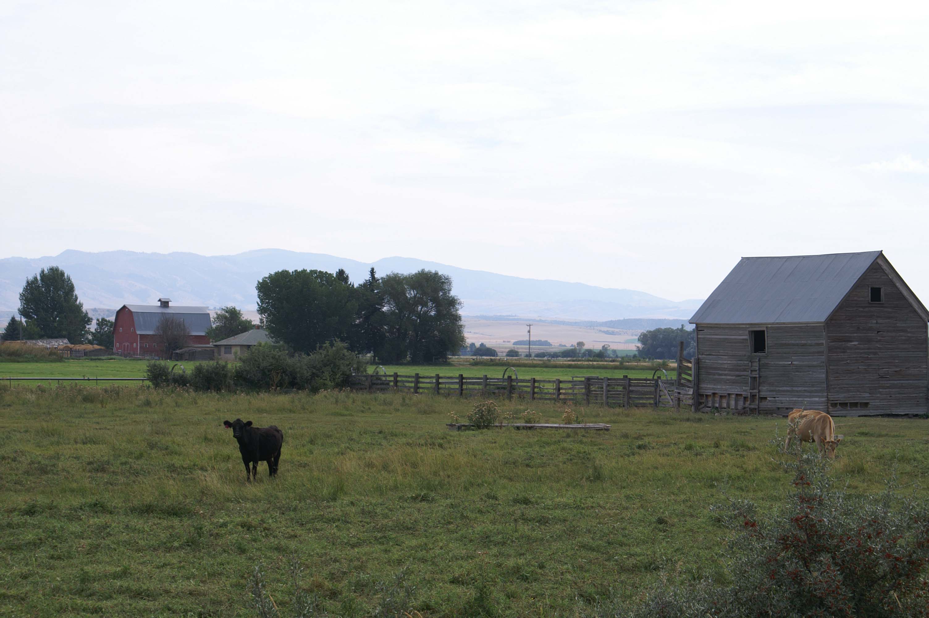
A very short day. Who knows why, but after riding 27 miles along a nice stretch of the Beaverhead River this morning, I arrive in Dillon and I am dragging. I get a good breakfast at a pleasant coffee house, but am feeling "mighty low". I wander over to the Beaverhead County museum and nap for a while on a bench and then on the grass out front. I don't feel much better after the nap, so I ride back to an old 1970s era hotel, check in, and sleep all afternoon. I get up with enough time to buy some shorts from the Patagonia Outlet and catch a good dinner at a restaurant downtown. Shortly thereafter, it's back to the hotel and back to bed. The route is flat today and the weather is good for biking.
Today's route passes Beaverhead Rock, which is 14 miles outside of Dillon. I can't figure out why folks can't see the beaver head, it's pretty clear to me.
Obviously, Lewis and Clark were getting anxious at this point. August 8, 1805, just south of Twin Bridges, Sacagawea recognizes Beaverhead Rock, and said her village passes this way during their summer hunting trips into Montana.
Distance: 27 miles today. 259 miles total.
Today I feel a lot better. I have breakfast at Sweetwater Cafe - some great sticky granola and some yogurt. At 8:30am, I head south to Clark Canyon Dam. I make it a slow mellow 20 mile bike. I travel a short quiet section on the I-15 shoulder, but the route mostly follows old Route 91 and the Beaverhead River. Fly fisherman are scattered along the route.
I stop at the KOA located just before Clark Canyon Dam and feast on Cheetos, cashews, and Gaterade. It is the only place to buy supplies, and it carries more fish tackle than food. I bought the healthiest items available. I'm not upset my food choices are limited.
I cross Clark Canyon Dam and wind up Horse Prairie Creek. (Lewis and Clark's Camp Fortunate, now under water, is located behind the dam at the junction of Horse Prairie Creek and the Beaverhead River)
For the first time, I see a mountain with a patch of trees on the north face.
It's a slow 12 mile climb to Grant. I pass through open "parks" and green bottomlands.
Now Grant is supposed to have food, per my map, but it is one of the saddest little communities I have ever seen and has no food. It's sunk way down below its peak of prosperity, and the peak must not have been too good. It seems to have the sense (and scent) of "fresh" decline. I feel guilty saying these things: 1) It may be better off as a ghost town, with everybody gone, and 2) I had to walk to the back of an abandoned building to go to the bathroom before I headed on, and had an uncomfortable feeling I'd left this town better than I had found it. (Sorry Grant residents - no offense - but you have a tough life in a very sad place!)
An old railroad right of way parallels the road beyond Grant. The railroad was used during the mining boom to get goods to Utah and the Union Pacific.
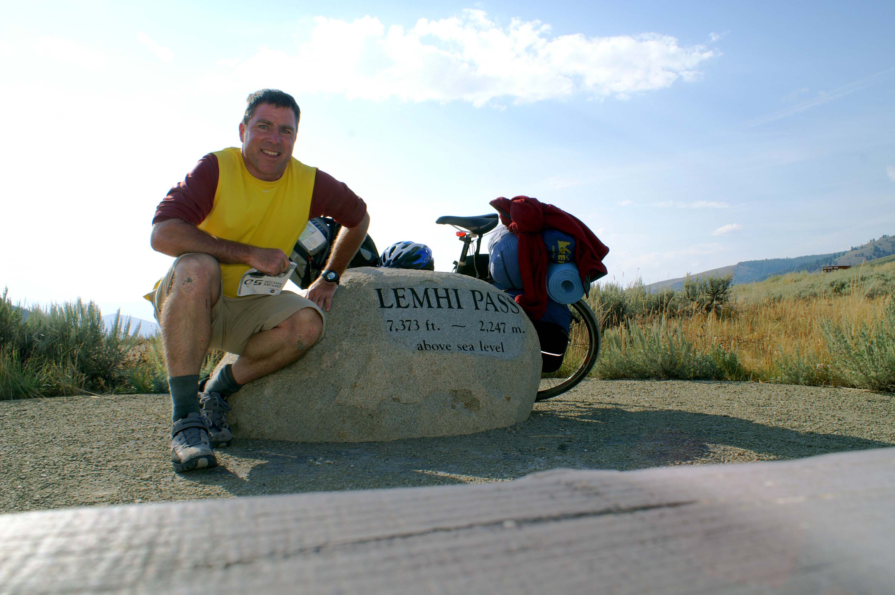
Ten miles from Grant, I turn onto Route 300, the gravel road to Lemhi Pass. Lemhi Pass is 13 miles up. The road is reasonably easy to ride on and crosses wide open dry bench lands and green pastures in the increasing narrow creek bottoms.
The last two miles are the toughest - pretty steep. I have to stop and walk for a while near an Aspen grove, the first I have seen on this trip.
Lemhi Pass at last. I was here more than ten years ago, with Herb.
Then, a plain brown wooden sign marked the the top of the pass. The site has been upgraded
for the Lewis & Clark bicentennial with a fancy carved stone, parking area, and trails.

I pause, take in the view, write a few postcards, and start looking for the road down to Tendoy.
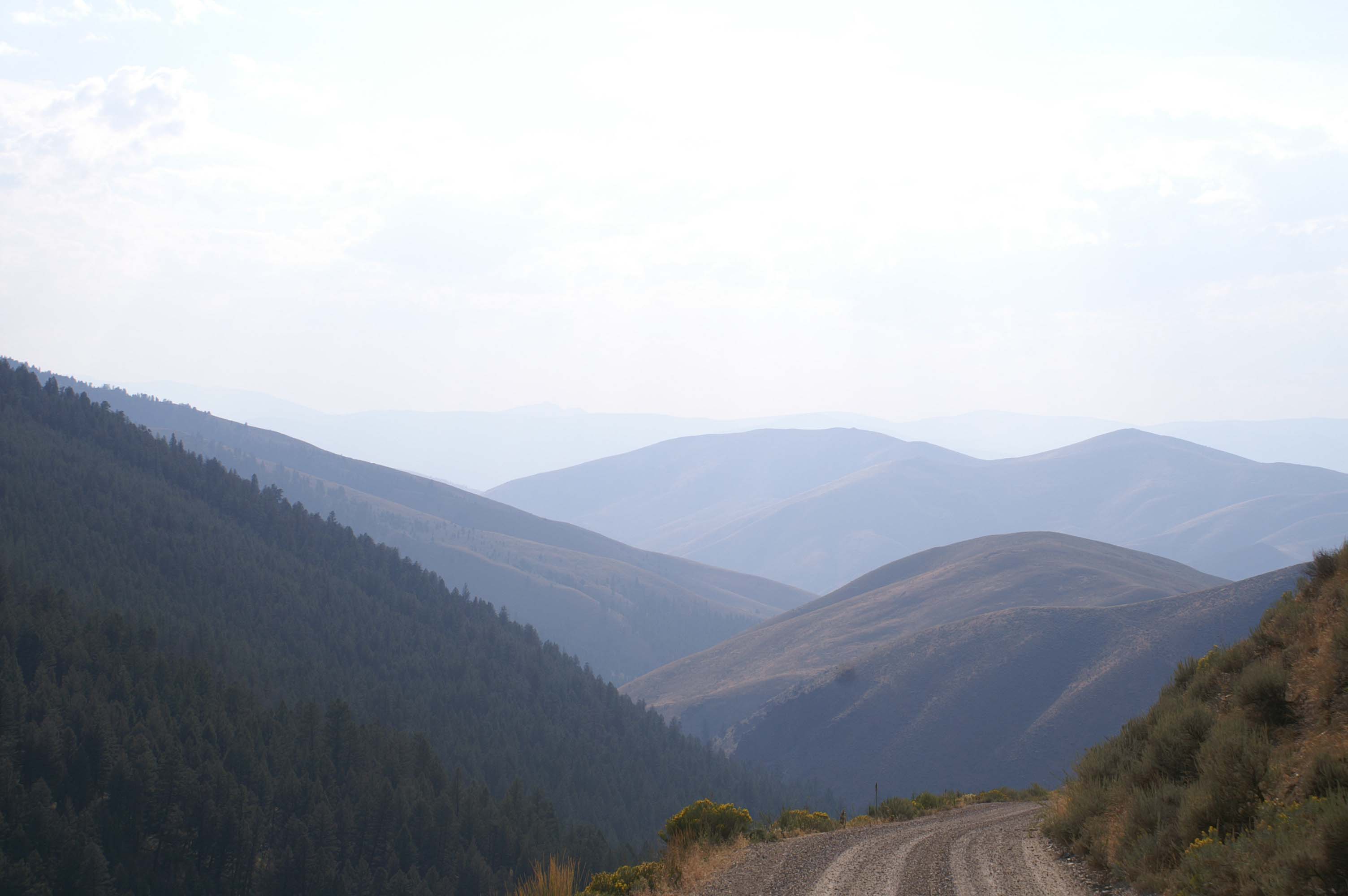
The road to Tendoy, Idaho is so steep that it is hard to see where it starts. And when it starts, it goes. It is so steep I worry that I will overheat my rims applying the brakes and melt/blow out a tire. Down. Down. Down. I take a few breaks to dissipate the heat on the wheels. Down. Down. Down.
Finally, the road flattened out a bit and I coast the last 4 miles to Tendoy. The Gas and Go is closed (it's about 5 pm) so I find a house and a hose (I knock; no one is home) to rinse my head and wash the dust off the bike. I lie down on some nice grass behind a big Lewis and Clark Trail sign. I'm too close to the road, so the vehicle noise keeps me up.
Distance: 67 miles today. 326 miles total.
Lewis and his crew, ahead of Clark's crew, crossed over Lemhi Pass, saw the massive complex of mountains to the west, and headed down towards the Lemhi River on August 12, 1805. I can imagine their relief at finally crossing the continental divide and their concern at the extent of the mountains before them. This is the first massive concentration of mountains the Corps has seen. On August 13, 1805 Lewis and his crew finally meet and communicate with the Shoshone near Tendoy. This meeting eventually leads to the Corps of Discovery acquiring horses and the services of the Indian guide "Old Toby". Lewis and his crew, and Cameahwait, the Shoshone chief, and his band head back east over Lemhi Pass to Camp Fortunate to rondez vous with Clark and the canoe party. It is in Camp Fortunate where Sacagawea, arriving with the Clark crew on August 17, 1805, realizes Cameahwait is her brother. The Corps spends several days buying horses and supplies at Camp Fortunate from the Shoshone. The Corps doesn't leave Camp Fortunate for Lemhi Pass until August 25, 1805.

After a poor night's sleep, I start north along the Lemhi River towards Salmon, Idaho. It's perfect riding weather - 55 degrees - and the Lemhi River valley is exceptionally beautiful. Rich green fields, a crystal clear Lemhi River, dramatic mountains to the east (The mountains are taller on this side than on the Montana side, because the Lemhi River valley is 1,500 feet lower in elevation than the Beaverhead River and Horse Prairie Creek valleys). It is all downhill, an enjoyable change after many days of slowly working uphill. I speed north on Route 28 through Baker to Salmon, where I stop for laundry, a good breakfast, and supplies. After checking the weather forecast, I mail my tent, heavy bike lock, and what ever else I don't think I'll need back home to Arlington. Lightening my load; increasing my options.
Next, a fast downhill (did I mention downhill?) to North Fork, Idaho.
North Fork is where the Lewis and Clark Trail Adventures' bus will turn west along the Salmon River to our
planned put-in. Because of the strong headwinds between Great Falls and Dillon, I am a day and a half behind schedule.
I already have Plan B: bike as far as I can and meet the outfitter's bus somewhere between here and Missoula.
And Plan C: cache my gear here and do the distance to Missoula without baggage.
North Fork is where I have to develop Plan D. At the Gas and Go/restaurant in North Fork, I find the Salmon River has been closed to kayakers and other boaters because of the forest fires. There will be no outfitters bus to meet up with, because there will be no main Salmon River kayak trip. I have no cell phone service. The pay phone is disconnected. The guy in the store won't let me buy a long distance phone call. AARGH. I have no idea what is going on with the kayak trip. The only option for me is: forward.
Ahead is a 34 mile climb to Lost Trail Pass. Can't wait!!! I need to get at least that far today, so I have a reasonable shot of biking or thumbing into Missoula tomorrow.
The grade is not bad the first ten miles to Gibbonsville. I pause for dinner at a cabin/campground/restaurant. I use the phone there to let the boys in Missoula know where I am, inquire about alternate kayak trip plans, and explain the options I'm considering.
I leave Gibbonsville about 5:30pm; 15 miles to the top. Again the grade isn't bad, but it is constant, and is steeper than before. It's also clear I'm physically tired. OK. 5 miles and rest, and in three cycles I'll be at the top. OK. Well. 4 miles before the first rest. The grade gets steeper. I am crawling. The sun sets. I keep grinding, slowly, up. I'm tuckered out flat.
It's dusk. 2 miles from the summit. I lean my bike against the guard rail and rest on a guard rail post.
I think I begin to hear music in the distance: "It's my bike trip, and I'll cry if I want to."
I adopt Plan E: finish one more mile and figure out Plan F in the morning.
An old Jeep Wagoneer comes up the road, I give the traveler's wave. The driver salutes back with a raised beer. It looks like the driver is peering into his rear view to see if I am OK. On he goes.
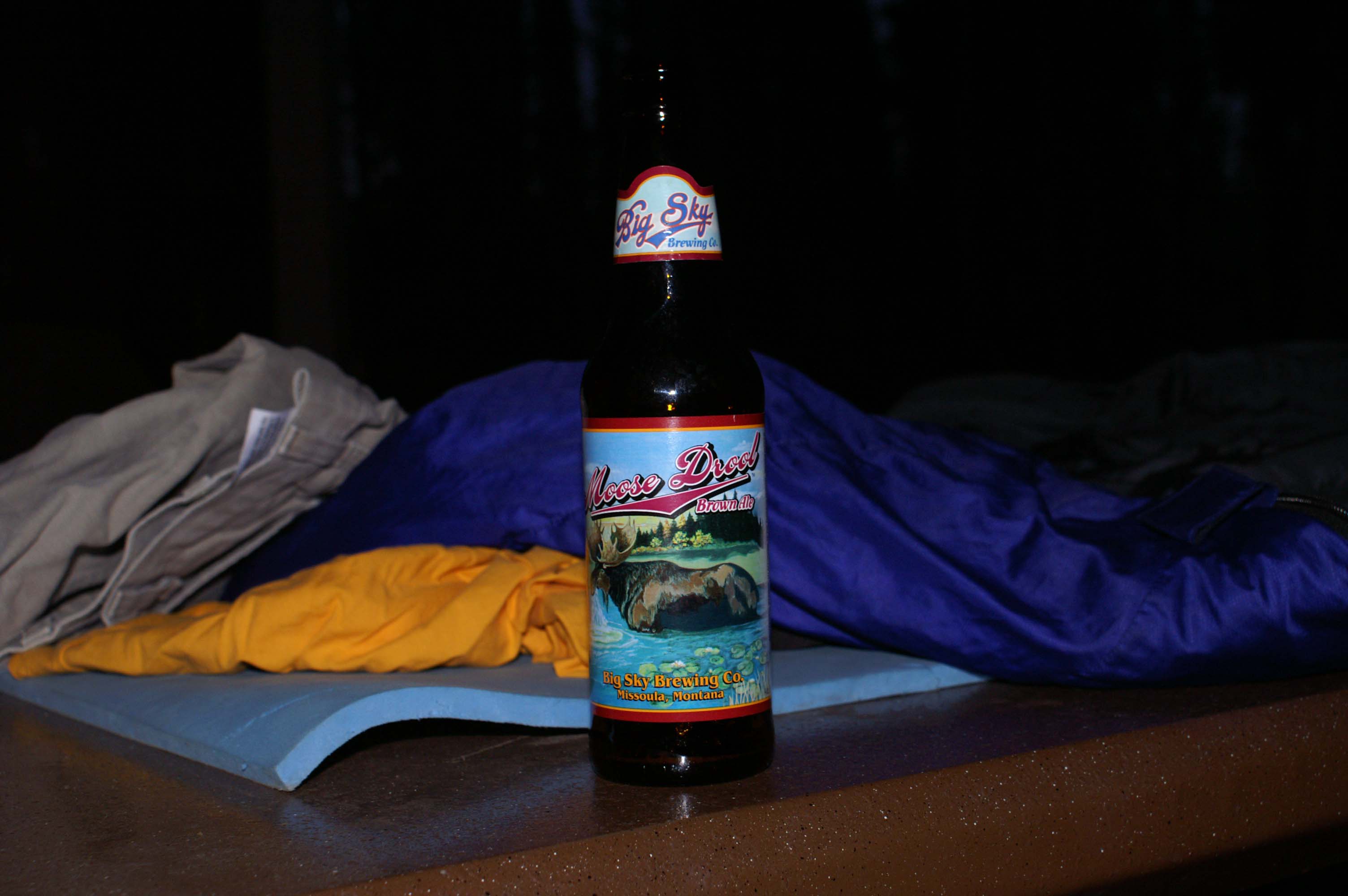
I start my last mile, having given up any hope of the summit. The grade is steep with numerous switchbacks. Rounding a switchback, in the last glow of light, I see a small peculiar object sitting to the right of the white line on the shoulder of the road. As I get closer: hey that looks like a bottle. Closer: hey, that is a beer bottle. Arrive: hey, that's an ice cold Moose Drool Brown Ale! Left by the guy in the Wagoneer!
YES! YES! YES! I can make it.
I charge through the last mile to Lost Trail Pass summit, pull into the rest area, drop my bike against a picnic table, and open the Mouse Drool.
Joy, Joy, Joy.
Thank you. Thank you. Thank you.
On September 2, 1805 The Corps of Discovery leaves what is now North Fork, Idaho and generally follows the North Fork of the Salmon River to the Bitteroot Valley. After two days of climbing steep, wooded slopes, they reach the top of the ridge on September 4, 2007. Old Toby, incidentally, lost his way leading Lewis and Clark up Lost Trail Pass, reputedly taking them 1,000 feet higher than they needed to go.
Distance: 67 miles today. 393 miles total.

Today is a blur. I have 101 miles to get to Missoula, and I don't know if I have the stamina to do that. I could thumb in or get close enough to Missoula that someone on the kayak trip could pick me up. That would leave a 20-50 mile gap in my path across the country. I don't want gaps! (It's a lot of work to fill them in.)
The morning is wonderfully cool. I slept well last night on the picnic table and make an early start. The first 13 miles are a fast downhill. I stop for breakfast in Sula. Onward another 17 miles to Darby. This stretch is much flatter, but gently downhill and I make good time. 30 miles down; 71 miles to go.
17 miles to Hamilton. I pause for a half hour rest at the farmers market, and then head out of town on the old valley road (which has a lot less traffic than Route 93). 54 miles remain.
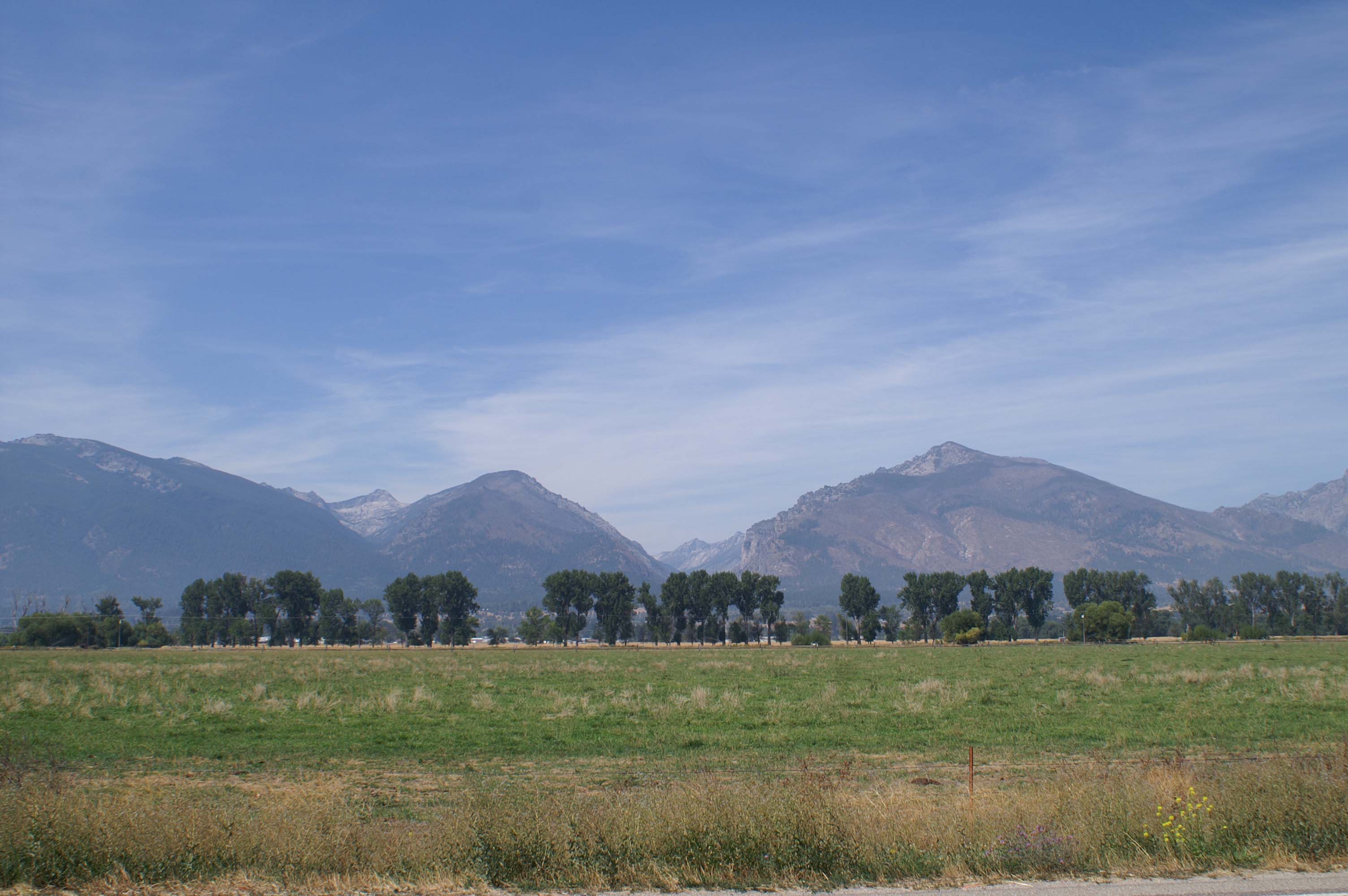
I'm riding through rich farm country in the broad Bitteroot Valley.
15 flat miles to Stevensville. I'm feeling it. I buy some food and drink, and rest and eat on some church steps in the shade. 33 miles left.
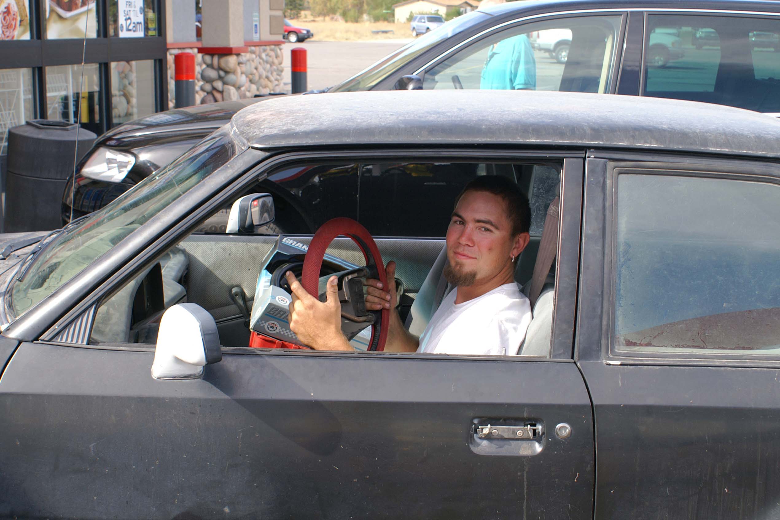
12 miles to Florence. I stop at the Gas and Go to recharge. I meet a new friend who is replacing his car steering wheel in the parking lot. Interesting.
21 miles to go,and only 8 miles to Lolo.
I ride the bike trail next to Route 93, since traffic on 93 is heavy with through and suburban traffic into and out of Missoula.
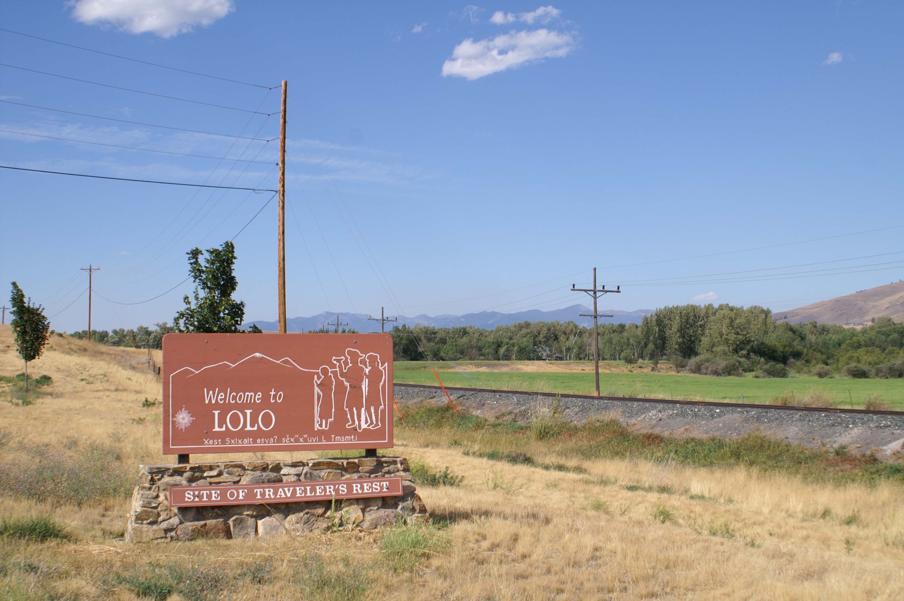
OK!! Lolo. I've connected this trip with my 2005 trip from Missoula to The Dalles. No Gap!!
I spend some time at Traveler's Rest, where Lewis and Clark camped for several days before their arduous crossing of the Lolo Trail Sept 12 - 19, 1805.
Only 13 more miles. This section of Route 93 will be narrow, noisy, and busy; there is no bike path. I phone in to let the kayakers know I won't need a rescue.
I wobble into Lewis and Clark Trail Adventures' office in Missoula about 6:30PM. Wayne, Chad, and others are there. Wayne gives me a nice cool beer. AAAHH. I meet up with the boys at the Holiday Inn Express down the street. I skip dinner, do laundry, clean up and sleep. Tomorrow we head to our put-in on the Lower Salmon at White Bird Pass, Idaho.
Many thanks to those who offered to come down Route 93 to pick me up.
Distance: 101 miles today. 494 miles total.
On September 9, 1805 Lewis notes in his journal that the Corps is passing
through the wide and bountiful Bitteroot Valley. They also learn that where at the mouth of the
Bitteroot, in present day Missoula, there is a path that leads back to Great Falls that takes
four days on horseback. The Corps had just spent 52 days traveling that distance. The Corps finishes
the day at Travelers Rest, a camp located alongside Lolo Creek in Lolo, Montana. They
spend two days here, recuperating and regrouping. They head up Lolo Creek
on September 11, 1805, and hit the first steep slopes of the treacherous Lolo Trail
crossing on September 12, 1805.
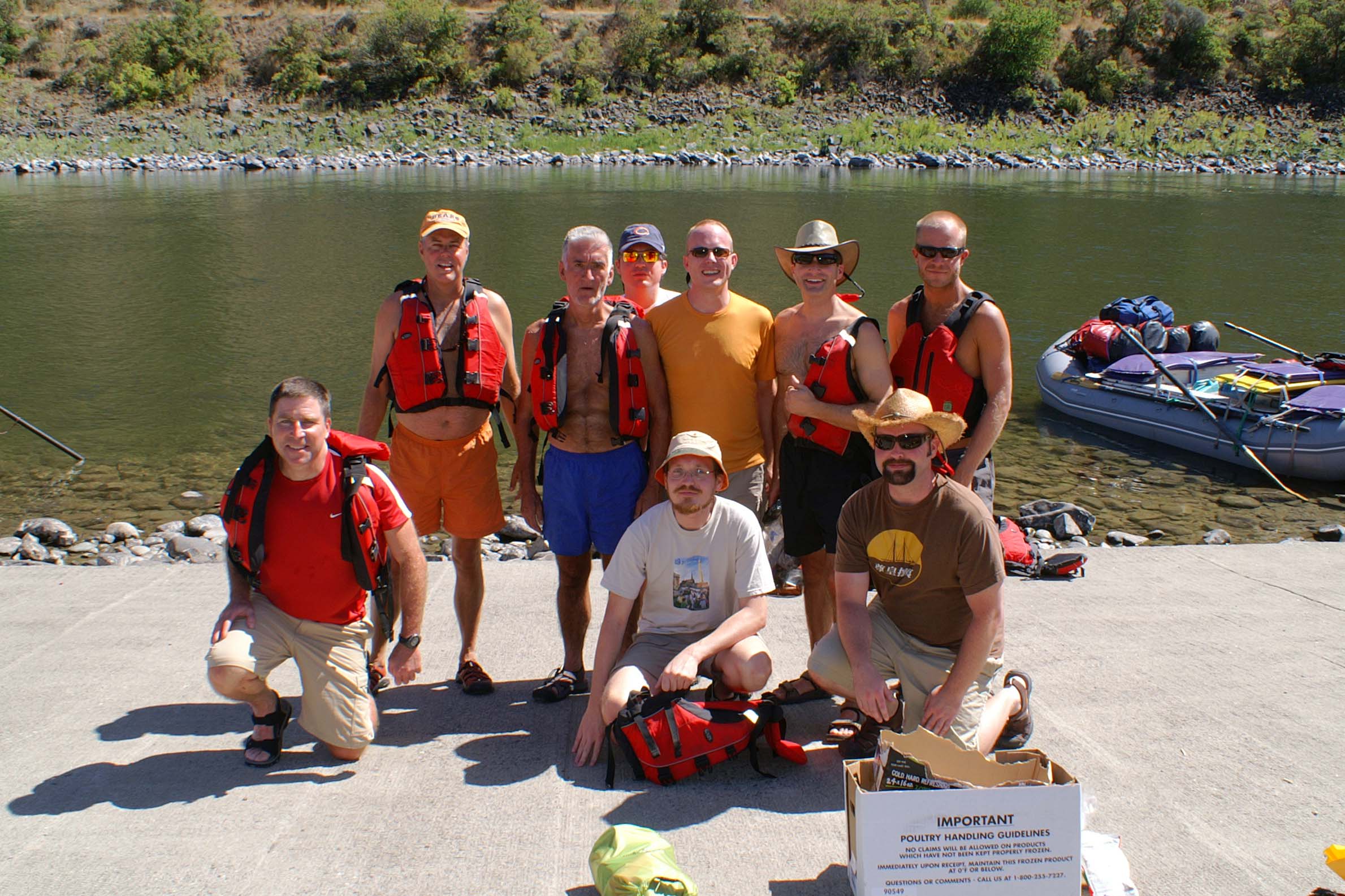
I switch from biking to boating. After a quick turnaround in Missoula, it's off to kayak the Lower Salmon River and a section of Hells Canyon with old and new friends.
Some pictures of our rafting trip can be found here:
Lower Salmon River
Kayak Trip August 2007
Last Update: October 8, 2007