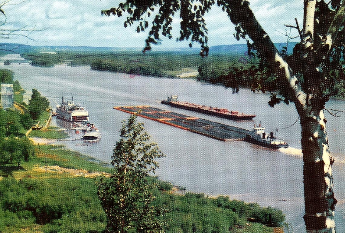
 << Typical barge tow on the Mississippi.
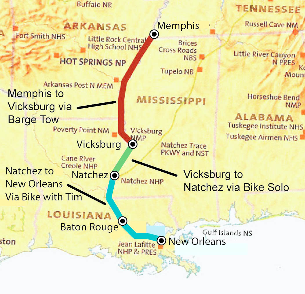
Vicksburg, MS to New Orleans, LA
Trip # I
Barging and Biking Down the Mississippi River - From Memphis to New Orleans
September 26, 1980 to October 13, 1980
230 Miles by Barge. 262 Miles by Bike.
After my ride from Seattle to San Francisco the previous summer, I was anxious to do another long bike trip. I had never seen the Mississippi River, I had a friend from the University of Virginia who was living in Memphis, and Tim M., a good friend of mine from D.C., was in his first semester at Tulane in New Orleans. Critical mass for a trip!
Though the original plan was to bike the entire distance from Memphis, Tennessee to New Orleans, Louisiana along the Great River Road,
this trip actually involved 230 miles of barge travel from Memphis, Tennessee to Vicksburg, Mississippi (YEAH!), 70 miles of biking solo
from Vicksburg, Mississippi to Natchez, Mississippi, and 192 miles of biking with Tim M. from Natchez, Mississippi to New Orleans, Louisiana.
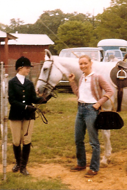
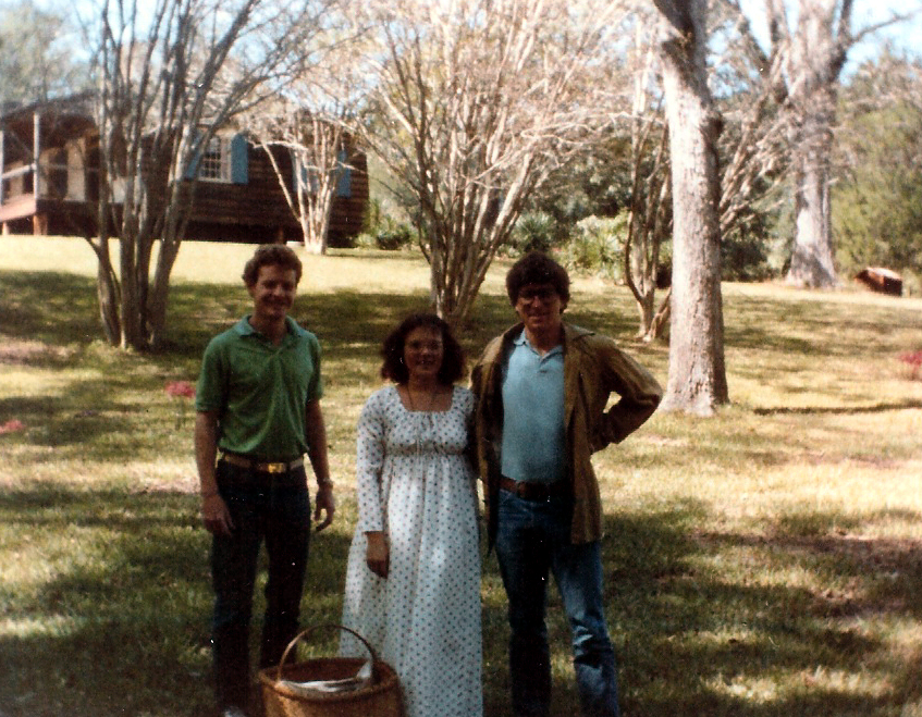
<< Sharon H. (right)
Sharon H. and I worked together for several years on The Declaration, a weekly newspaper, at the University of Virginia. I can't remember how it came about that I stayed with Sharon and her family in Memphis. Did Sharon's invitation settle that Memphis would be my starting point? Did Sharon extend an invitation or did I wrangle an invitation to visit? However it happened, visiting Sharon, meeting her family, exploring Memphis,and staying at Sharon's family home proved to be delightful and fortuitous.
What luck! Sharon's father had a good friend at the Southern Towing Company. Shortly after my arrival in Memphis, Sharon's father asked if I would like to travel part of my trip down the Mississippi on a barge tow. Absolutely! How better to see and understand the Mississippi than float down it.
Good thing. This East Coast boy knew what levees were,
but really didn't understand the practical impact of them to a cross country biker who wants to experience the Mississippi River. Generally a
high levee sits between the road you are riding on and the river, so you really don't get to see the Mississippi very often.
<< Typical barge tow on the Mississippi.
My memory is fuzzy here. I don't remember how many days it took to get to Vicksburg from Memphis
on the barge tow. I'm not certain I knew I was going to be dropped off in Vicksburg.
I'm not even quite sure what
I did to pass the time while we were working our way down The River. I do remember:
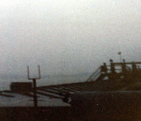
<< The view from the "Charles Southern", the tug pushing the ammonia barges from Memphis to Vicksburg.
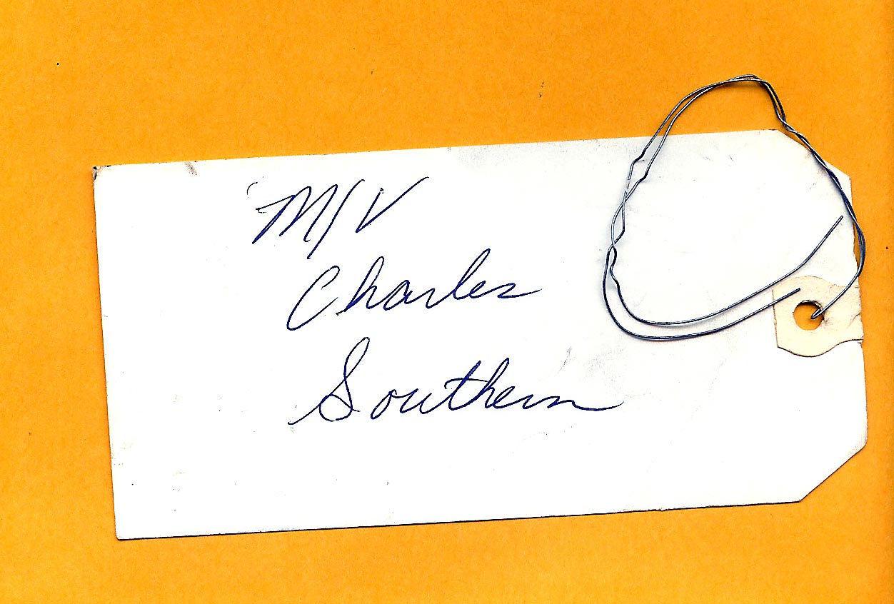
<< A souvenir of my time on Charles Southern, my luggage/destination tag.
 Once on land, I explored Vicksburg National Battlefield Park.
Biking south from Vicksburg, I distinctly remember riding through Port Gibson, my first small rural Mississippi town. I remember that pick up trucks were big in Mississippi and that roads were narrow. I noticed that there were more pick up trucks than cars. (1980 was before the advent of the small urban pick up truck and the general acceptance of pick up trucks for non-farm suburban transportation.) I remember lots of corn and cotton fields.
Outside of Natchez, I found a campground near the Natchez Trace Parkway.
The next day in Natchez, I was meeting Tim M., a friend then studying at Tulane. We were going to bike the rest of the way to New Orleans. Tim quickly became a good friend after I met him in 1979. He was always up for anything crazy -- like biking down the Mississippi River.
On the numerous occasions I biked in and out of Natchez during my stay, I began to feel that the town folks noticed, recognized, remembered me. It wasn't a creepy feeling, just a sense that in a small quiet southern town like Natchez it didn't take much to make an impression.
70 miles today. 70 miles total.
 << Mount Locust Inn - On the Natchez Trace Just Outside of Natchez.
I can't remember how Tim M. and I coordinated our meeting in Natchez. I do remember sunning, reading, and resting in a little city park overlooking the river landing, and the friendliness of the locals, before meeting Tim at the bus station.
At some point, on his arrival day or on the following day, Tim and I toured the Mount Locust Inn and learned about the Natchez Trace. Farmers and tradesmen in the Ohio River Valley floated their crops and goods down to Natchez or New Orleans to sell, and then trudged back up the Natchez Trace, a well-traveled dirt track from Natchez to Nashville, to get home.
We also visited one or two huge ante-bellum plantation homes in the area. The decades leading up to 1860 and the Civil War were very good for planters and landowners in the area. The plantations were exceptionally beautiful, sophisticated, even majestic, particularly placed against the vast expanse of simple fields and woods. In 1980, the area felt a little "off-the-beaten-path" and seemed to lack economic vibrancy, except for its historic architecture and heritage tourism. This magnified the contrasts between the two eras.
A huge octagonal plantation house, Longwood, I think, was particularly memorable.
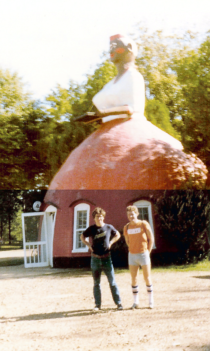 << Another Kind of Southern Architecture.
Even in 1980 in Mississippi, this looked interesting and a little uncomfortable. A gas station modeled after an Aunt Jemima figure.
On our ride from Natchez to Baton Rouge, we also stopped at the Oakley House in Audubon Memorial State Park, near St. Francisville, about 30 miles north of Baton Rouge.
89 miles today. 159 miles total.
Tim and I spent the night in a campground Baton Rouge, on what was then a semi-developed bypass around the city. I'm pretty sure we followed Route 61 most of the way from Baton Rouge to New Orleans. I remember a two lane highway lined with large petrochemical complexes and industrial plants.
I also remember entering New Orleans proper after dark, and wheeling down Carrolton Avenue and on to Tim M's house on Magazine Street. I don't remember whether we cleaned up first or not. But soon we left Tim's place for the French Quarter and started sipping bourbon and celebrating our 100 mile plus bike ride and the completion of our trip. It didn't take too many sips to make us very comfortable, and before long we headed back to the Magazine Street house. I'm sure we slept soundly.
103 miles today. 262 miles total.
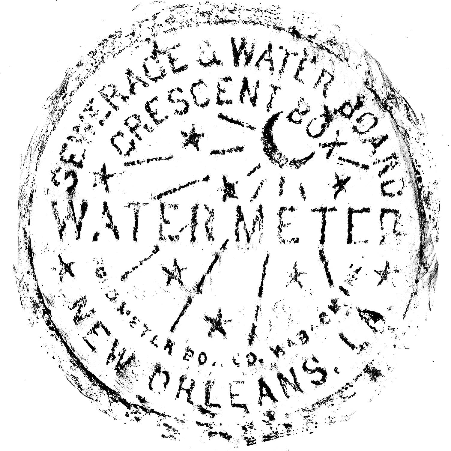 << Even New Orleans Water Meter Covers Have Style and Flavor!
This was my first time in New Orleans. In the following days, I inhaled the charms of the Garden District, the St. Charles Streetcar, the
southern vernacular architecture of the city, the special flavor of the French Quarter, the Camellia Grill, and the coffee and beignets at
Cafe du Monde.
This has been an interesting webpage to put together; a little archeology expedition.
Because of some back pain issues, I haven't been able to sleep through the night. I have been re-organizing my drawer of photographs during those late night hours when I had no choice but to be awake. I found a small number of photographs about this trip, amazingly, with dates on the back!
Going through those old photographs shows how poor cameras were back then. Most of my photos are blurry and of poor quality. I can't remember the name of the slim little cameras Kodak was pawning on us back then -- some model that followed their "Instamatic" line. The negatives are literally 1/4 of an inch by 1/4 of an inch. Such a small negative would guarantee that most images would come out blurry because of the photographer's natural inability to keep the camera absolutely still while taking a picture. Add to that, the futility of trying to obtain a sharp, reasonably-sized print from such a small negative.
Not to be totally cynical: these 27 year old photographs do bring back memories of things I had forgotten about the trip.
There is other good news. Maybe the hippie drug culture of the Sixties declined more quickly than the historic records (i.e. photos of the time) indicate. It's only the blurry, poor quality Kodak photos that have lead all of us to believe that everyone was zoned out on drugs for many more years than they actually were.
I continue to be amazed at the advancement of internet mapping technology even over the last two years. This technology is extremely useful when trying to re-create trips like this bike trip, which I took 27 years ago. It even provides additional information that was not readily available at the time I took the trip.
Using "Map My Run", which is based on Google Map technology, I can easily map and calculate distances between cities. (A big change from using a ruler on an "old-style" paper road map.) The website also has options like "show mileage markers", "follow roads" (so you can click between two points, and the mapped line and calculated distance won't be a straight line, but will bend to the curves and turns in the road). It can give you an elevation profile of your route, show only roads, show roads on satellite photographs of the area, and now even display roads over topographic information. It's amazing.
Map My Run even has a feature that lets you paste the maps you make to your webpage. (See below). Many thanks to the nice folks at Map My Run.
It's not perfect, of course. Mercifully, you still have to use your brain and think occasionally. I had some problems remembering if certain sections of the Natchez Trace Parkway which are open now, were even under construction back in 1980.
The Baton Rouge to New Orleans Century. Mapping Courtesy of Map My Run
Last Update: January 26 2008