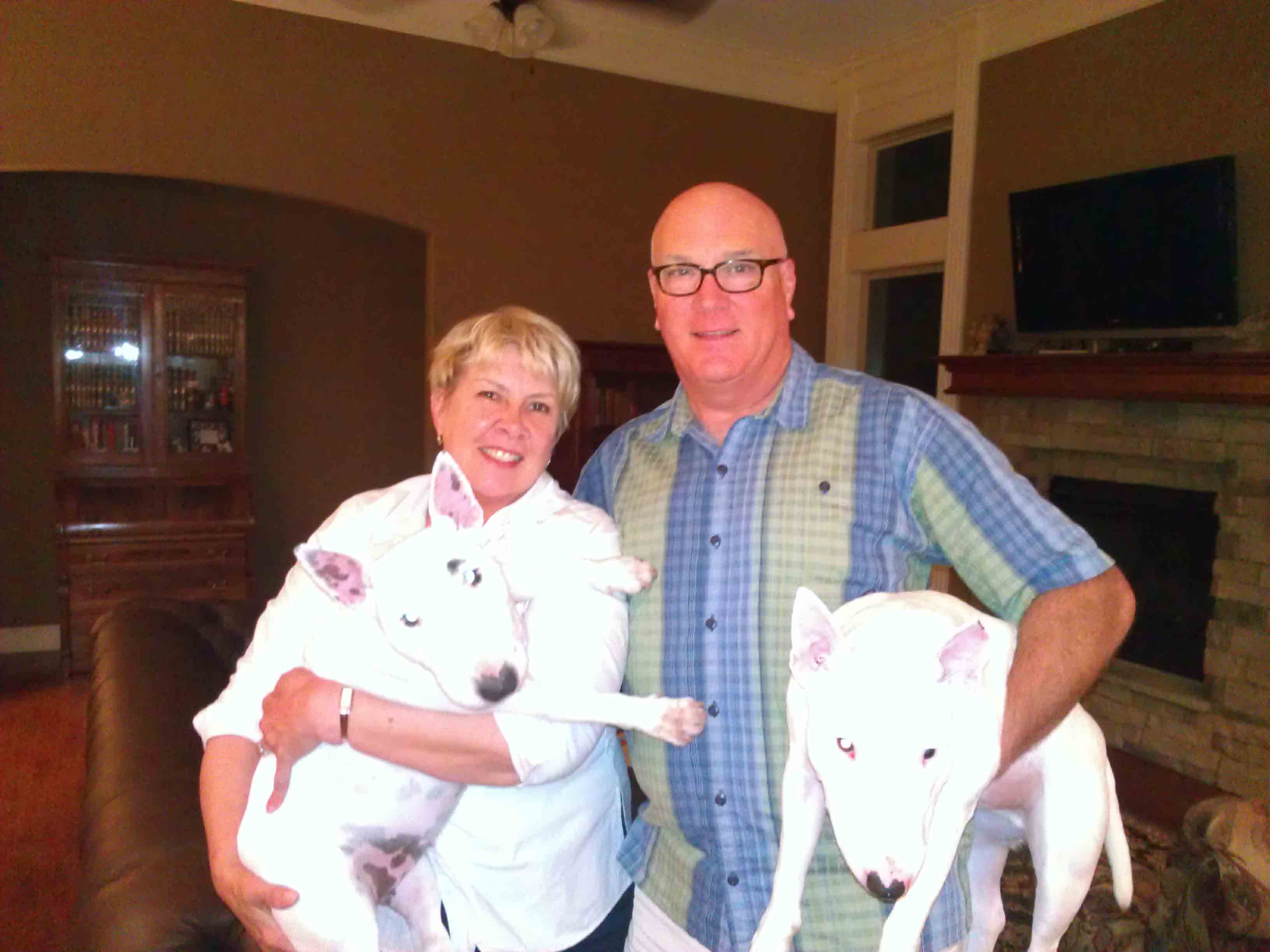
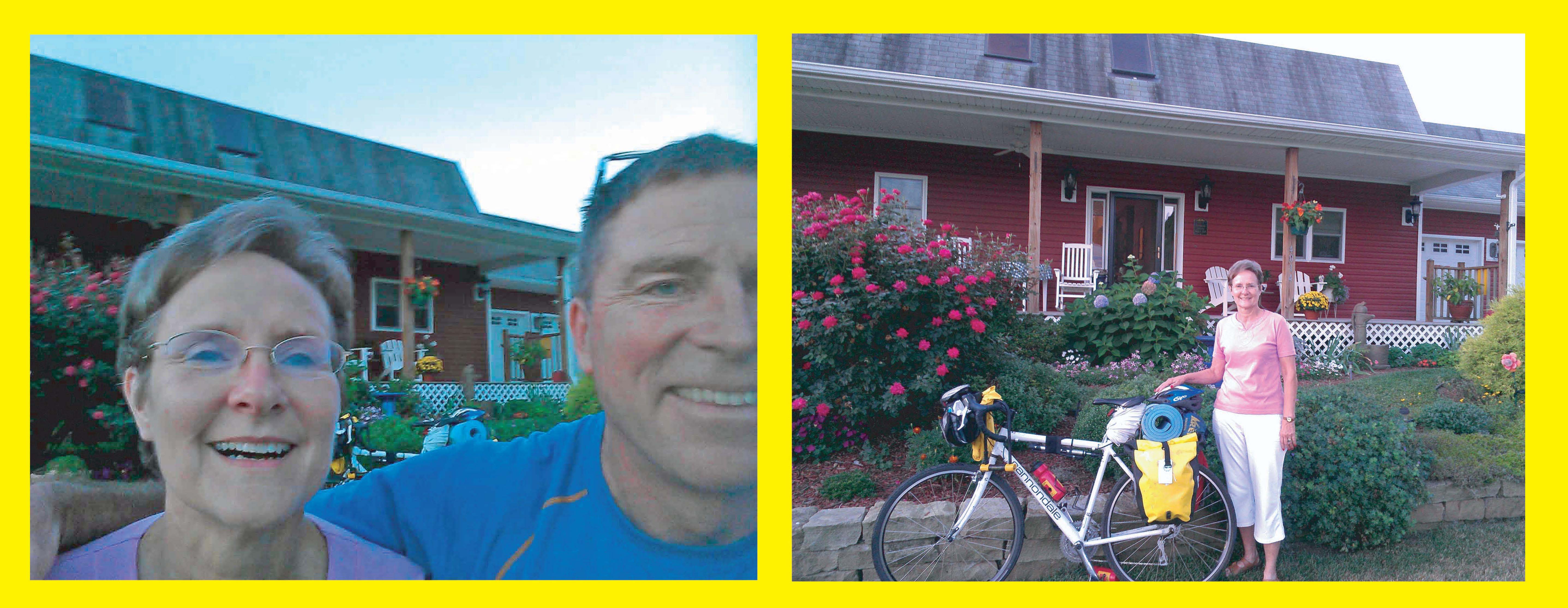
 Mad and Jim W., Jemma and "Hawk Ear". Olathe, KS.
Kansas City, Missouri to Jefferson City, Missouri
St. Louis, Missouri to Camp Dubois (Hartford, Illinois) and St. Charles, Missouri
Grand Pass, Missouri is located just south of the purple symbol near mile marker 68; Rocheport campsite is south of reddish brown symbol near mile 125.
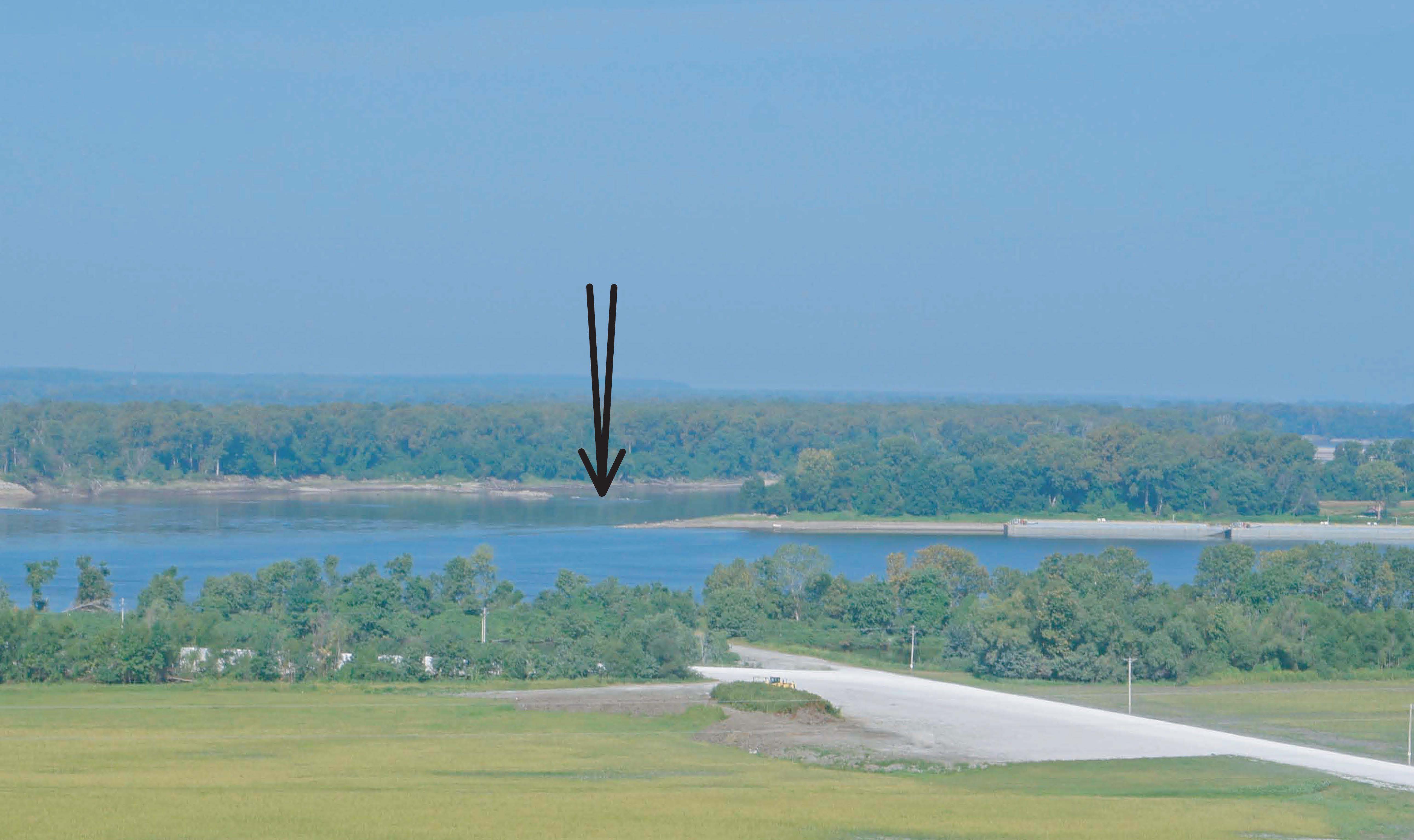
Note the bluffs on the north side of the Mississippi west of Alton; they set the northern-most and eastern-most location of the Mississippi River. Also note the bottom lands in the curving wedge between the Mississippi and the Missouri Rivers.
48 miles to St. Charles plus 20 miles from St. Charles to the St. Louis Lambert Airport Metrolink station for 68 miles total.
Tuesday morning, just before I head to the airport, I check the Missouri weather report. I see: "Record Breaking Midwest Heat to Build". 96, 97, 96, 99, and 98 degrees are the highs forecasted for the rest of the week! Checking in my morning flight on USAir at Washington National, I learn USAir charges $200.00 for bikes. Ouch!
Mad and Jim W., Jemma and "Hawk Ear". Olathe, KS.
I arrive
in Kansas City at 10:30am, and Jim W., an old biking friend, picks me up at the airport and takes me back to
their new home in Olathe.
I get to meet the newest dog, Hawkeye (who I will call
"Hawk Ear" - the result of a sad story with a happy ending!).
Jim and I grab lunch, and I settle in for an afternoon nap. Over an excellent BBQ dinner, I catch
up with Madelynn (a friend
from two building projects in Kansas City) and Jim, and life in Kansas City after their move
back from San Diego this
spring.
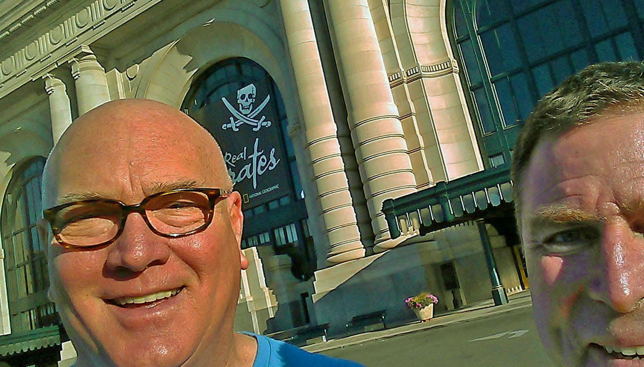 Kansas City Union Station.
Jim drives me downtown to Kansas City Union Station. Many thanks Mad and Jim for picking me up, putting me up, feeding me, and dropping me off. I start riding at 8:30am; the humidity is still low; it's about 75 to 80 degrees and sunny. I bike up and across eastern Kansas City, noting a few Hispanic neighborhoods. The traffic is quite light, so I have a pleasant ride to Independence, MO.
The town square in Independence was a way station on the Santa Fe Trail as well as a major jumping off point for pioneers headed out the Oregon Trail. The first caravan of Santa Fe traders passed through Independence in 1821, the first large group of prairie travelers to Oregon headed out in 1843. Independence, for its age and history, is spread out, so you don't get that old settlement feeling. I make my "de-rigeur" pilgramage to the National Frontier Trail Center, where I started my explorations of the Santa Fe and Oregon Trails many years ago.
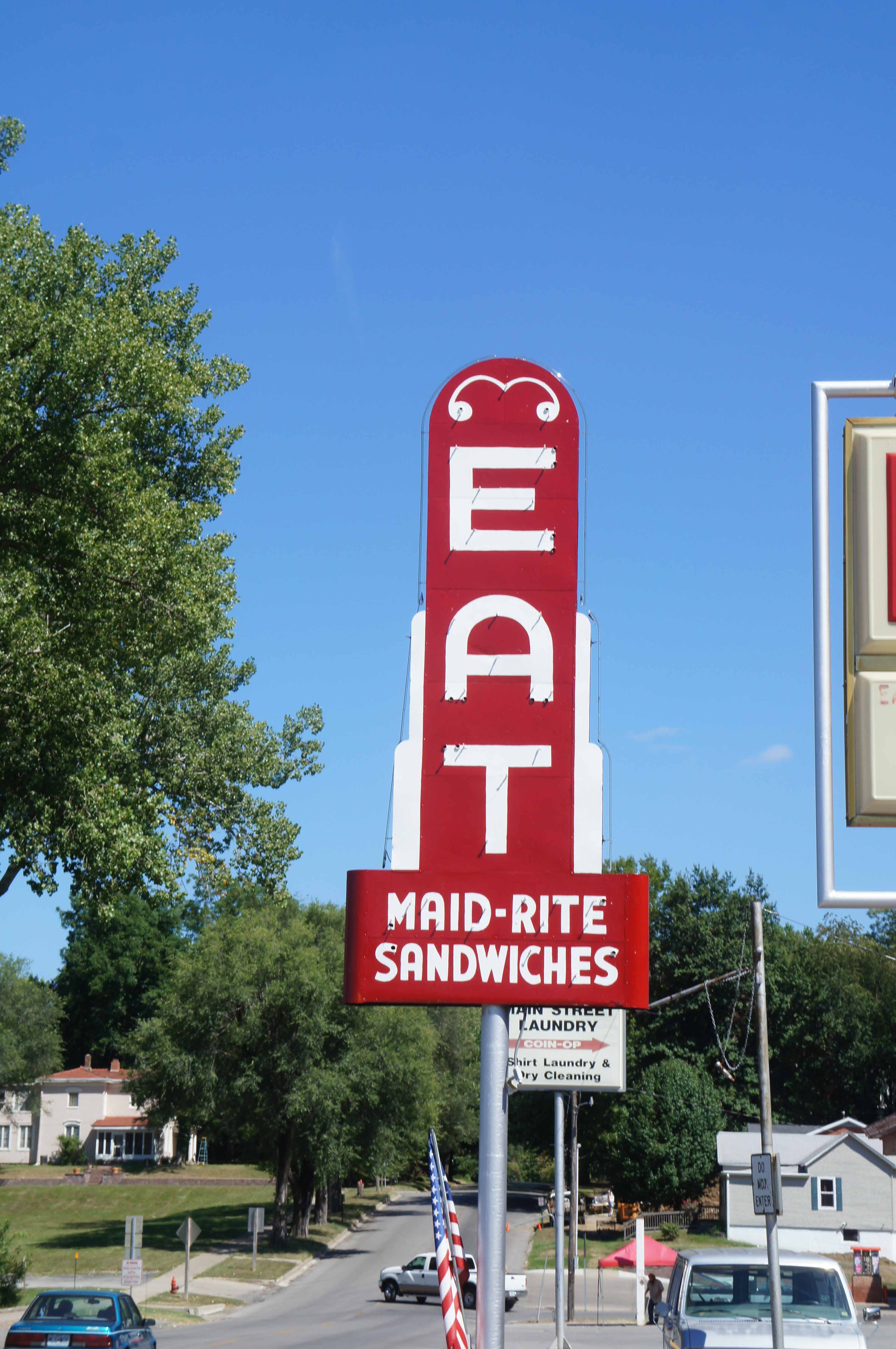
East of Independence, I follow Route 24, and then, at Napolean, MO, shift to Rte. 224 (old route 24) which runs closer to the Missouri River. I cross Waterloo Road, and pass through Wellington. Continuing on to Lexington, the fields are green, the grass is green, and summer looks to have been wet and mild. I pass lots of apple orchards and vineyards. Lexington is "Missouri's Apple Capital". Lexington, MO's revived "Main Street" is impressive, but I stop just east of old downtown at "Maid-Rite Sandwiches" to prep for the last hot 20 miles to Grand Pass, Mo.
 Recoup and rest up in Lexington, MO.
Big lemonades, large ice waters, and two orders of salty fries at the Maid-Rite.
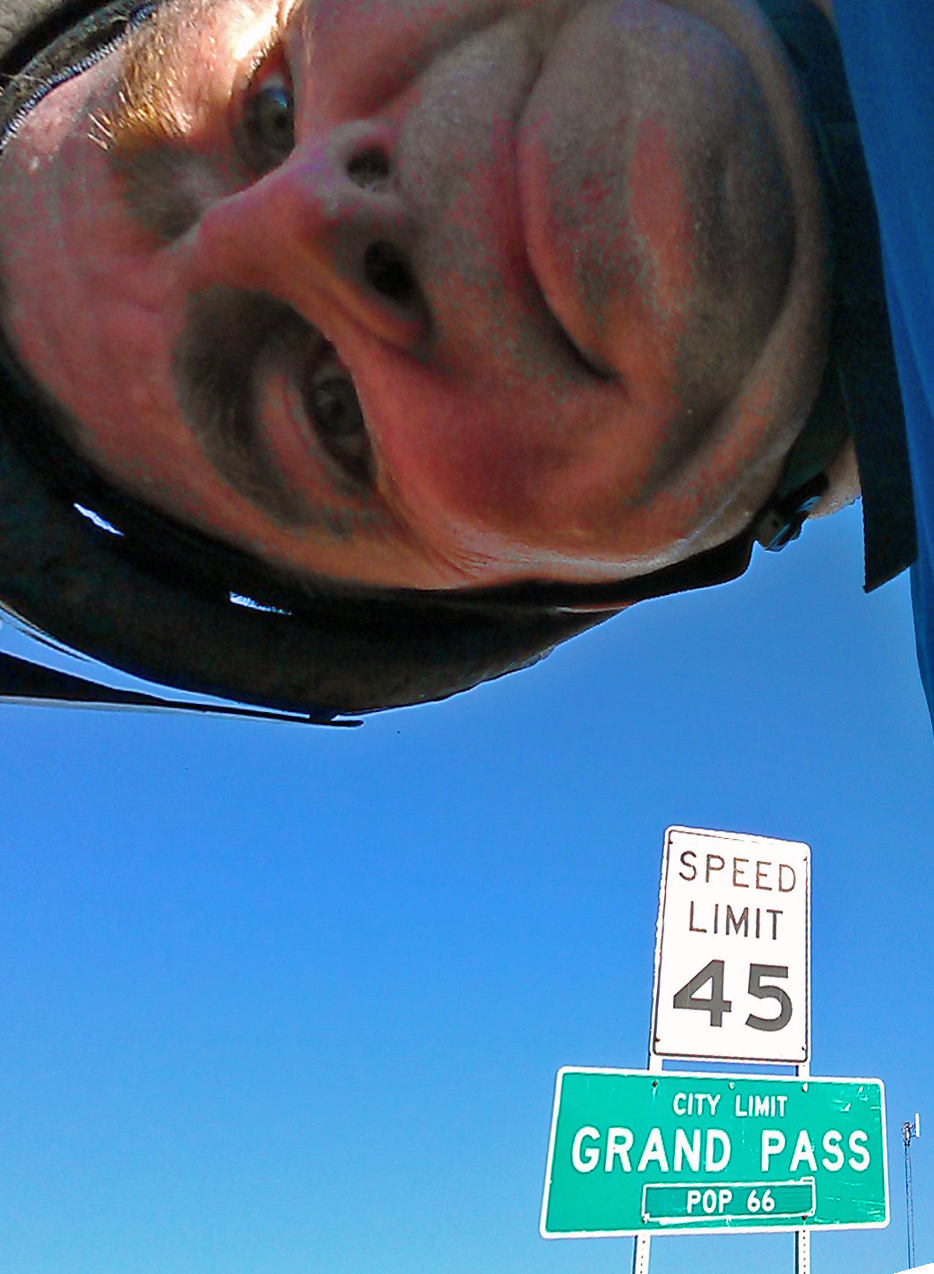
I head out of Lexington at 3pm. There are some hills, but it is mostly flat for the 10 miles to Dover. I cross a large number of short 1930s bridges: 80 plus years old. They appear to be structurally sound, well maintained, and still able to carry the highway. I'm tired and it is hilly and hot the last ten miles to Grand Pass.
I wonder if I
might bike right by Grand Pass, and then wonder how I would get directions back? The only landmarks are
cornfields, and they all look the same to me. At 5 pm, I find the
white steepled church that Chris confirmed was across the
street from her house.* And then I find Chris W. !
* Information and mapping technology has changed tremendously in the last ten years; I have
a friend who proposed as a project
for the millenium (2000) taking a picture of
every address in the country, a physical census of the U.S. It is interesting to think that he was way
ahead of his time. When I started biking, map technology wasn't much more than
paper and highlighter-marked directions (aka AAA "TripTiks"). See some of the maps of my earlier trips!
Now I can look around a community like Grand Pass, Missouri from my desk in Virginia, and get a feel for what the town looks
like and get specific visual directions there.
In fact, when I was talking with Chris on the phone to get directions to
their house, I was simultaneously checking out Grand Pass via Google Maps/Street View.
It's been in the 90's all afternoon,
but with low humidity. The route has a fair amount of shade and I drink a lot of water.
 Grand Pass, MO.
I catch up with Chris and we have dinner when Keith gets home. I see Chris's quilting machine - but she is a quilting machine in her own right. Keith tells me that after last year's drought, some farmers had planned to plant wheat this year as it requires less moisture. Then, a wet spring, including an 8 inch snow May 1st, added the risk of rotting seeds to every farmers worries. While the spring and early summer were wet, it has been dry recently, and the soybeans need a little rain to plump up for harvest. (The forecast says that is not going to happen this week).
I've been promising Chris I would stop by on my "next" bike trip for years -
funny that it would be on my last trip on the
Lewis and Clark Trail that I am finally able to keep my promise.
The route I followed today hugs the Missouri River, the Lewis and Clark Trail, and the Santa Fe Trail (Franklin, MO to Independence, MO to Santa Fe). The trees and grass are unusually green for late summer.
69 miles today, 69 miles total.
 .
.
Thanks Chris and Keith for the hospitality.
I am on the road by 7am and see a DAR Santa Fe Trail marker on my way out of Grand Pass. (I am also a dedicated Santa Fe Trail rut nut). It is flat the first ten miles, then hilly for 3 miles, and then flat the last 2 miles to Marshall. I have clear skies; it is humid and in the low 70s. Marshall is a prosperous agricultural and transportation hub.But where is it?? Downtown is hard to find. I finally find the downtown square a little past 8 am and stop for donuts and diet coke.
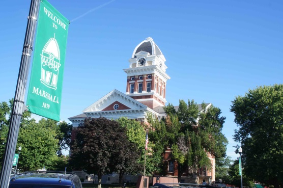 Courthouse, Marshall, MO.
I leave Marshall by an old narrow concrete road - Old Route 40 maybe? I also carefully cross a long 1930's bridge which is "failing". There are large holes completely through the deck, and I can see the water below. Peering through many holes, you can see exposed rebar, but in some holes, the rebar is completely gone.
I arrive at Arrow Rock at 9:30am, checking out Main Street first and then the state park visitor center. I learn about the Boonslick region and its settlement. After the War of 1812, restless american farmers and woodsman moved west from Kentucky, Virginia, and Tennessee, to find new, free, richer land. Franklin, Missouri, just down river, was founded and had a newspaper in 1819. The first group of Santa Fe traders, lead by William Becknell, left Franklin in September 1821, crossed the Missouri River on the Arrow Rock ferry, and headed to Independence and then west and south to Santa Fe. In 1822, the first wagon train of Santa Fe traders gathered on the bluff at Arrow Rock. The town of Arrow Rock was established in 1829 in part because of its location on the Santa Fe Trail. In 1834, a local entrepreneur built a sturdy two story brick tavern and general store to serve the large number of travelers and the growing local community. The tavern still serves food today.
Arrow Rock was one of the largest ports east of the Appalachians in the mid 19th century, serving as a transhipment point for trade goods headed to Santa Fe, provisions to supply the pioneer emigrants traveling the Oregon Trail (beginning in the early to mid 1840's), and tools and stores for the miners streaming west on the California Trail (beginning with the 1849 Gold Rush). Throughout this period, local agricultural products (tobacco and hemp) were floated to markets in the east, north and (mostly) south. Eventually the civil war, the end of slavery as a source of agricultural labor for the local farmers, and the coming of the railroads which bypassed Arrow Rock, doomed the economy of the community.
After lunch under the shade of a big tree, I head south out of Arrow Rock about 1PM. I lost my cool morning momentum exploring Arrow Rock. It's getting hot. The skies are still sunny and clear. I pass lots of corn and soybeans. A car-screech reminds me the road is narrow. I necessarily stop under old farmstead tree to cool off and get some water. I enjoy a couple of miles of hilly riding tempered by the shade from passing clouds. It is too humid to evaporate sweat, even when moving.
I take a "inside" rest stop near Lamine, MO, from 2 pm to 3pm, which includes air conditioning, no beating sun, and 4 bottles of waters.
From Lamine, I follow a pleasant but hot "Old Santa Fe Trail" into Boonville, getting in at 4pm. I settle in at the Phoenix Bar for cool air, beer, fries, salt, a burger, water, and shade. I meet Jesse Richman there. He is a biker, from Montreal, in Boonville on his way to Taos, NM to learn zero energy no water house design and construction. He has worked for Greenpeace. Coincidentally, the restroom has the hand sink over the toilet, so the water you use to wash your hands refills the tank. Pretty slick.
I leave Boonville at 6:30pm, after the afternoon sun has faded a bit, cross to the north side of the Missouri River, and arrive at the KATY Trail trailhead. The KATY park sign there states the Santa Fe trail ruts in Chris's church's graveyard in Grand Pass are famous because of their excellent condition. Whoops! Missed those ruts.
After biking on pavement in the sun with traffic, a crushed limestone trail with shade and no traffic is a very nice change. I first rode this section of the KATY Trail (Boonville to Easley) in July 1996 (yes, 1996), but did not make it all the way to Jefferson City. It is a treat to be back on the KATY.
At New Franklin, I see an interesting exhibit on the ornate old viaduct that carried the main road from Old Franklin, across the floodplain, over the rail yard, and up the bluff to New Franklin: it served as the town's formal entrance. Very hot and very humid. Moving does not translate into cooling. Despite lots of water and food in Boonville, I start to "boink"; the two gala apples from Chris and Keith save me.
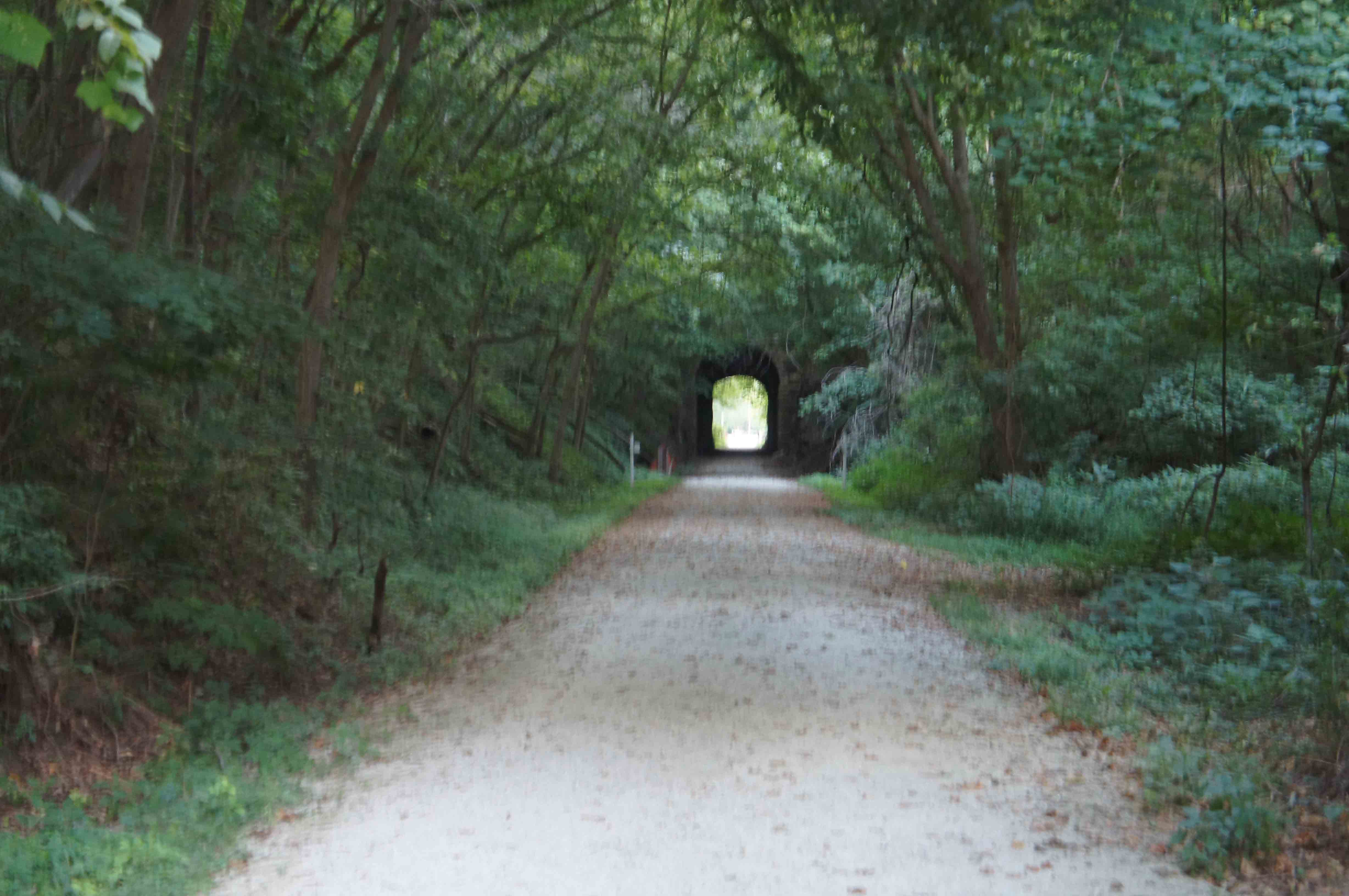 Rocheport. Missouri. KATY Trail.
At sunset, I arrive in Rocheport. No food is available this late. I repeatedly pour cupped-hands fulls of cold water from the restroom sink over my head to cool down. No sanctioned camping here. Mosquitos. I call to get my train tickets from Jeff City to St. Louis, but the Amtrak afternoon train tomorrow has no more bike space, so I must catch 11:18 am train. This means I have to focus tomorrow morning on a good pace and not too much stopping to"smell the cottonwoods".
I pitch my tent (without the rain tarp, in hopes of a catching a breeze) at dusk between
a mowed section of the right of way
and some woodlands. There are only rare, light, short breaths of air. I meet two riders from DC,
both 19, biking across country before
joining Navy. They have good gear but are more heavily loaded than I am because of the equipment needs of
a longer trip. Spoke/wheel problems delayed them today. The also
mention "hospitality" problems??
(I hope this is not because they are African American). I can tell they have already
learned a lot on this trip,
and wish them luck. (Note: the kind of "learning a lot" I am referring to is the kind
that would make any parent proud.)
66 miles today. 135 miles total.
I am up at 4:30am. I wasn't really sleeping; being awake and hot most of night. The night sky is still clear and starry, with a bright waning moon. Cooler than yesterday at dusk, but not cool. I quietly and slowly pack and prep. I recharge my phone, purchase my Amtrak ticket, and am off again at 6:30am, cognizant that I need to keep moving this morning to make the train to St. Louis. I am cruising on the KATY - no cars, no directions to puzzle over, no hills, only biking, relaxing, and moving fast and easy; I'm able to just enjoy looking around and taking it all in. Biking + sweating + moving again = cooling. There are lots of people on trail this morning (15+), trying to beat the heat perhaps. Bluffs to the north. Fields planted fence post to fence post (or fence post to bike path !). It is always calming to see a line of tall cottonwoods lining the river bank in the distance. Ocassional pockets of "cool" air hover in the woods near the river.
Saving grace -> Coopers Landing Campground and Marina for a late breakfast. All the right amenities, but not... quite... 5... star... Iced Honey Bun, Diet Coke, Starbucks Mocha Frappuccino in a bottle, and peanuts/raisins/M+Ms mix (2 bags actually) are on the menu. Doritos for desert! The Breakfast of Champions....with a great view of Missouri River.
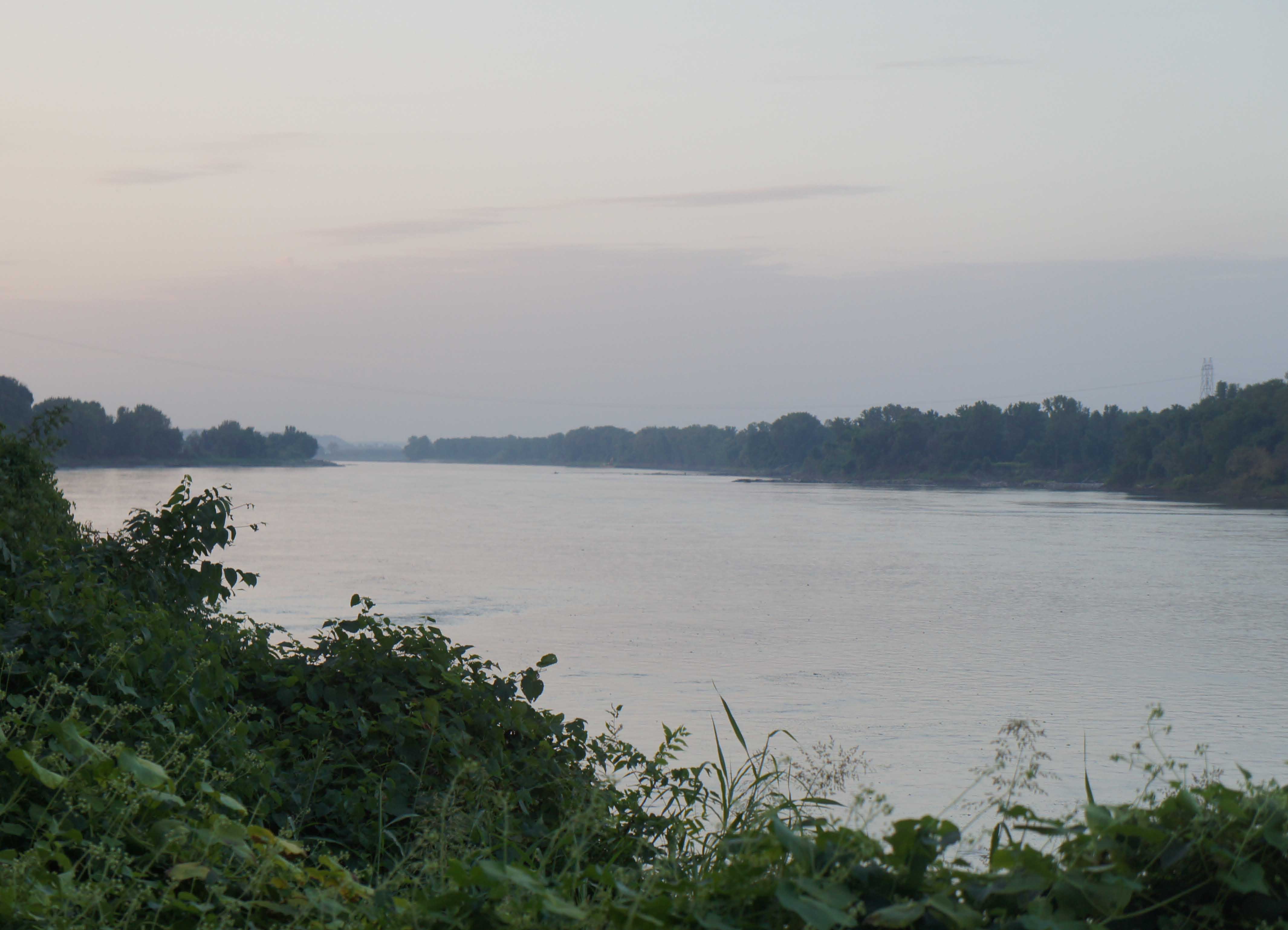 Missouri River at Cooper's Landing, Easley, MO.
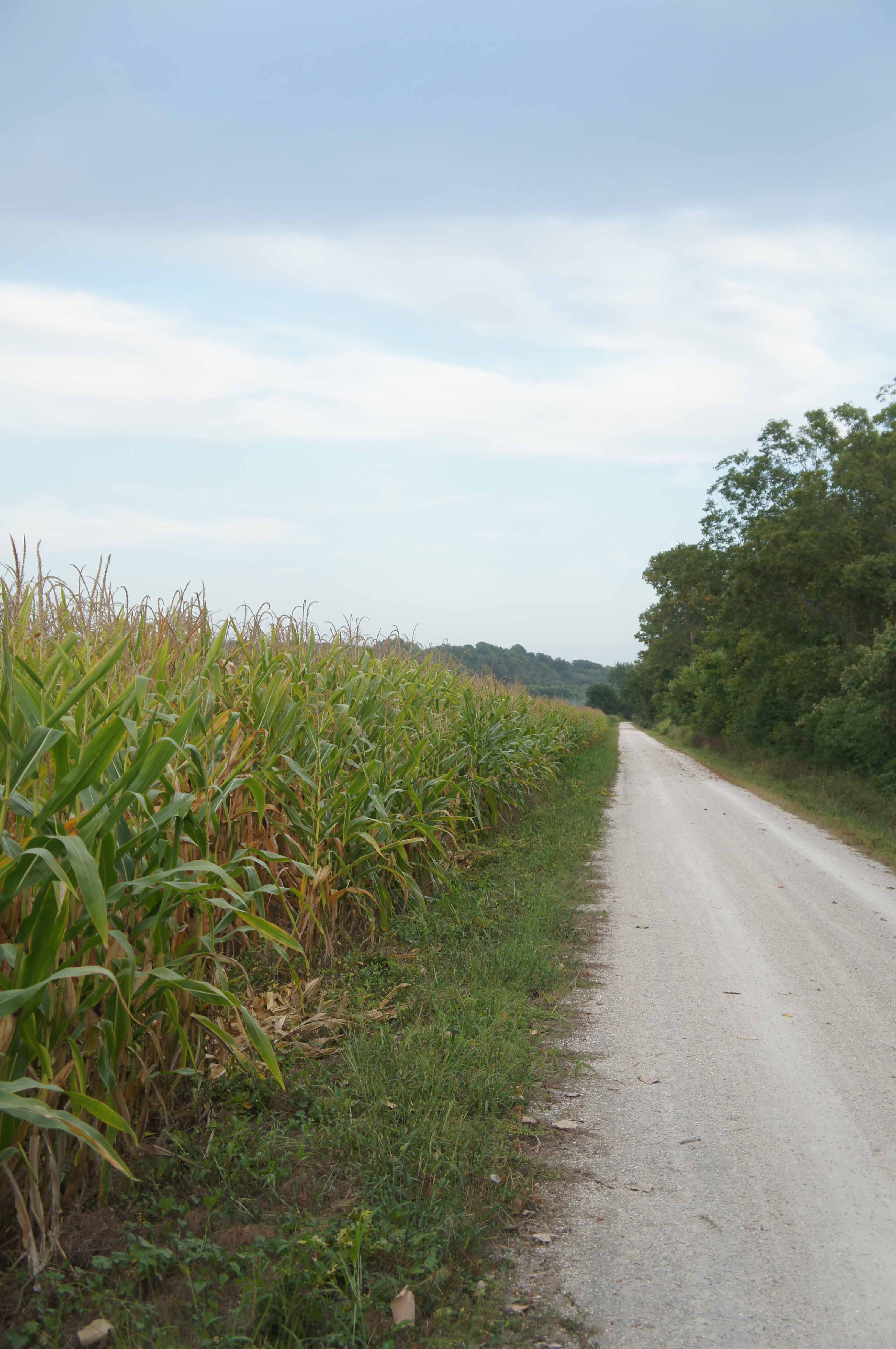 Corn planted in the right of way right up to the bike path. East of Rocheport, MO.
Goldfinches, trumpet vine flowers, sun flowers! I meet a biker in an orange shirt at Hartsburg, but have
to cut our conversation short to make my train. I saw that same (faster) biker at the Amtrak station
in Jeff City, and regret that in my rush getting ready for the train, I
miss my second chance to chat with him.
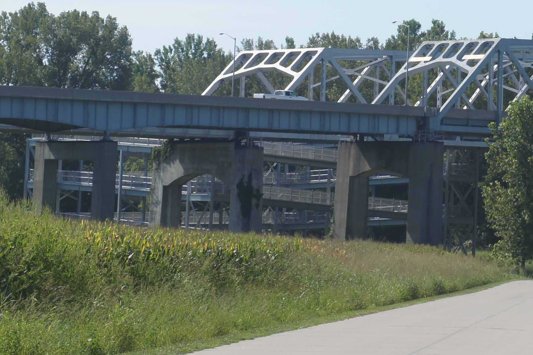 Massive bike ramp from the KATY Trail up to the bridge across the Missouri River to Jefferson City.
Kudos to Missouri for the bike ramp to the Route 54 bridge over the Missouri River to Jeff City. Four complete loops of ramps "cork-square" up to the bridge deck, this being a very straight forward design solution. Now a new challenge, where exactly is the Amtrak station in this hilly town?? Once found, I get what I will call an "Amtrak shower". The KATY Trail has an excellent surface, much like a clay tennis court. But if you ride it any distance, you and your bike will be covered in white clay dust - like you fell into a bag of flour - only grittier. Add in a lot of salty sweat and a little road stink, and you want to (and feel a little obligated to) clean up a bit before you sit down next to anyone for any length of time.
The nice folks at the Amtrak counter say there is no hose out back. They offer a bucket, but it would not have fit under the restroom sink faucet.
I spot an sturdy Amtrak plastic bag (for holding brochures??) at the counter - about the size of a plastic grocery bag. I fill the bag with water from the restroom sink, hang it from a tree around the side of the station, make a small hole in the bottom corner of the bag and > bingo > shower. I ask what look like Missouri State Policemen, who walk up shortly after I start cleaning up, if I am going to get in trouble... Nope. They are correction officers escorting prisoners on the train to St. Louis. Note: I did have my bike shorts on the whole time.
I manage to clean up, discretely change out of my bike shorts (back in the restroom), and rinse off my bike
just in time to board the train. I'm really disappointed that of all the shortcuts
and tricks I have learned over
the years, it took me so long to figure out the plastic bag shower.
The train left Jeff City on time at 11:20am. It is crowded. Good thing I got washed up. From the train, you get a different view of Missouri River's north bank, since you are sitting higher up. All is still very green.
Note: I biked the Jeff City to St. Charles section of the KATY Trail in the spring of 1998,
which is why I am skipping over this section.
It is a beautiful section of the trail though, and well worth doing more than once.
The train arrived in St Louis Union Station at 2PM. It is "city summer" hot in St. Louis. I check into my hotel at Washington and 8th, shower, unpack, nap, and get groceries. Nice to be back in St. Louis after only 3 months. I head out that evening for a drink (unusual for me).
40 miles today. 175 miles total.
I believed that my 1998 ride on the KATY Trail into St. Charles, MO and my bike up the Mississippi into St. Louis this spring meant I just had a short few miles to connect the two trips. Not so lucky. Though Lewis spent considerable time in St. Louis, and Clark came into the town ocassionally during the winter of 1803-1804, Camp Dubois, their winter quarters, was actually on the Illinois side of the Mississippi River, about 20 miles north of old St. Louis. It was at the mouth of the Wood River across from the confluence of the Missouri and Mississippi Rivers. And St. Charles, MO is about 30 miles up the Missouri from this confluence. So closing the gap is not just a sweet few miles.
Because of the heat, I leave the hotel at 7am, head to the Arch and turn north along the Riverfront Trail. The Trail going north provides an impressive overview of St. Louis's industrial and riverfront history.
The Riverfront Bike Trail passes through an area that contains historic industrial infrastructure (massive in scale), is home to many beautiful older commercial and industrial buildings, demonstrates the economic advantages of river access, includes expansive stretches of floodplain that support manufacturing, warehousing, and commerce uses, and shows the challenges of and ingenious solutions for operating in a flood prone environment. All these things made St. Louis a great city.
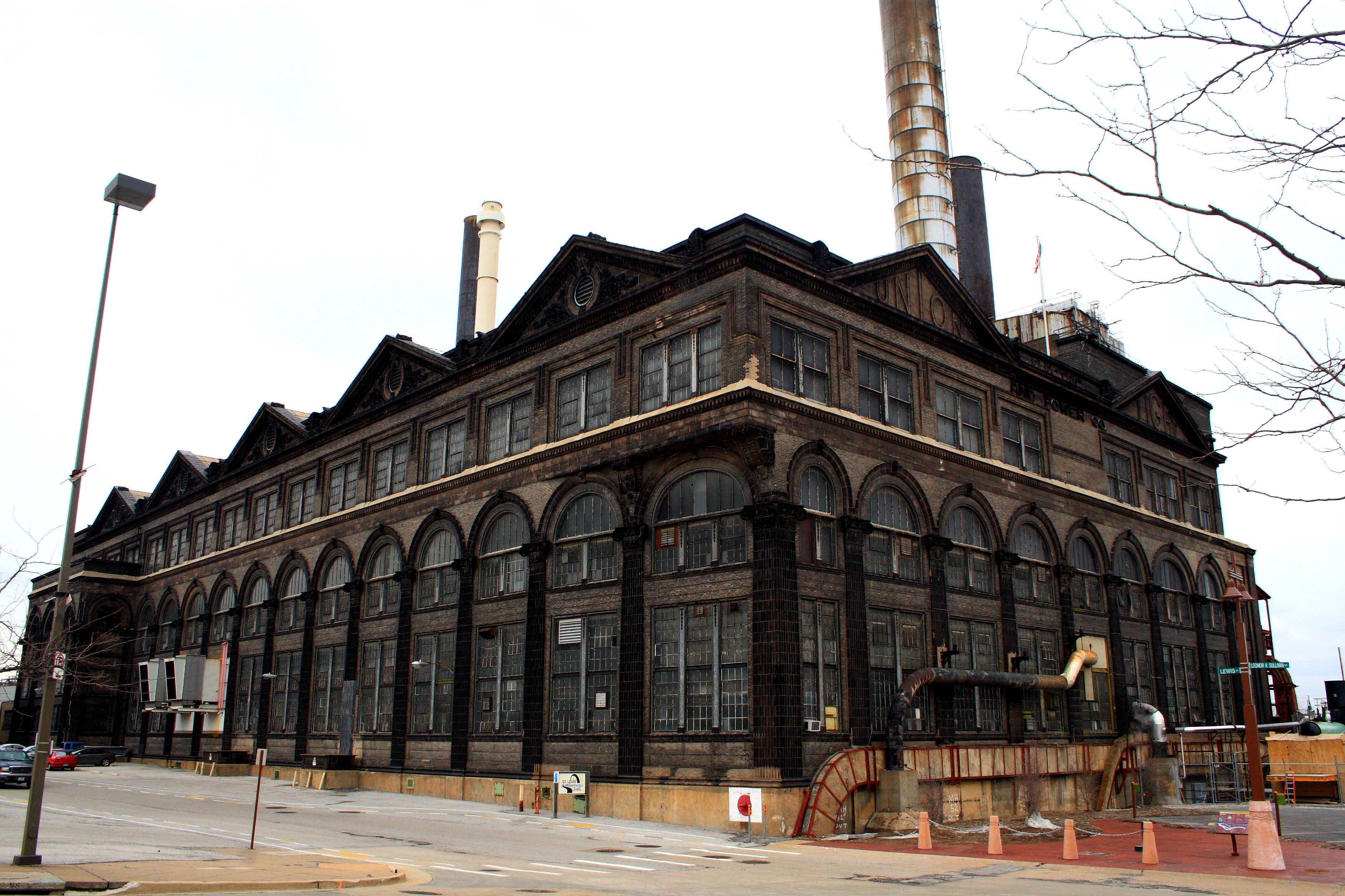 Old Industry North of Downtown St. Louis:
Union Electric Light and Power Plant.
photo credit: Frank Peters
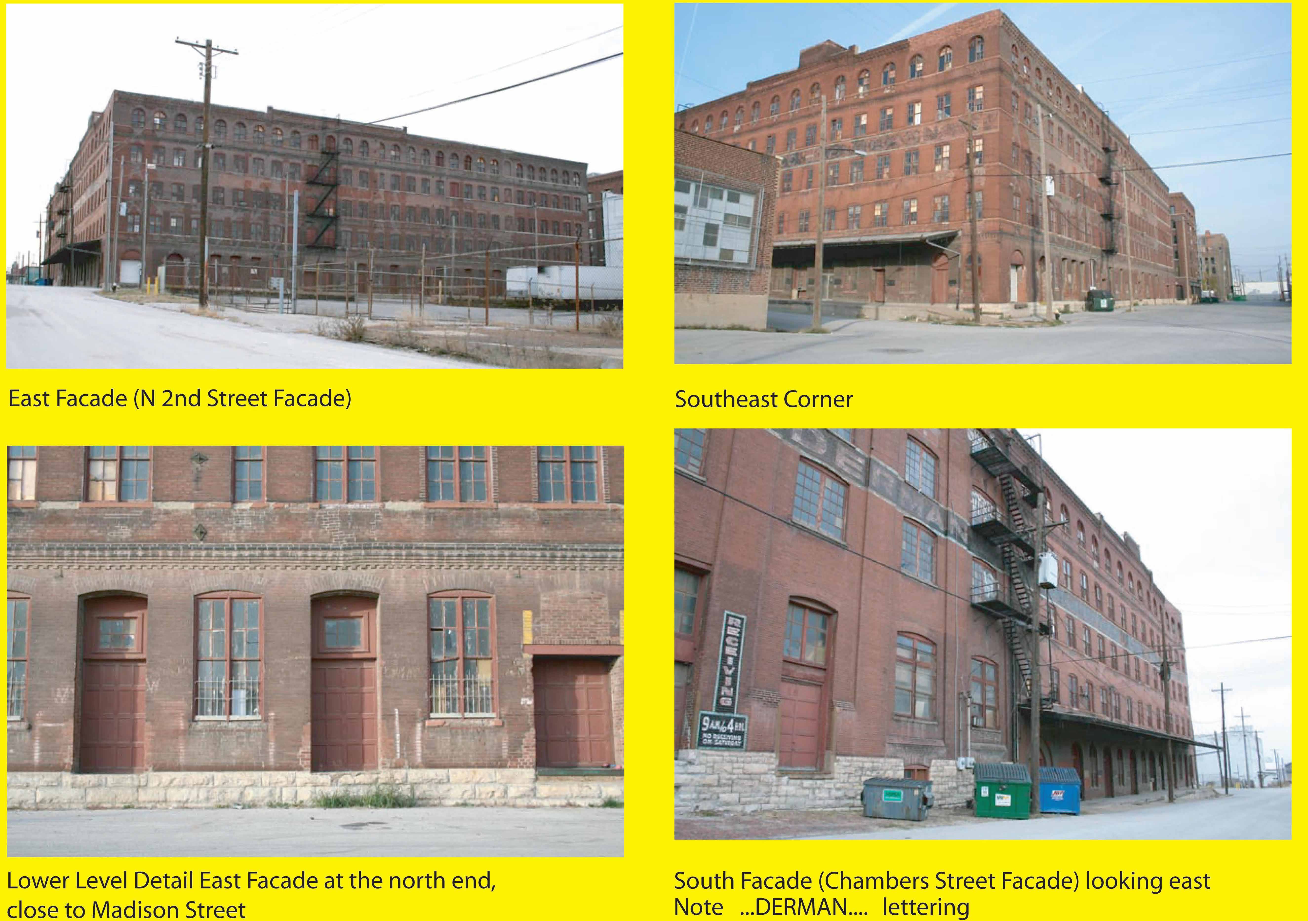 Old Industry North of Downtown St. Louis:
Biederman Furniture - Standard Stamping Company Building.
photo credits: Built St. Louis, Robert Power
If you are near this building complex, you can clearly see the faded company names that were painted onto the south side of the building. *
* or Try Google Maps Street View: 585 Chambers Street, St. Louis, Missouri and "look" up.
The quality of the
photography available on Google Maps Street View is crisper than the photos shown here and
the warm patina of the building facade with the old lettering is much brighter.
 Old Industry North of Downtown St. Louis:
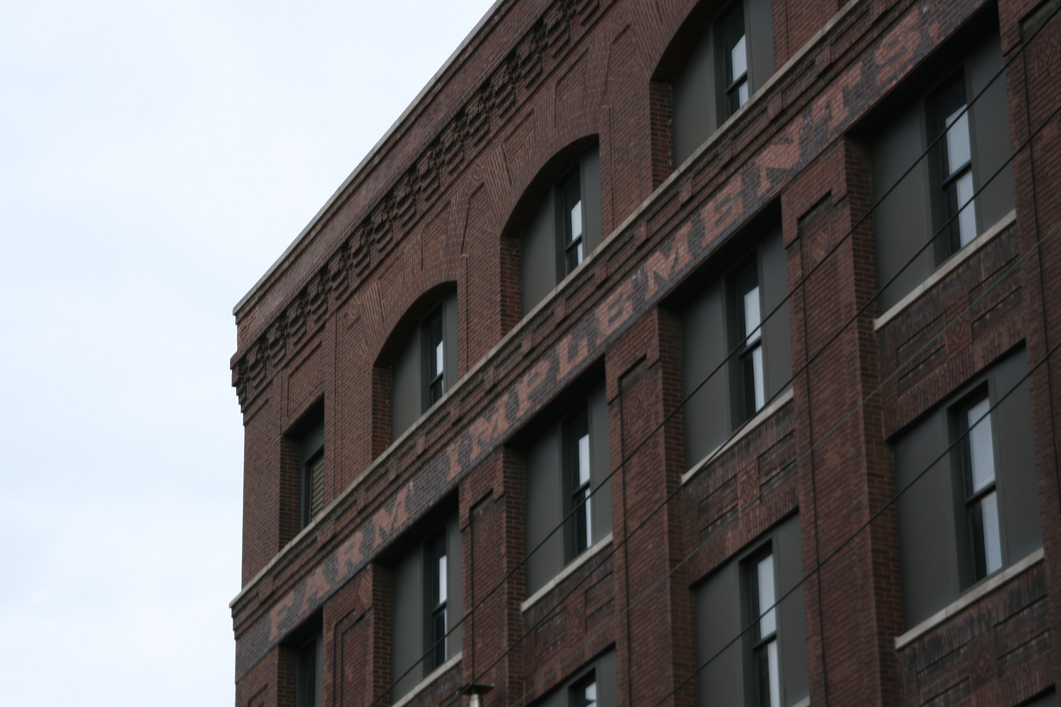
Farm Implements, Wagons,Vehicles.
Missouri Moline Plow Company.
photo credit: Paul Sableman
If you are near this building complex, you can clearly see the faded company names painted on the south side of the building. *
* or Try Google Maps Street View: 422 Madion Street, St. Louis, Missouri and "look" up. The lettering is
not as clear as in this photo, but if you look carefully you can see all the lettering
referenced in the caption.
 Old Industry North of Downtown St. Louis:
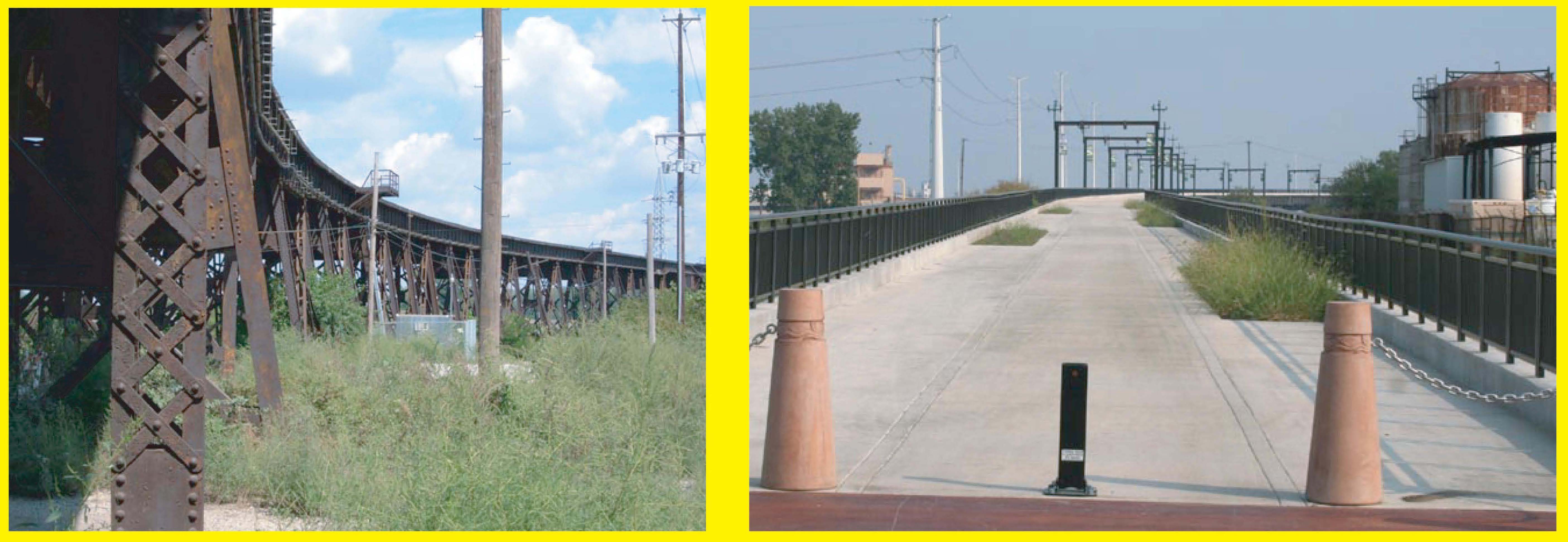
Railroad Infrastructure Reborn
photo credits: Built St. Louis, Robert Power
An old elevated rail line,
(l.) like the one that serves the Merchants Bridge, (r.) can be transformed to take the
Riverfront Bike Trail up to the McKinley Bridge and Illinois.
It is all a palimpsest of industrial history, brought on by the evolution of technology and economic opportunity.
The website, Built St. Louis, is a great place to learn more about St. Louis's architectural past, including its industrial past.
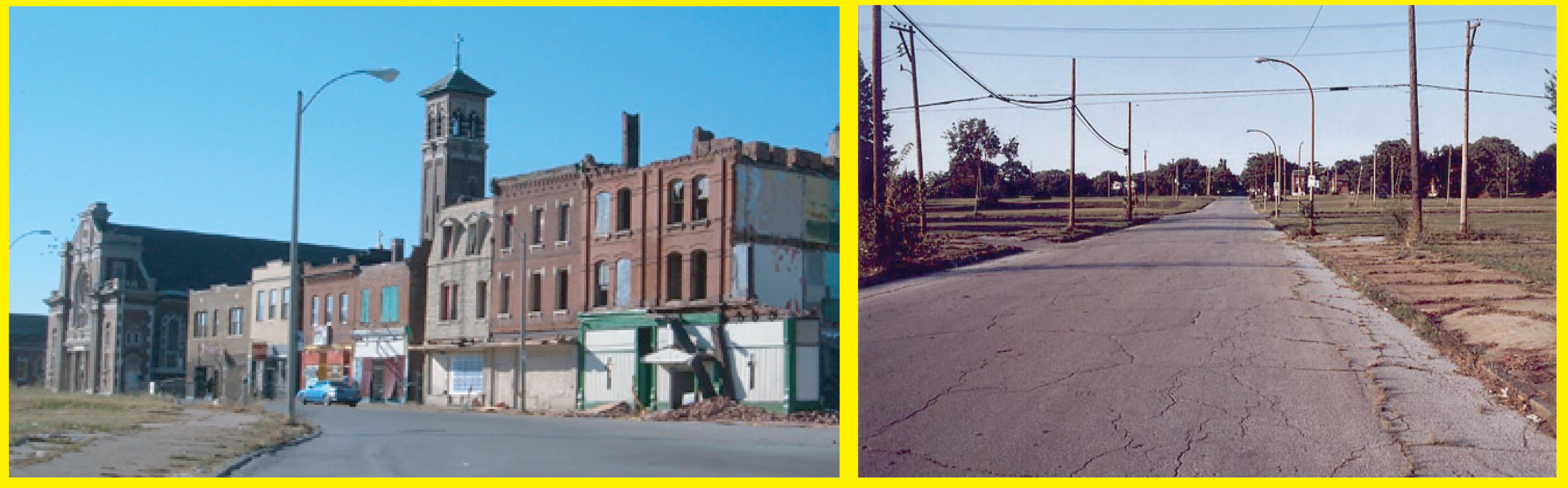
photo credits: Built St. Louis, Robert Power
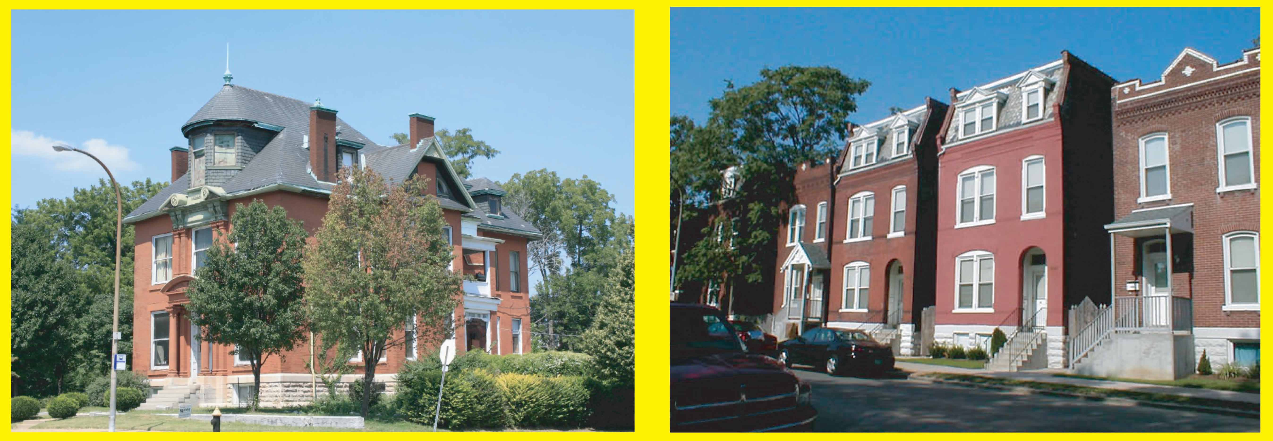
If you look north from just about anywhere in downtown or mid-town St. Louis, you see church steeples in the distance sprinkled over and anchoring what seem to be extensive old neighborhoods - much like Boston's North End or South End look from Boston Common. The website Built St. Louis, specifically Built St. Louis - The North Side, mournfully and photgraphically depicts the story of the "great emptying" of North Saint Louis, where its once splendid architecture and rich urban fabric frays and becomes threadbare because of suburban flight. (St. Louis = a little Detroit?).
For another view of the tragic decline of St. Louis's North Side, see the website St. Louis Patina, which is organized differently than Built St. Louis, and offers some exceptionally high quality images depicting the decline of the North Side.
To consider yet another perspective of the diaspora of St. Louis as a city, see the website Mapping Decline: St. Louis and the American City, which examines the use, over almost a century, of real estate market mechanisms to impose or enforce racial segregation, including exclusionary zoning, land covenants, private and federal home loan rating standards, and urban renewal/removal projects and programs. Cartographic representations of both white and black flight show the unfortunate results.
Finally, look at Google Maps/Street view. Take a street level tour of the St. Louis
Place neighborhood along St. Louis Avenue
and Rauschenbach Avenue to understand the current range of housing quality, or examine
some satelite views of the North Side
neighborhoods to see how truely empty many
of the blocks have become.
 The Former Glory of North St. Louis
photo credits: (l.) St. Louis Patina, Chris Naffzinger
and (r.) Built St. Louis, Robert Power
It's 10 miles from the Illinois side of the McKinley Bridge to Hartford, IL, home of a reconstruction of Camp Dubois and an excellent Lewis and Clark museum. I follow a paved bike trail along Route 3 and on top of the levy. Interestingly, Jefferson County Transit has responsibility for the bike trails on the Illinois side, so the trail signage and trail system information posted along the trail is excellent. So too information and maps available on the web. (Missouri jurisdictions are not quite as good.)
The Lewis and Clark State Memorial Park is a must see. The volunteers and staff are exceptionally friendly and helpful. The most amazing thing in the visitor center is a replica of the keelboat used by the Corps of Discovery. You can see drawings of the boat and read descriptions of it in the journals, but until you actually see it, you don't realize how big and clumsy the thing is. It must have been an ungainly vessel to handle in the Missouri River and it looks like an almost comically bad idea to use a boat of this type. I am sure when the Corps finally left it behind, there was not a tear shed by anyone.
One of the docents said Camp Dubois was located on the Illinois side because the Spanish wouldn't have looked kindly on a large group on Americans on the west side, "their side", the soon-to-be-French-again side, of the Mississippi. When Jefferson was originally planning the expedition, before the idea of the "Louisiana Purchase" even existed, he had to consider the the perceptions of the Spanish regarding "scientific exploration" verses "reconnaisance" for military and other "could-cause-trouble-later" reasons.
The Lewis and Clark State Memorial Park and visitor center is located on a small creek/drainage canal, about 2 miles south and slightly east of the 1804 location of the mouth of the Wood River and the confluence of the Mississippi and Missouri Rivers. The present day location of the mouth of the Wood River is also approximately 1/2 mile north of its location in 1804.
Less than a mile upriver, I stop by and take the elevator to the top of the Lewis and Clark Confluence Observation Tower. Finally completed by Hartford, IL in 2010, it has a good, but not an exceptional, view of the confluence.
It's about 10:30am now and is already hot. Clear sky means the sun is sharp.
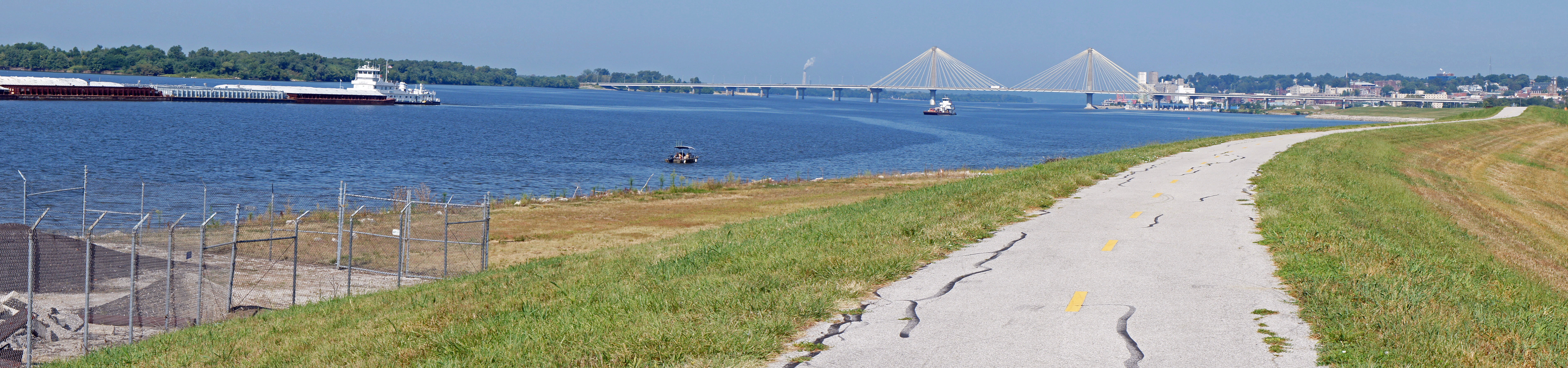
 The Missouri River meets the Mississippi River.
 Missouri River looking towards Alton.
Another 10 miles of bike trail gets me to Alton, IL. Bluffs begin to appear on this side of the Mississippi, and, not surprisingly, Alton is located on the first one. This is another Illinois town that the economy and technology seem to have passed by. Some nice old buildings, but not much going on downtown. The only vehicle I see moving is a hearse parking on Main Street. A riverboat casino, of course. After "cooling and fueling" at the only place I could find, a Subway, I head south on the Lewis Bridge, Rte. 67, to Missouri. The bridge was built so bicycles could use it...only recently has St. Louis begun dealing with the problem that most major river crossing in the metro area do not allow and can not accommodate bikes.
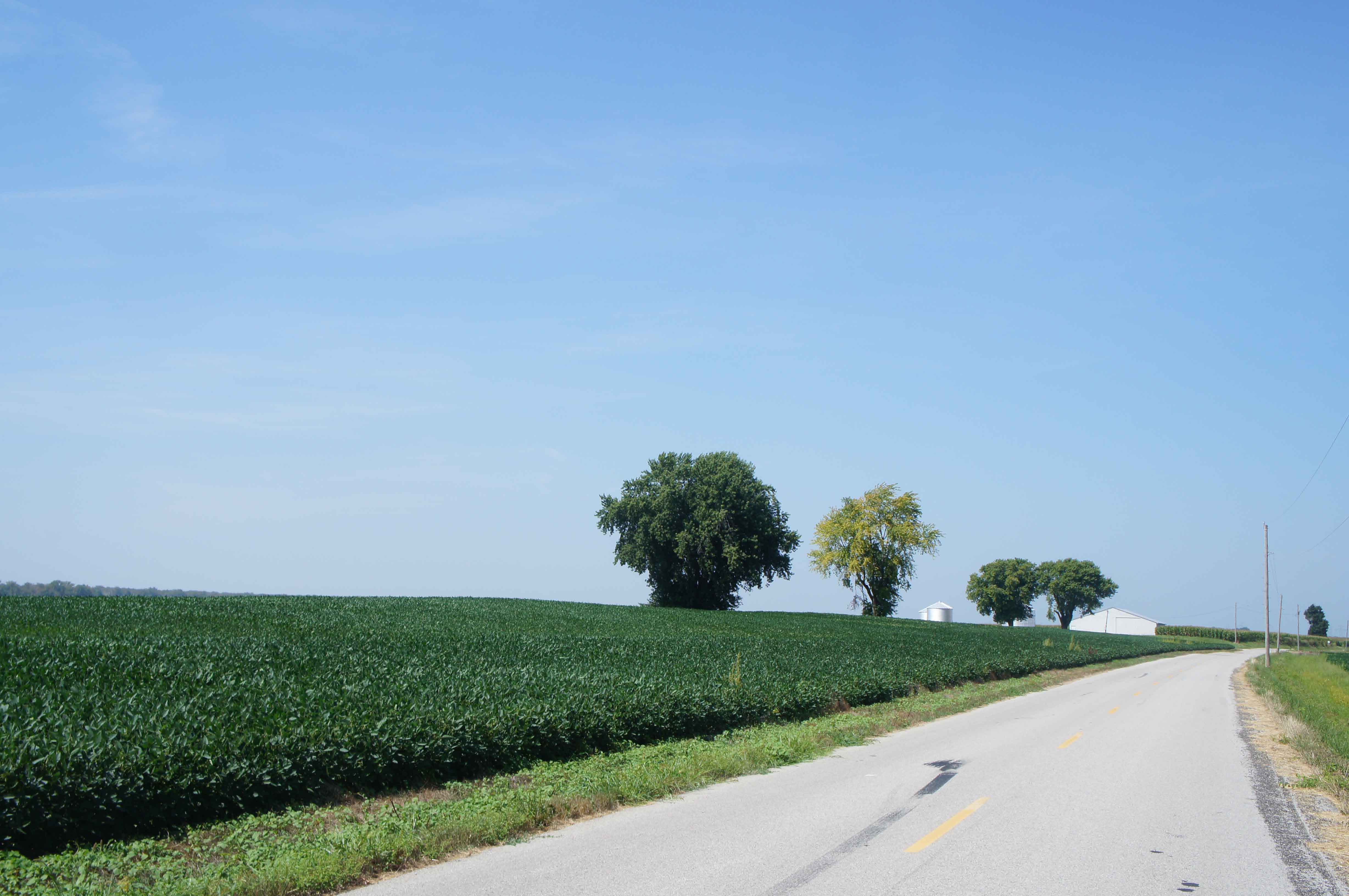
Farmland between the rivers.
Bam. Talk about flat bottom lands in the floodplain, the wedge of land between the great curves of the Mississippi and Missouri Rivers is just that. It is as rural as it is flat. All the little communities and industrial plants crouching behind levies or up on higher ground that I travelled by this morning disappear. The 20 miles between Alton, IL and St. Charles, MO is all cornfields, quiet roads, and easy, but hot, riding. To the right, you can see the bluffs on the north side of the Mississippi; to the left, cottonwoods lining the south side of the Missouri.
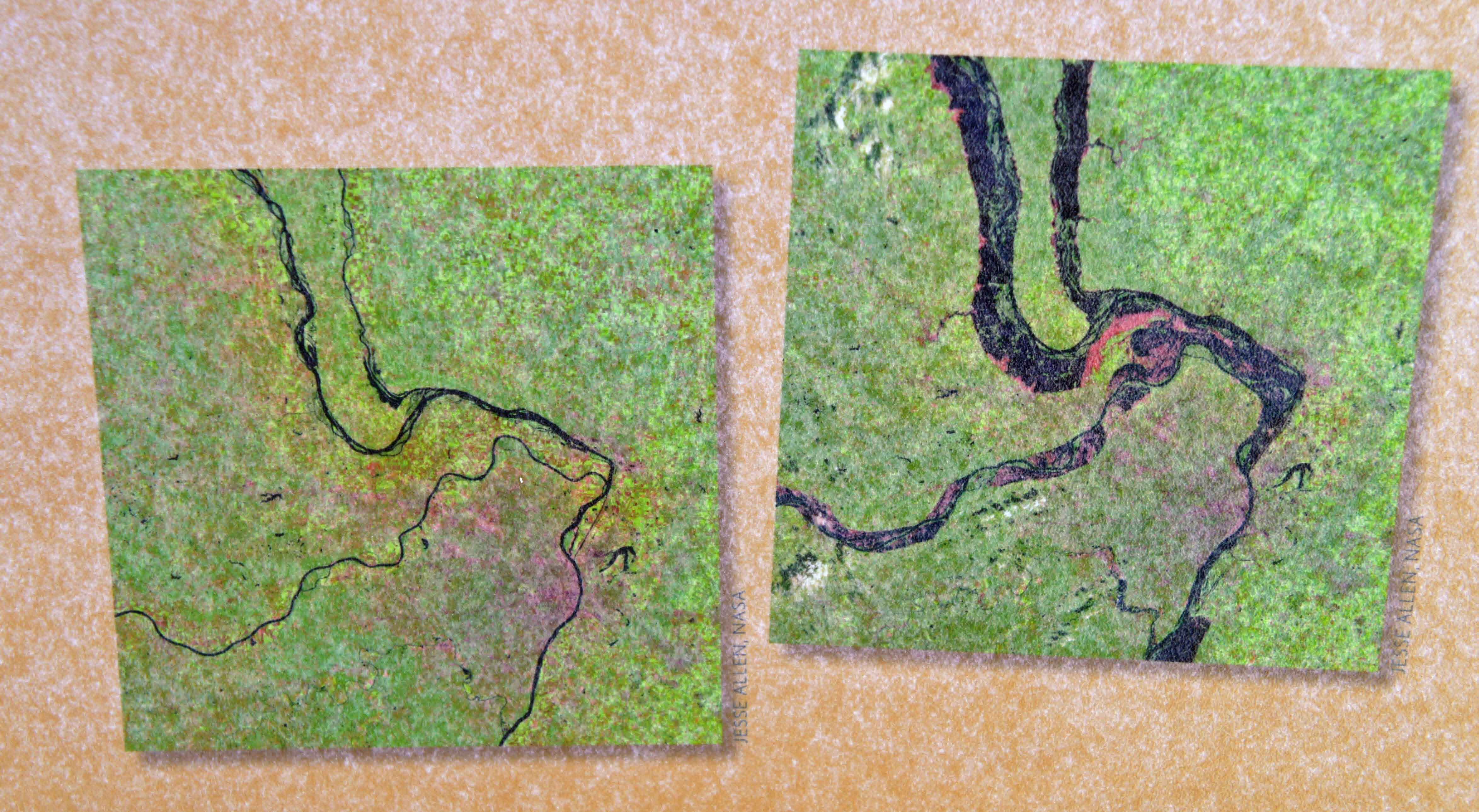 Land between the Rivers before and during the 1993 flood.
An excellent explanation of the concept of "floodplain" at the confluence of the Mississippi and Missouri Rivers.
 The Machens Trailhead.
The Machens Trailhead is well hidden. In fact, at the end of Machens Road, where it turns to gravel, there is a sign posted (next to the active rail line): "No Access to the KATY Trail". Hmm. Except, fortunately, if you walk about 100 feet east between the rail line and the trees, and happen to slowing turn around and peer through the trees and vegetation... you see a typical bike trail gate post and the KATY trail. ??? OK. That was good luck.
 The KATY Trail near Black Walnut, MO.
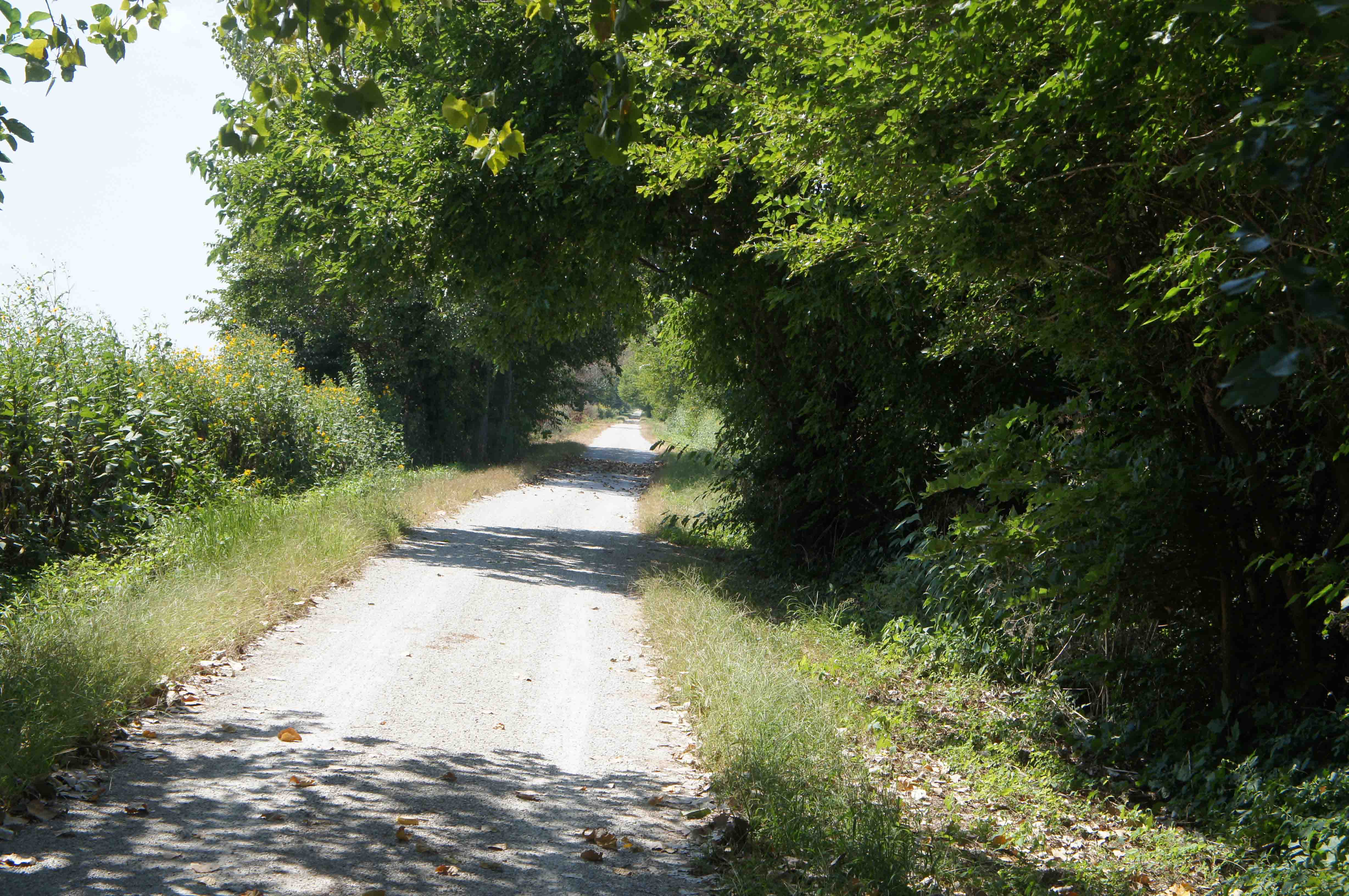
Now I am biking on friendly territory. Straight,
flat, and lots of shade... great news considering the heat and sun. A recent flood has damaged the
trail, but some
bulldozer work following the flood provides a decent path over the rough patches. Only ten miles
remain to St. Charles
and closing my gap. A southwest wind and forward movement provide some necessary evaporative cooling.
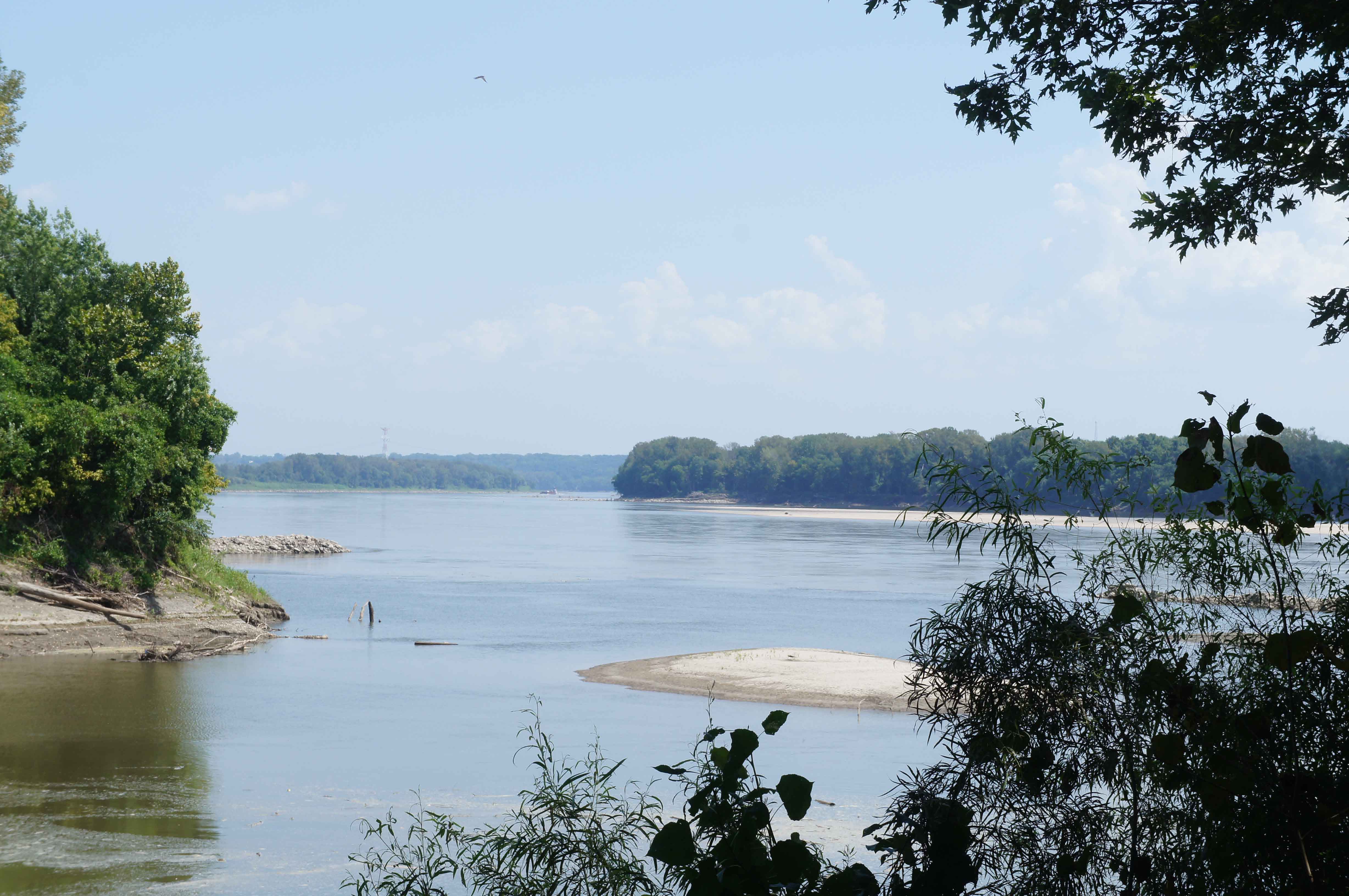 The Missouri River Just Downstream from St. Charles.
Finally, the trail exits the cornfields and squeezes up to the Missouri River.
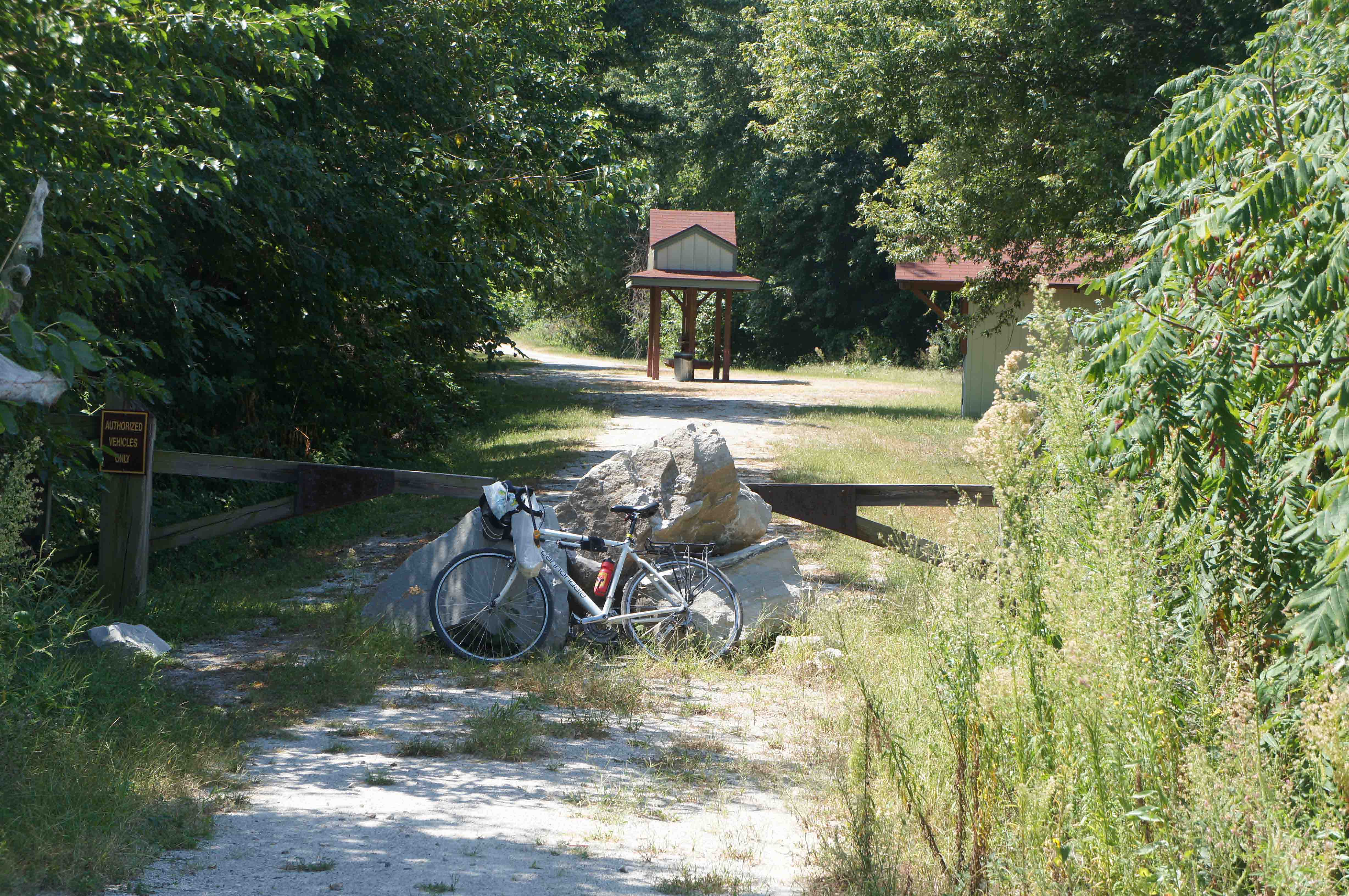
I pass an expansive but shuttered steel fabrication plant just outside of St. Charles, and arrive at Pioneer Park in St. Charles at 2pm. Hot. Gritty. Thirsty.
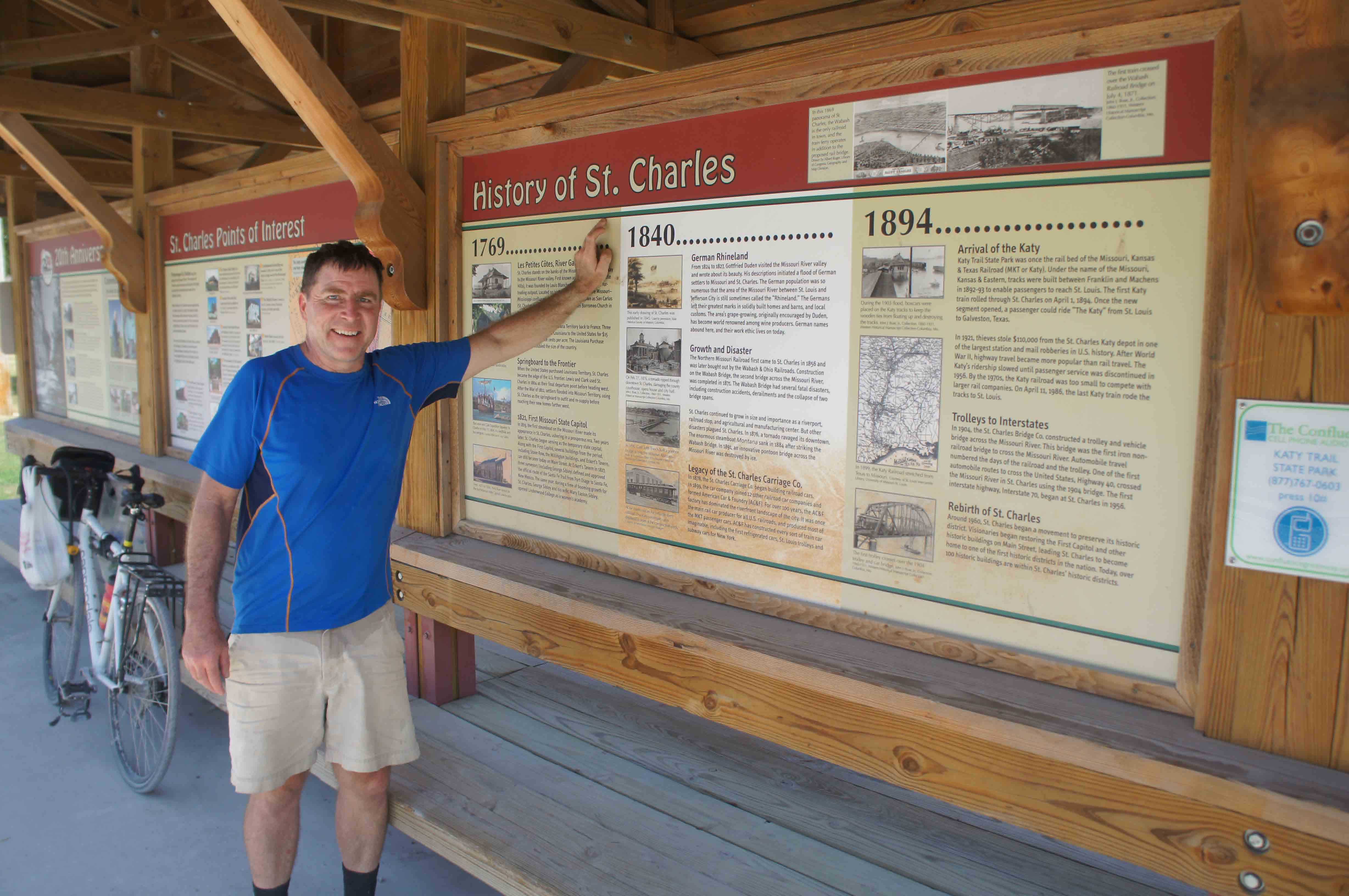 St. Charles, Missouri - KATY Trail Trailhead.
Annoyingly, I don't have much time in historic St. Charles. The bike shop in downtown St. Louis that is shipping my bike home closes at 6pm. The twenty mile bike back to the airport Metrolink station is via the new Page Road/Rte. 364 bridge (8 lanes) which is five miles south of St. Charles. The I-70 Bridge in St. Charles and the Rte. 370 bridge just north of St. Charles are not bike accessible. ARGH. (OK, Rte. 370 will be bike accessible again, after the completion of a major road re-construction project.) After a big plate of pasta and lots of water in St. Charles, I head off to Creve Coeur and Lambert Airport to pick up the Metrolink to downtown.
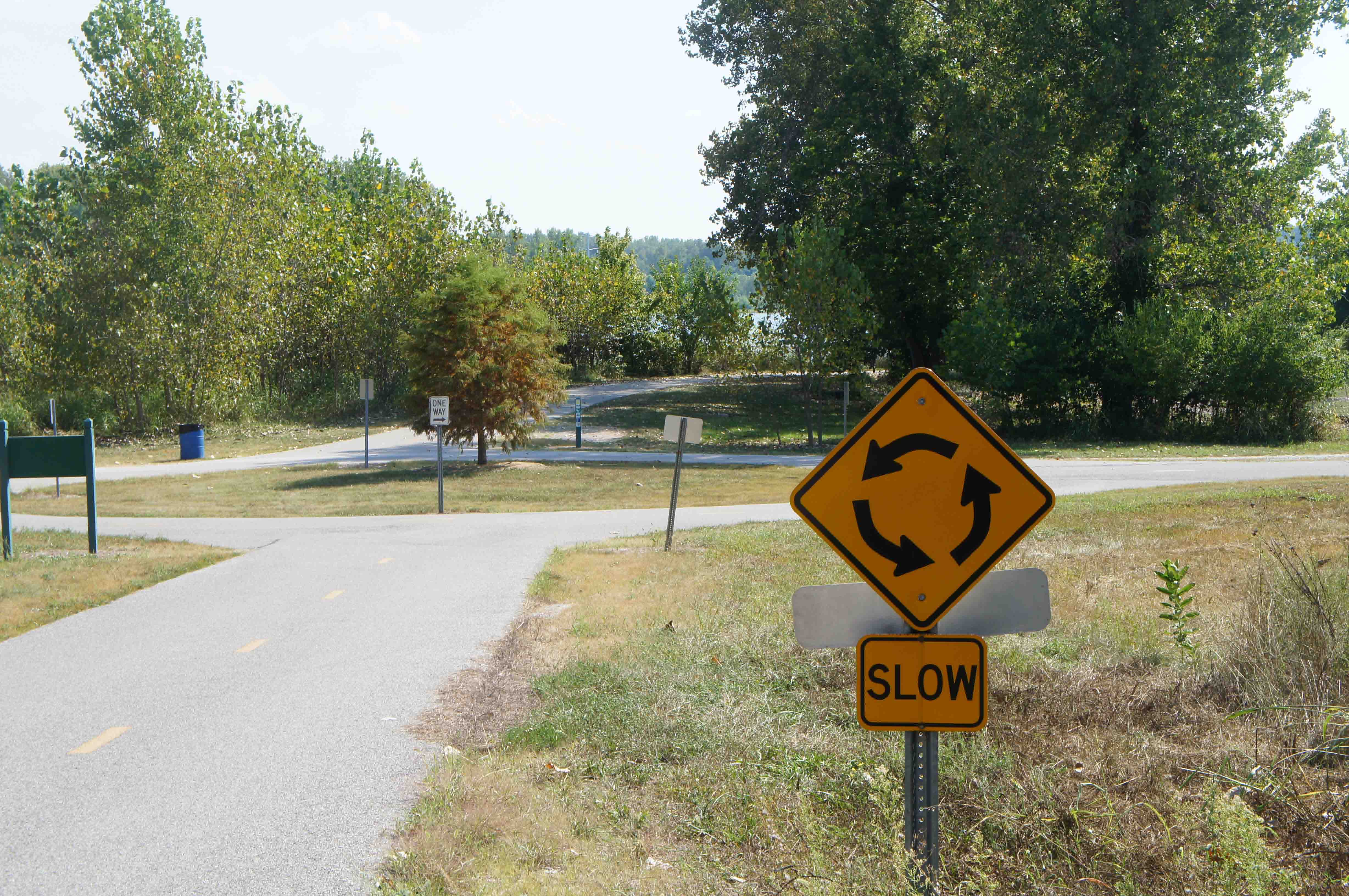 Wow! A bike traffic circle in Creve Coeur Park
Hot and sweaty and tired and pleased, I drop off my bike at Big Shark Bikes at 5:45pm. Not much time to spare. The Weather Channel says the high in St. Louis today was 102; the next day's newspaper says the high was only 100 degrees. I did a good job hydrating today. And, while hot, it didn't seem too bad.
And it feels VERY satisfying, after all these years of bike trips, to finish the traditional Lewis and Clark Trail from Camp Dubois, IL to Fort Clatsop and Seaside, OR - all 3,000 miles of it. Of course, I have a beer while I am smiling and showering off the salt and grit.
48 miles, St. Louis Arch to Hartford, IL and St. Charles, MO. Plus 20 miles via the Rte. 364 bridge, Creve Coeur Park, and Bridgeton to the St. Louis Airport Metrolink station.
68 miles total today. 243 miles total trip.
Only 120 miles remain, between Cincinnati and Louisville, to complete my coast to coast bike!
Lewis and Clark and the Corps of Discovery landed on the Saint Louis river bank on September 23, 1806 after two and 1/2 years in the wilderness. It only took me ten years to do the same trip - one way.
In 1804, "...Captain Lewis estimated the average speed of the current at 6.5 to 7 miles per hours, reaching 23 miles per hour in some spots. Clark wrote that the river "riffled and roared like a great fall. The river varied in width from 200 yards at Arrow Rock, MO to nearly two miles above Glasgow, MO. On average, the river was three times wider than it is today, with multiple channels. Before 1950, an average of 142 million tons of sediment flowed past Sioux City, Iowa, compared with 4 million tons today.
Starting in 1927, the Missouri River was squeezed into a single self scouring channel, largely devoid of islands and sand bars. Levees were constructed, wetlands were drained, and farming up to the riverbank became possible.
Arrow Rock Historic River Landing Trail, Lewis and Clark Heritage Foundation, Inc. Manitou Bluffs Mid Missouri Chapter, 2008
Last Update: Dec 29, 2013.