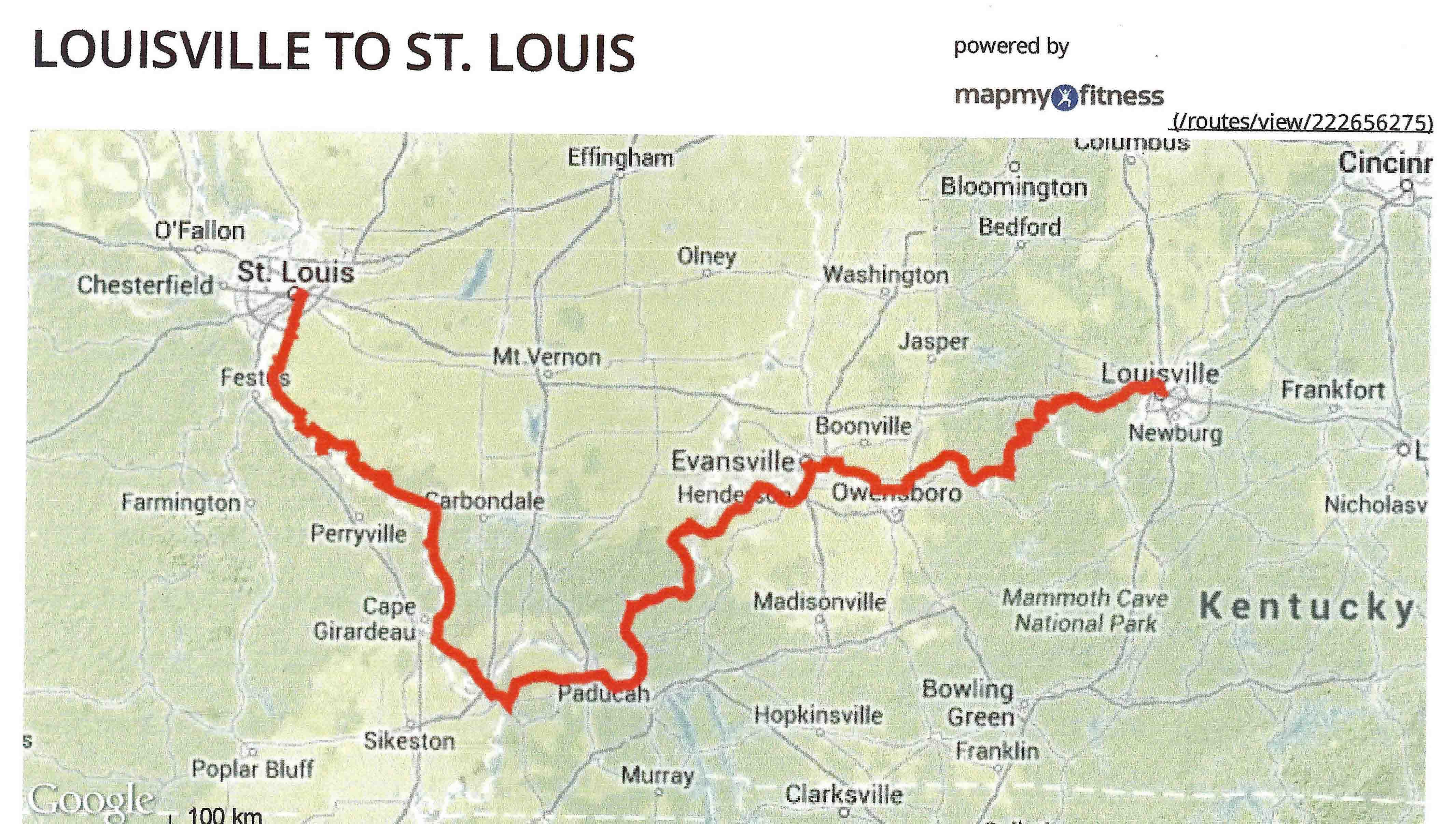
Louisville, KY to St. Louis, MO
Trip # 27- Down the Ohio and Up the Mississippi - Lewis and Clark in the East
May 23, 2013 to May 31, 2013
525 miles
Prologue
I anticipate this will be a great trip. One, I have a good friend, Jack P., riding along.
We had planned to do this ride last year at this time, and Jack held out and held on to
do it this year. Two, the Adventure Cycling Association does not have a bike route
mapped along the Ohio River, so this is one of the first long distance bikes trip
where I have the added challenge of planning (guessing?) a route and locating
support services (i.e. food, campgrounds, bike shops) along the way. Last year, riding
down the Ohio River from Huntington, WV set the expectation: a mostly rural
and thinly serviced crossing. I relied heavily on Google Maps and Google Street View,
to discern, for instance, if a parking lot in a 12 building town could be a gas station
or a convenience store. Three, I will cover a large chunk of what I have left to
finish my cross country trek. All-in-all, I have an extra sense of excitement about this trip.
Wednesday, May 22, 2013
Victor G. was nice enough to wake up early this morning and drive Jack and me,
and our bikes, to BWI airport. Thanks Victor (a long distance biker himself)!
We fly Southwest to Louisville, cab into town, check into our hotel, and spend
the afternoon enjoying Louisville. It is sunny and pleasantly warm. We walk
through NULU and Butchertown, reviving old neighborhoods east of downtown, and
then head north to a riverfront park that is home to the Big Four Railroad Bridge.
In earlier times, railroads used this bridge to cross the Ohio River. Today there is a
huge new pedestrian ramp up to the bridge on the Kentucky side. You can still see remains of the
long elevated
approach structures that brought the trains from ground level up to a fixed bridge crossing
high enough to allow ships to pass underneath. We check out the results of urban redevelopment
and freeway construction along
the downtown Louisville Riverfront, which separates the old city from its riverbank
roots. We finish our walk by heading through the restored west end - the cast iron
district, grab dinner at a Mexican restaurant, and return to our hotel to prepare
for our departure tomorrow.
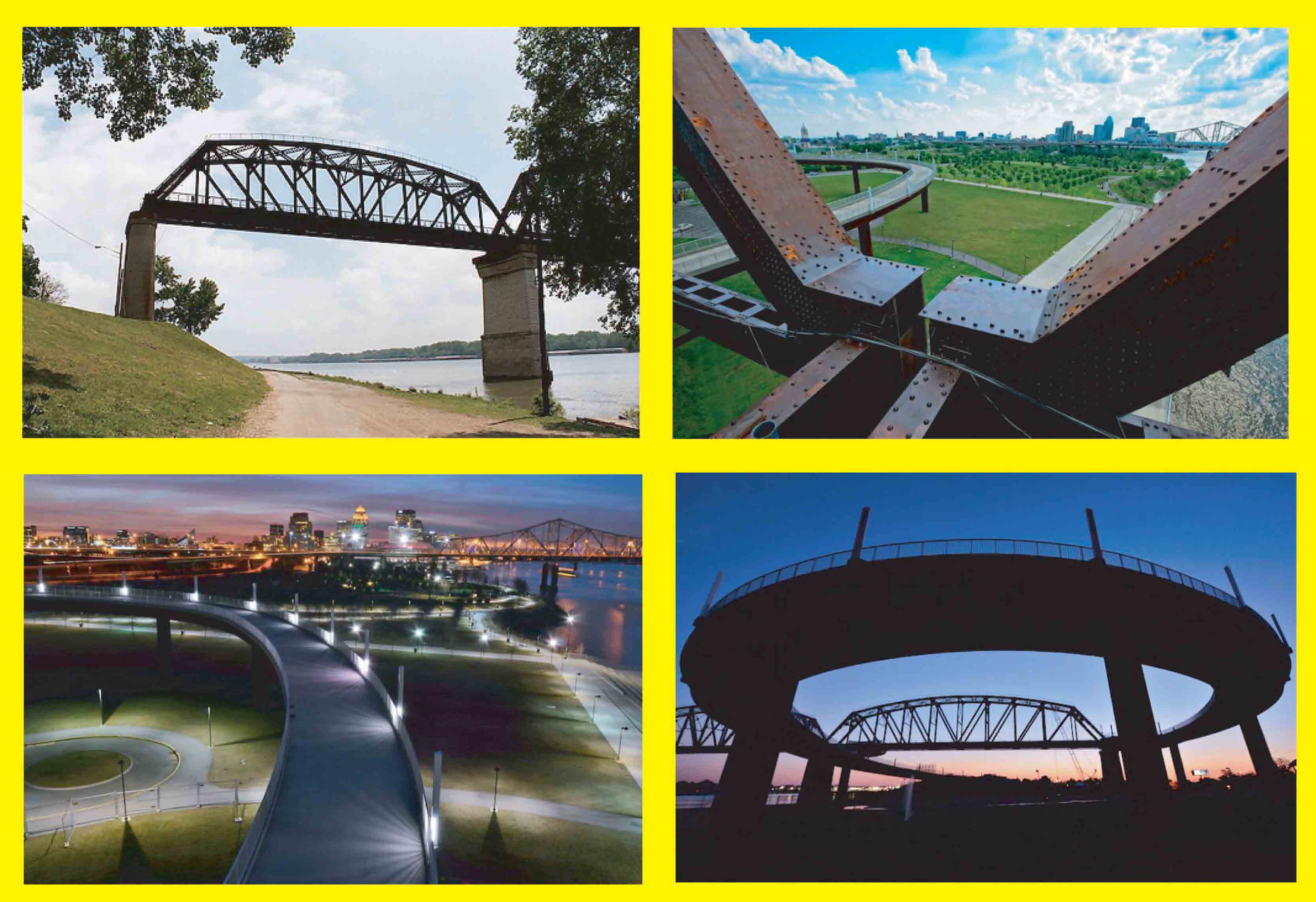 Clockwise from top right.
1) Kentucky side of the Big Four Railroad Bridge disconnected from the approach structures that
brought the trains up to the high level bridge. 2) View from Big Four Railroad
Bridge across new pedestrian/bike ramp toward downtown
Louisville. 3) Big Four Ramp at night, with the Second Street Bridge and downtown Louisville in the distance.
4) Another evening view of the ramp. Source: www.louisvillewaterfront.com
Clockwise from top right.
1) Kentucky side of the Big Four Railroad Bridge disconnected from the approach structures that
brought the trains up to the high level bridge. 2) View from Big Four Railroad
Bridge across new pedestrian/bike ramp toward downtown
Louisville. 3) Big Four Ramp at night, with the Second Street Bridge and downtown Louisville in the distance.
4) Another evening view of the ramp. Source: www.louisvillewaterfront.com
This is one big pedestrian ramp.
Day 1: Thursday May 23, 2013
Thursday March 23, 2013: Louisville, KY, Clarksville, IN, to Magnet, IN.
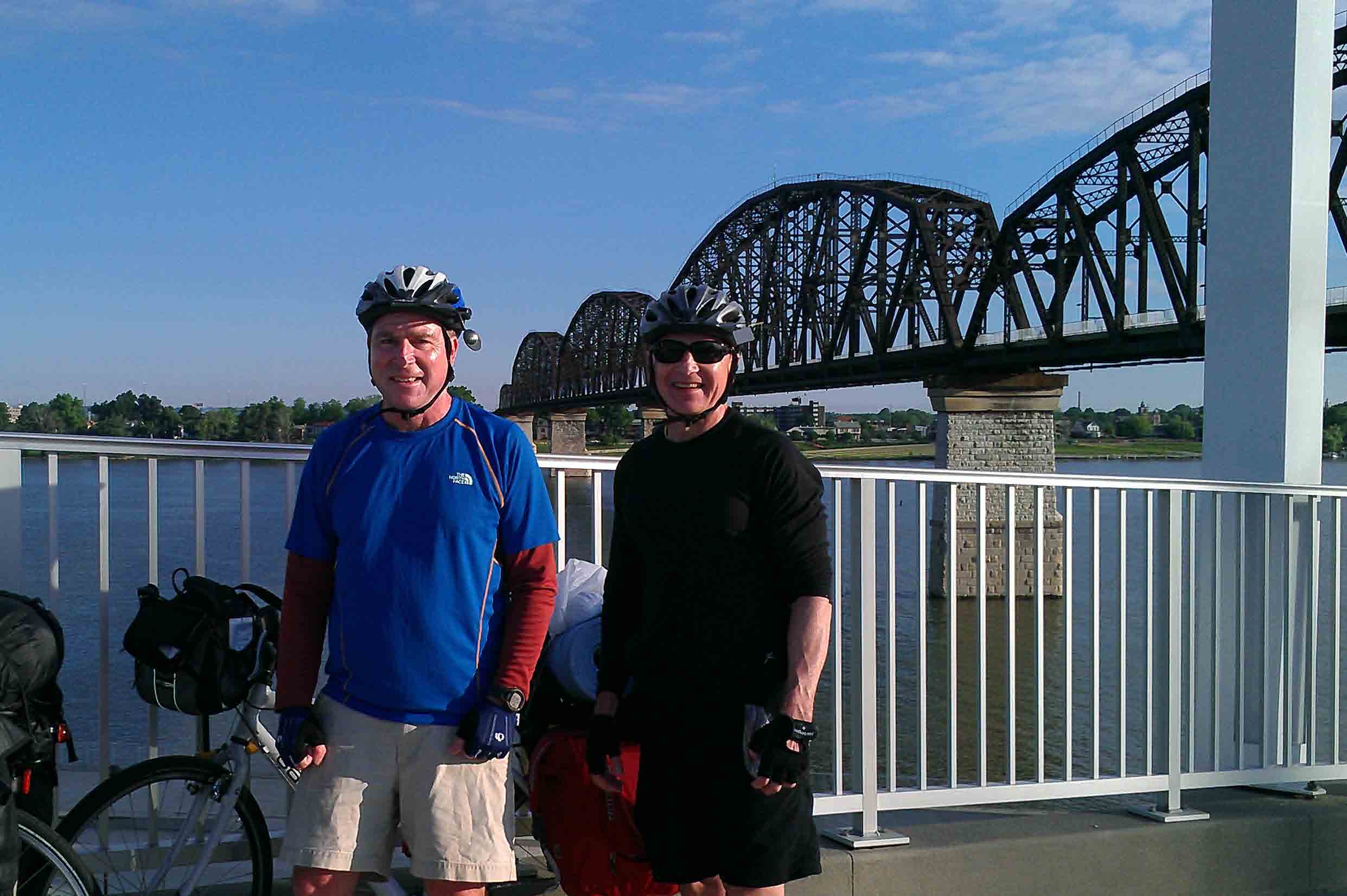
Big Four Bridge, Louisville, KY.
We are up early, at 6am, finish assembling and packing our bikes and grab breakfast.
Then we head over to the new pedestrian and bike ramp at the Big Four Railroad Bridge...and find
that while the Kentucky ramps are complete, and runners and joggers do use the bridge, the Ohio
side ramps are not finished, so we can not cross the river here. After a "start of trip" picture,
we head back down the Big Four ramp, ride to downtown Louisville, and cross the Ohio River on
the old Route 31 bridge to Clarksville, IN. It is a narrow Art Deco bridge, known as
the George Rogers Clark Memorial Bridge or the Second Street Bridge. It opened in 1929.
It is a comfortable (about 60 degrees) blue sky morning, but with a sharp WNW wind.
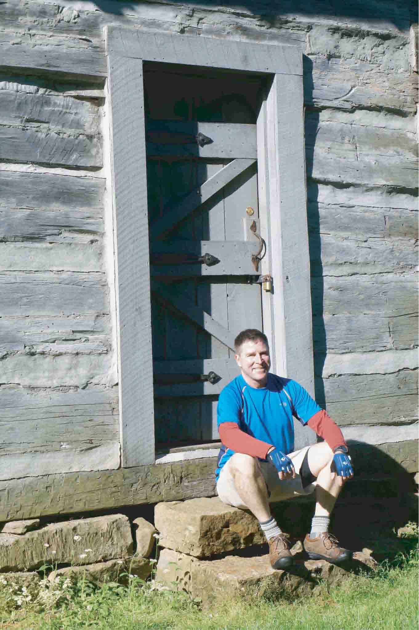
George Rogers Clark Homestead, Clarksville, IN.
Our first stop in Indiana is the Falls of the Ohio State Park, where we can look back up river and see
the skyline of Louisville, KY. Our second stop is the George Rogers Clark cabin, a reconstruction
of the William Clark's father's homestead, and where Lewis and Clark meet each other on
October 10, 1803 (+/-). They had not seen each other in seven years, and are about to spend the next
two years and nine months together leading the Corps of Discovery to the Pacific Ocean and back.
From Clarksville, we head west on Old Corydon Pike, Route 62, through Edwardsville and the green fields,
forests, and flat land or slow rolling hills of the Indiana countryside. Corydon is a substantial,
prosperous, and good looking town. At the west end of town, we encounter a detour sign and barricades;
Route 62 is closed 12 miles ahead because of bridge construction.
Folks in the convenience store say that we can use an old back road at the construction site
to get to Leavenworth, so we continue past the barricades and on to Leavenworth.
We have a traffic free run across western Harrison County; the whole road is ours.
And at the bridge construction site, after a steep and bumpy ride down the old road, we arrive on the banks
of the Ohio River at Old Leavenworth. A handful of older buildings survive in useful condition, or not.
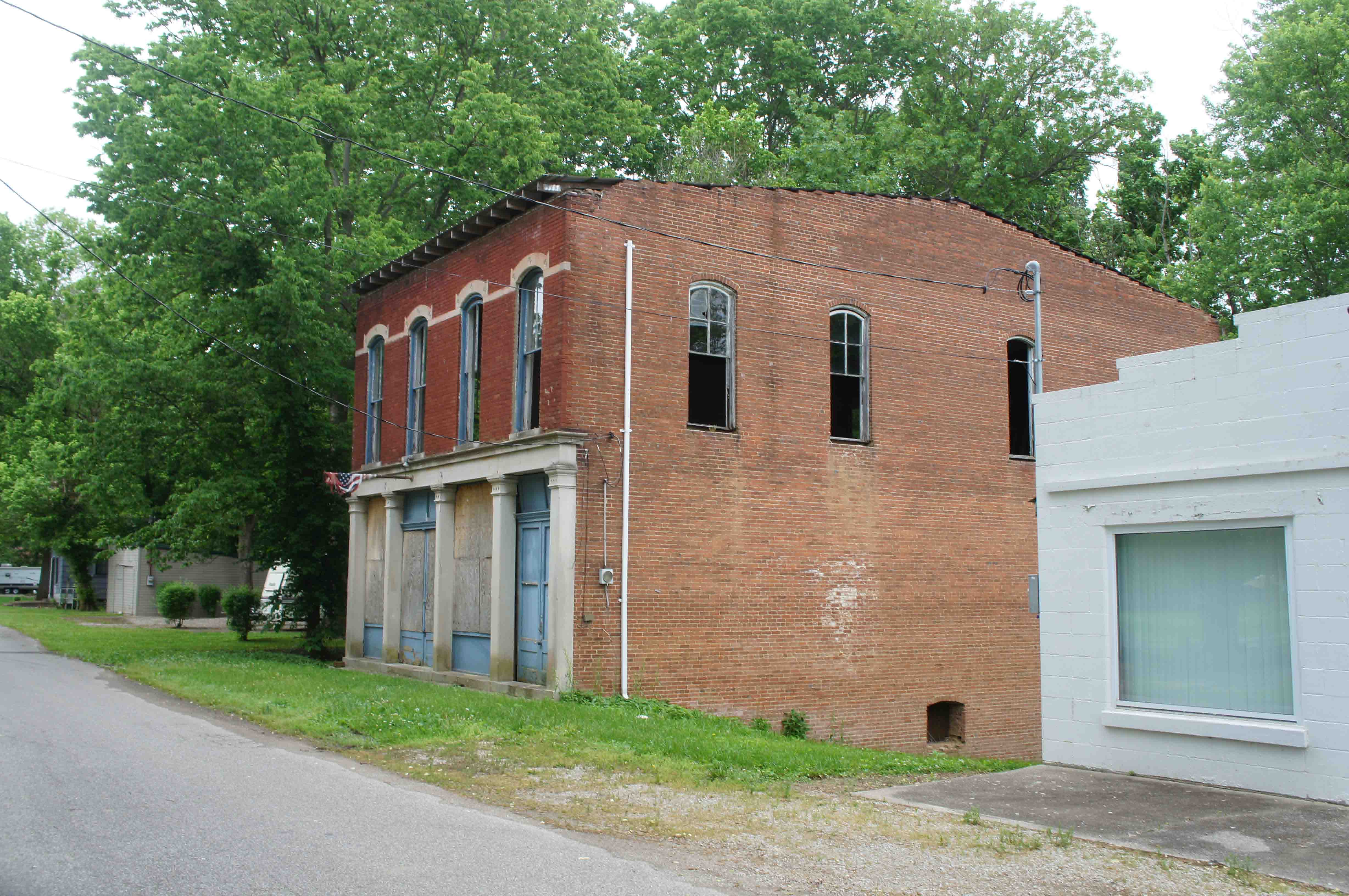
Remains of Old Leavenworth, IN.
All along the Ohio, and the Mississippi and the Missouri Rivers you will find twin
cities - Old such and such - at the original townsite - since abandoned because of
flooding or bank erosion - and New such and such - at a new site higher up and farther
away from the river.
Each twin is a little haunting. Often you can see the character, prosperity, and charm of the
"older" sibling - or what is left of her - and the practicality of, but slightly less ambiance of,
the "newer" sibling.
We have a steep, steep climb up the bluff from Old to New Leavenworth, stop at the General Store for
lunch (pie and sandwich in that order), and purchase food for later.
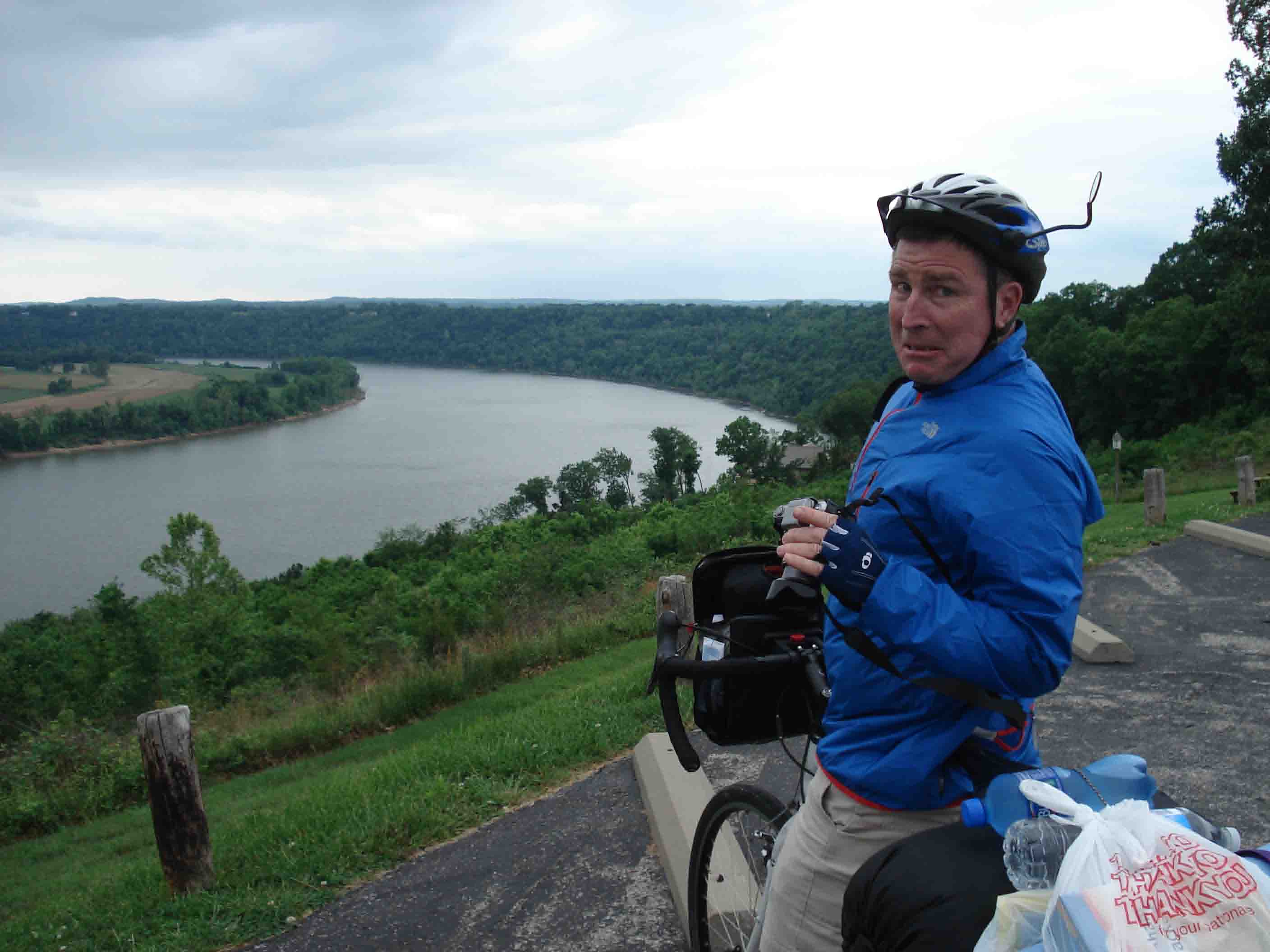
Horseshoe Bend, Ohio River, just above Magnet, IN.
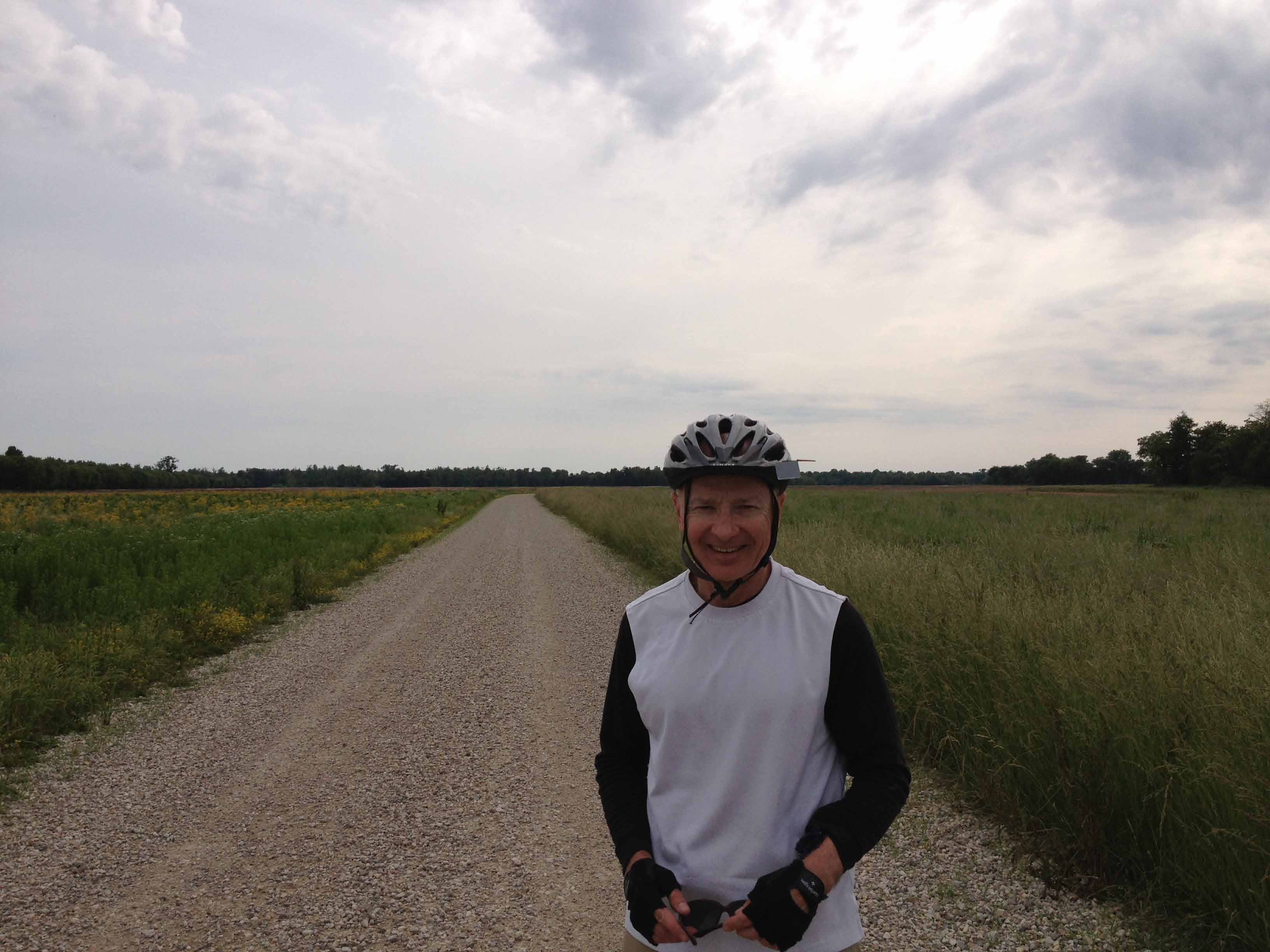
Bucky just found out how far it is to the next diet coke machine.
From New Leavenworth, we continue along the river by turning south towards Fredonia and Alton.
We see the broad curve of Horseshoe Bend and other chunks of the Ohio from the bluffs.
At Alton, we turn onto a smaller road - with lots of hills - to Magnet. It has been cloudy
all afternoon, but we only have two short spells of very light rain.
One of the planning challenges of this trip is that we are covering rural ground and campsites
are few and far between. Often, you can't quite make the map and the distance you think you can ride
match. You just have to see what happens. German Ridge campground is 20 more miles down
the road, but we have run out of daylight. Magnet offers us a solution. There is a boat ramp there.
There are picnic tables near the boat ramp. There is a shelter built over the picnic
tables. This is a set up that will serve us well the rest of the trip.

Magnet Camp - First Night.
After a "river wash" at the bottom of the boat ramp, Jack and I walk 50 yards to Betty
Rae's Landing, the local bar and restaurant, for our evening meal. We meet a few of the
locals at the bar - some fairly pickled. Magnet again proves the maxim that the fewer
people around, the more helpful they tend to be. A young woman asks if we need a place to stay
while we are checking out the picnic shelter as our evening camp. She later leaves a bowl
of hot ramen noodles on the picnic table for us, and Jack says she came down later, after dark,
to check in on us (I was dead asleep long before).
Our first day out was pretty good. A little bit of history, nice country, good riding, good weather,
little traffic, great river views, an unexpected campsite, a hot meal, and the kindness of strangers !
61 miles today. 61 miles total.
Friday March 24, 2013: Magnet, IN to Evansville, IN.
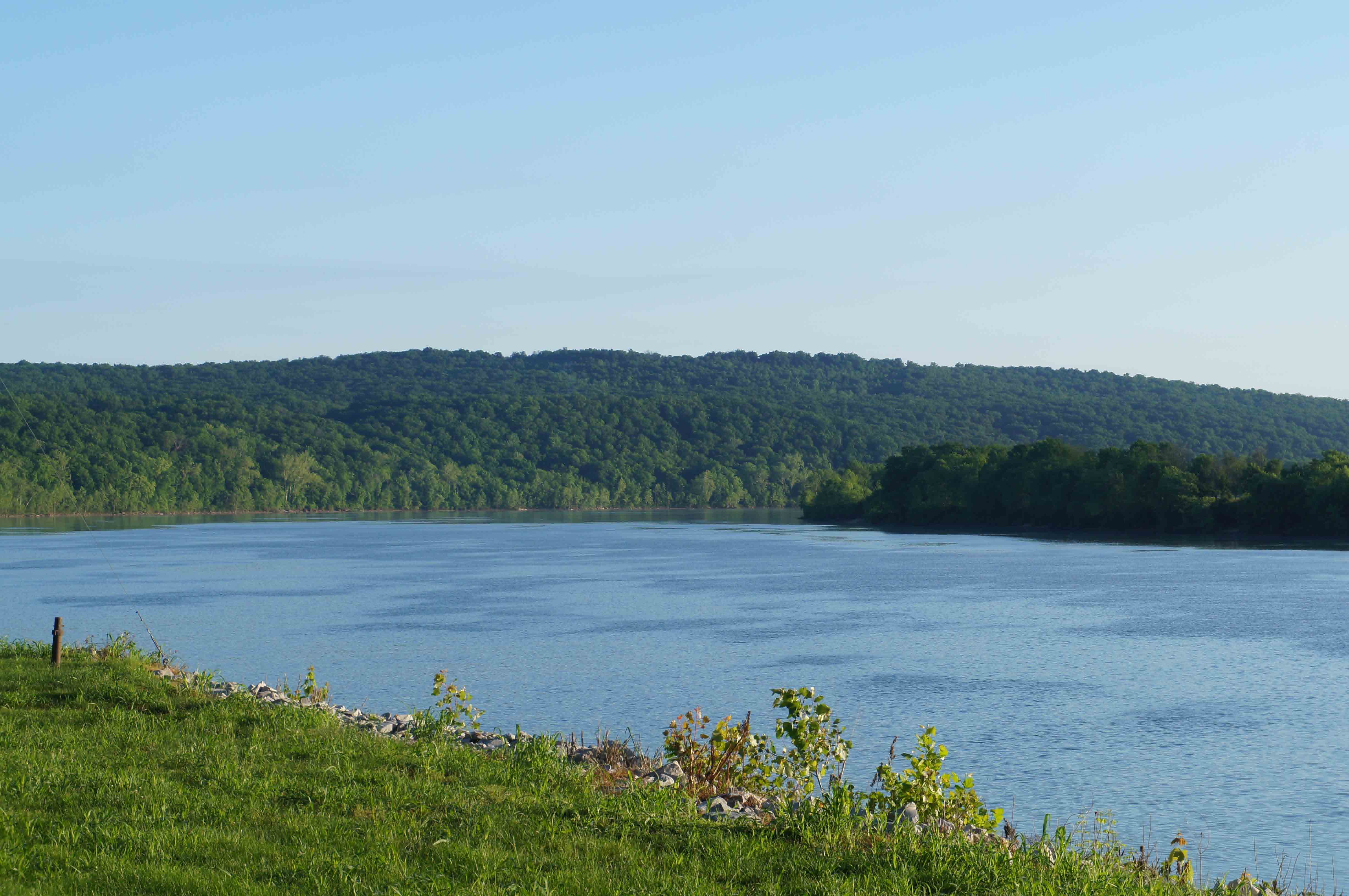
A view of the Ohio River from our camp in Magnet, IN.
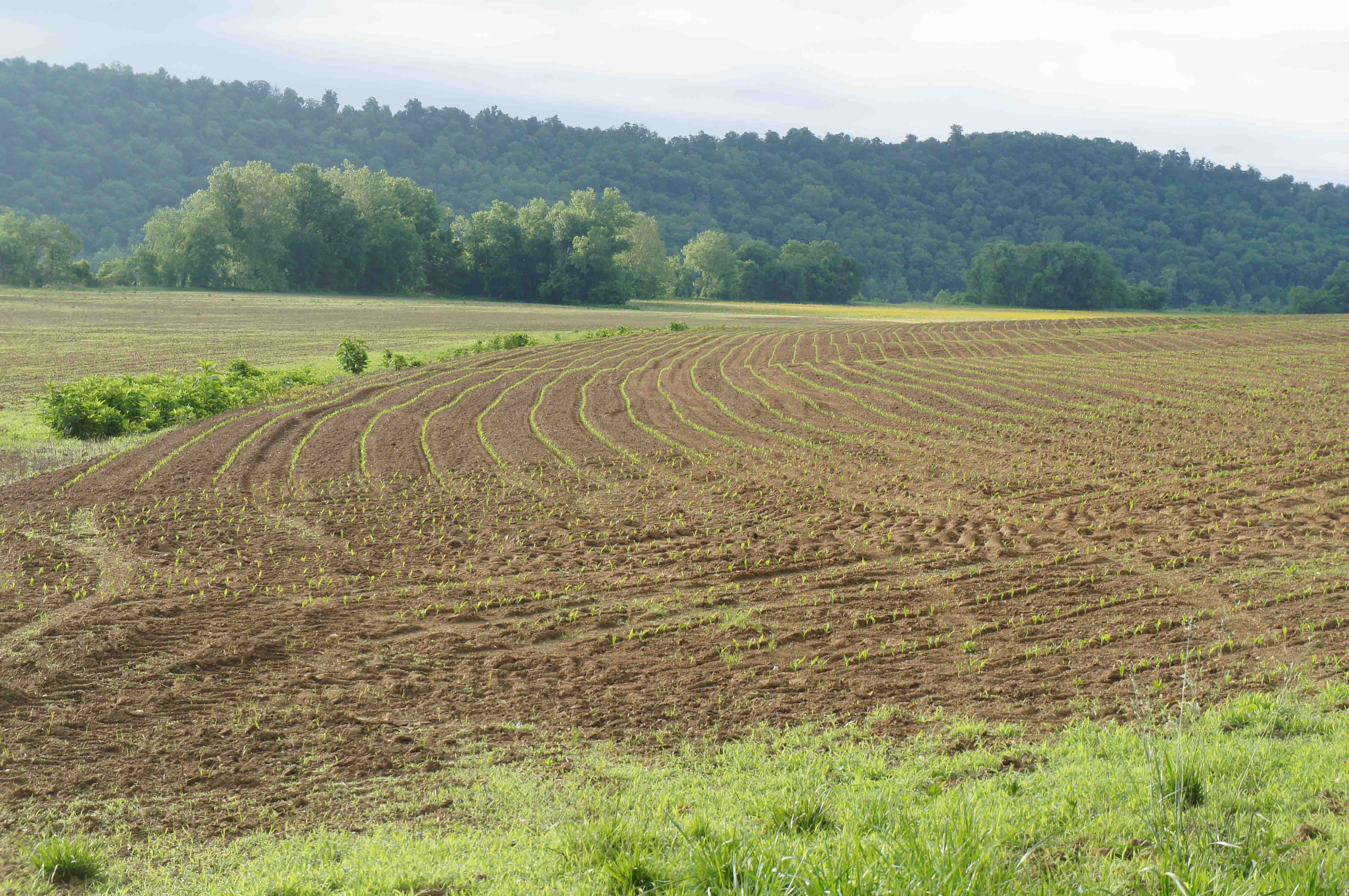
Crops sprouting in the fields south of Magic, IN.
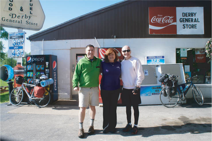
Ms. Derby and the Derby General Store.
Jack and I make an early and chilly start south along the back road to Indiana Rte. 66,
which will follow the Ohio River for the next twenty miles. We stop in Derby
for our mid-morning break, and meet "Ms. Derby", the owner of the Derby General Store.
She came out to chat with us as we ate our breakfast. I give her credit. She is
making a fresh start after an uncomfortable divorce. She has courage.
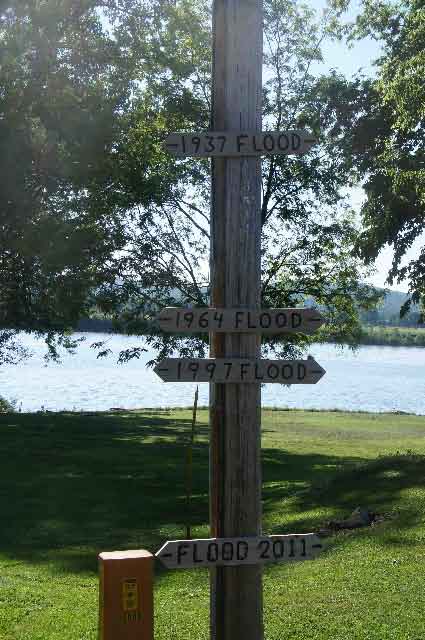
Flood level markers in Derby, IN.
Note the 1937 Flood level. It is considered a 500 year flood,
and was as bad as the infamous 1927 flood of the Mississippi River. The 1937 flood was responsible for
many of the "Old..." - "New..." twin cities along the Ohio River.
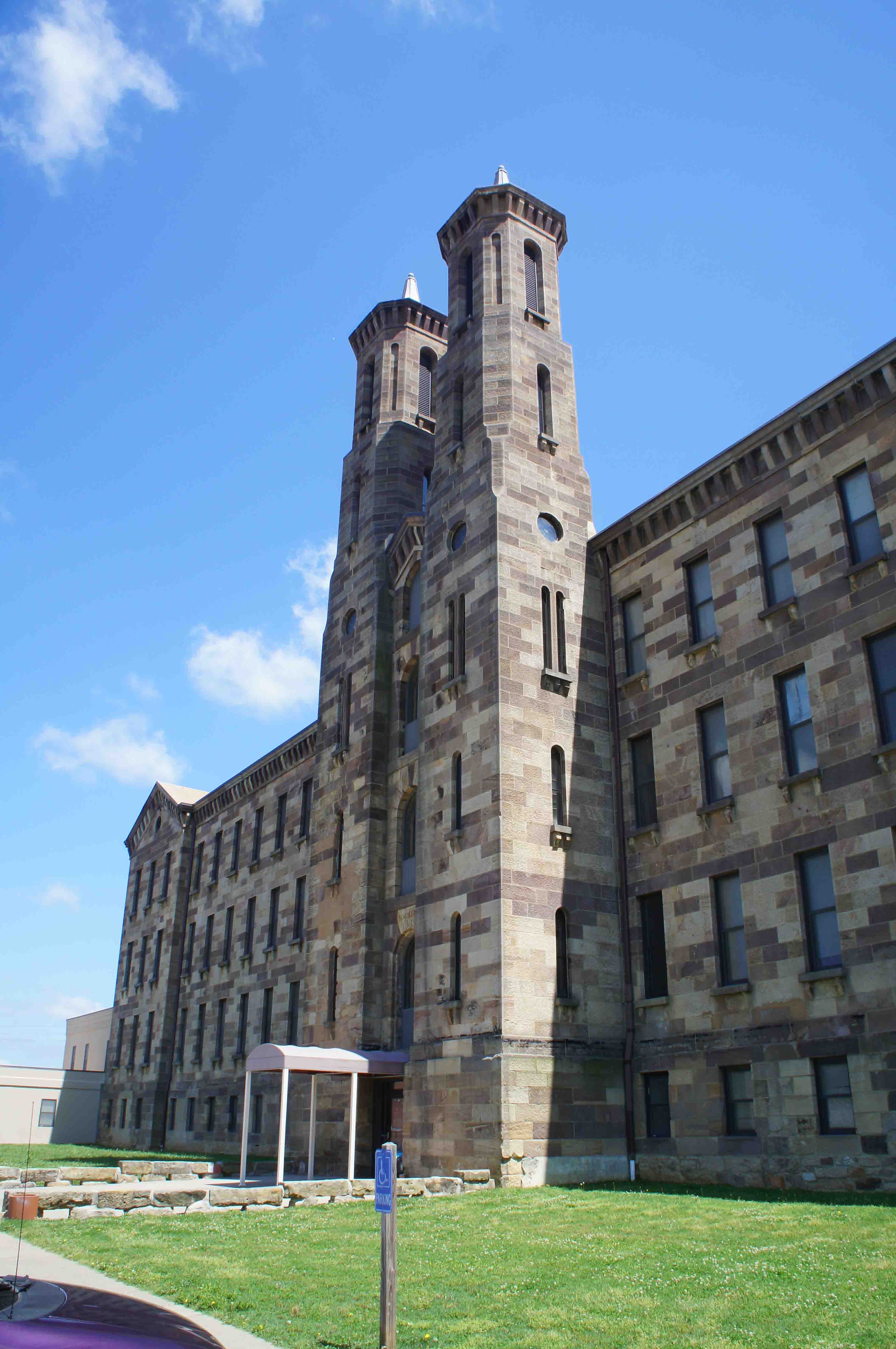
Old Textile Mill in Cannelton, IN.
The ride is hilly, green, lush and we have nice views of the river. At Rome, we
turn from south to west and head up and over German Ridge, an area that is part of
Hoosier National
Forest. We are told this area is the "Rocky Mountains of Indiana". Great!
So much for flat floodplain river riding! It wasn't tragically steep, but we
had a good climb this morning. We bump into the Ohio River again at Cannelton.
Amazing to me, we see a large masonry textile mill here.
I always think of Lowell,MA or Rhode
Island, or the south when I think of textile mills. I guess locating on the
Ohio had its advantages at one time too.
It's sunny and cool now - in the low 50's.
We miss the old part of Tell City, and just register the fast food lined roads entering town.
The 25 mile stretch after Tell City is flat country and the route follows
the river through Grandview, Rockport, and Patronville. We get a little
lost west of Patronville, where, of course, we hit a few hills, but after a
few miles of off-and-on gravel road, we find our way back to the main (i.e. correct) road and to
Eureka and Hatfield. It's still sunny and warmer than this morning. I
"boink" near Eureka, but after eating some sugar rich
junk food, I quickly bounce back.
At Hatfield we turn west, back onto Rte. 66, which is now a divided four
lane highway, but the traffic is light so it isn't noisy. We take a few
slow low grades, but nothing challenging, and eventually find our way into
Newburgh. Newburgh looks pretty toney for a rural town; there must be a college
here or this is home to well-off suburbanites. There is a
separated bike trail between old Rte 62 and the river, the
downtown has some charm and a restaurant overlooking the
Ohio River. We have dinner there.
Our final ten miles today is from Newburgh to the eastern side of
Evansville, Indiana. After squeaking through a road construction barricade
(notice a theme here?) we arrive at our hotel at 8:30pm - dusk.
(Credit card camping tonight (i.e. hotel) because there isn't a campground near.)
87 miles today; 148 miles total.
Saturday March 25, 2013: Evansville, IN to Old Shawneetown, IN.
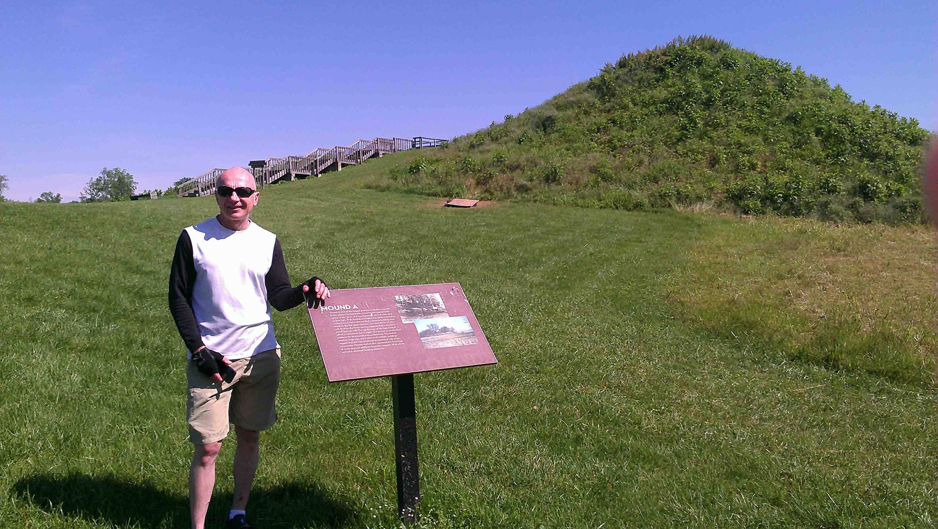
Angel Mounds State Historic Site, Evansville, IN.
We start later than usual - 9am. It's warm (68 degrees) and the sky is clear.
We first head south towards Angel Mounds State Historic Site. The park contains an impressive collection
of "pre-contact" Native American mounds, a very cosmopolitan place in its day. Native Americans of the
Mississippian culture, which flourished along the midwest's river systems, were responsible for these mounds.
From Angel Mounds, we head towards downtown Evansville, via Riverside Drive. The good news is that even here
in Indiana nice older urban neighborhoods, which declined after being abandoned in the 1970s and 1980s,
show signs of rebirth: the "Christ Light Church" in a storefront in one block, a proudly restored
Victorian charmer in the next.

307 SE 1st Street, in the Riverside Historic District across the street from the Pagoda.
Just east of downtown, we make the "Pagoda" our base.
The Pagoda is a 1912 riverfront pavillion, restored in 1995 and reclaimed for public use. Looking out
from the Pagoda, along the riverbank, across the new bike and jogging path, and over the levee, you
can see downtown. To our north is Riverside, a neighborhood of large ornate houses representing a prosperous era
sometime earlier in the city's history. I wonder, where, in this sweeping view of the downtown
riverfront, is the big bridge crossing
the Ohio River?? I don't remember seeing a sizable town along the Ohio River without a bridge...
From downtown Evansville, we ride back east, detouring through the Riverside Historic District
to see some of the stately old mansions,
looking for the Rte 41 bridge that crosses the Ohio
River into Kentucky. The crossing is not well marked, and the old city street approach (Kentucky Avenue)
has been built over by freeway ramps. We finally find our way across the bottom lands, get
to the narrow and noisy bridge crossing, and "tight" knuckle our way across (of only we could close our ears
on these things). Rte 41 outside of Henderson is not an idyllic bike route. It is a four lane
highway with continuous left turn lanes in both directions. Traffic roars by on our left side.
Fast food, gas stations, car dealerships and stores pass by on our right. Most of what we bike has
no shoulder. We find the
old road (and some peace and quiet) and take that into downtown Henderson, pause to pick up some
food and drinks, and
head west.
South of Alzey, KY.
Our path arcs from Henderson, KY through Geneva, KY and Alzey, KY to Uniontown, KY and
roughly follows two convex and semi-connected river bends. We are biking up and next to and
then down in the bottom lands. It is quiet and rural country. Alzey, KY is now only one old
substantial building and a crossroads. We leave a paved road for a gravel one, and the
gravel is only about 1 inch higher than the surrounding fields. At one point it seems
like we are lost, and it looks like might be lost, and we probably should be lost.
But, luckily, we are on track. (I let Jack use his cell phone to find out where we are,
the first time on the entire cross country trip I have used GPS). Reassured that we are
not lost makes the rest of the afternoon much more enjoyable, even if Jack did have a flat,
which we quickly address.
Looking at what we are travelling through, and checking the topo and satelite images of the river
after returning home, I have an answer to the missing Evansville bridge question. The north side of
Kentucky south and west of Evansville is low, low land if not plain mud.
There is no place for a bridge from downtown Evansville, IN to land in Kentucky.
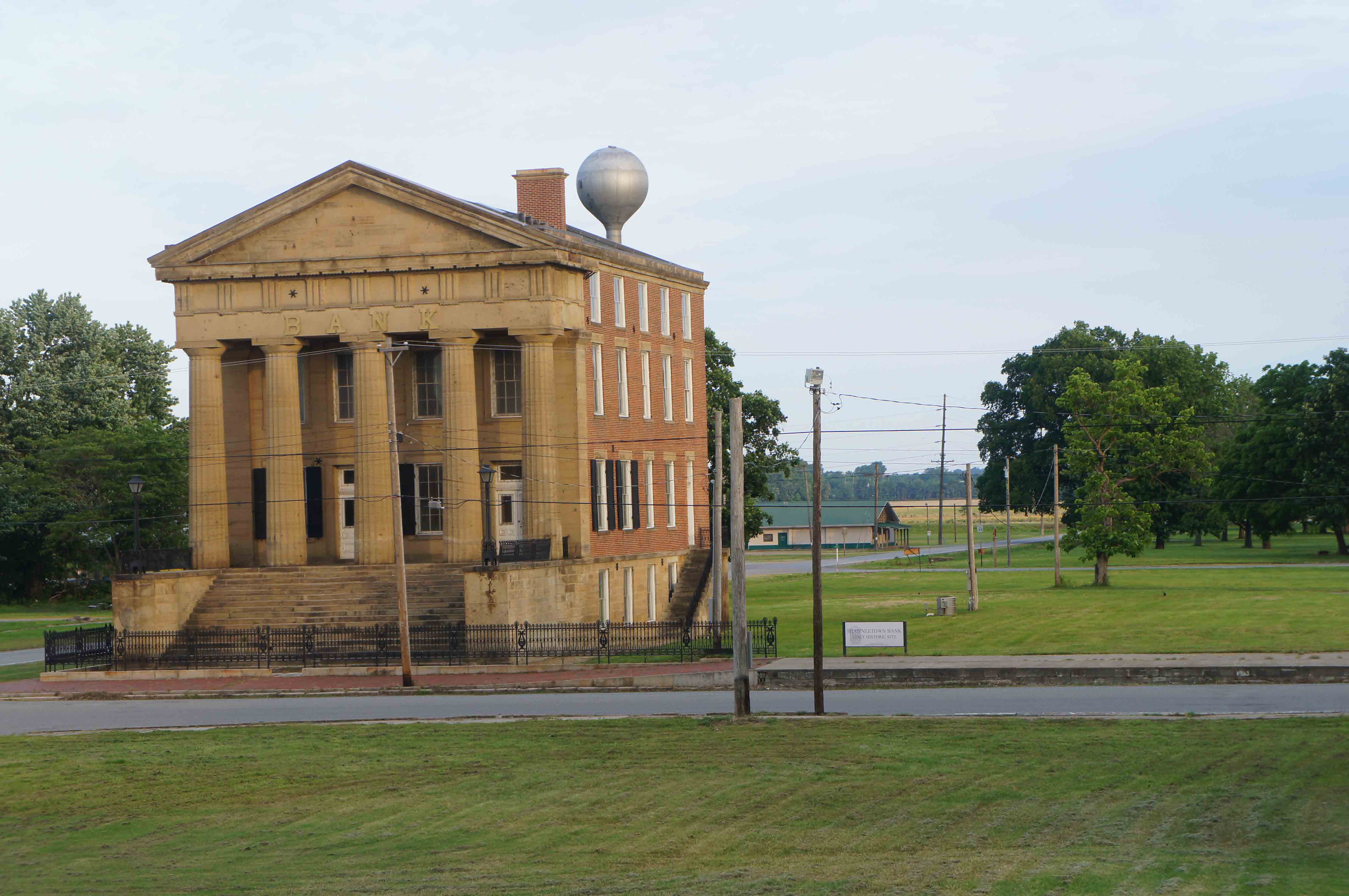
Old Shawneetown Bank. During the 1937 flood, the second floor served as a place of refuge
during the record breaking flood.
At Uniontown, we rest at Floyd's Grocery Store, and then make the last, late-afternoon,
15 mile push to Spring Grove, KY and the Rte 56 bridge across the Ohio River into Illinois.
It is a pinch after 8pm when we cross the bridge, which is narrow, but not busy.
Once on the Illinois side, we make a big u-turn off Rte 56, and come down and around into Old Shawneetown,
which is nestled up against the river below the bridge. We find a picnic table and shelter
in the mowed townsite of Old Shawneetown.
We feast on a buffet of power bars, with the old bank
building peering over our shoulders from Main Street. The first few days of the trip,
I unmercifully scoffed at Jack's vast selection
and supply of power bars. No longer. They looked and tasted pretty darn good, and rated better
than any of the other odds and ends we had available for dinner.
Parting thoughts as we leave Indiana behind today: 1) Beautiful countryside, and 2) State
License Plate Motto: Hard Place to Find Good Postcards!
65 miles today. 213 miles total.
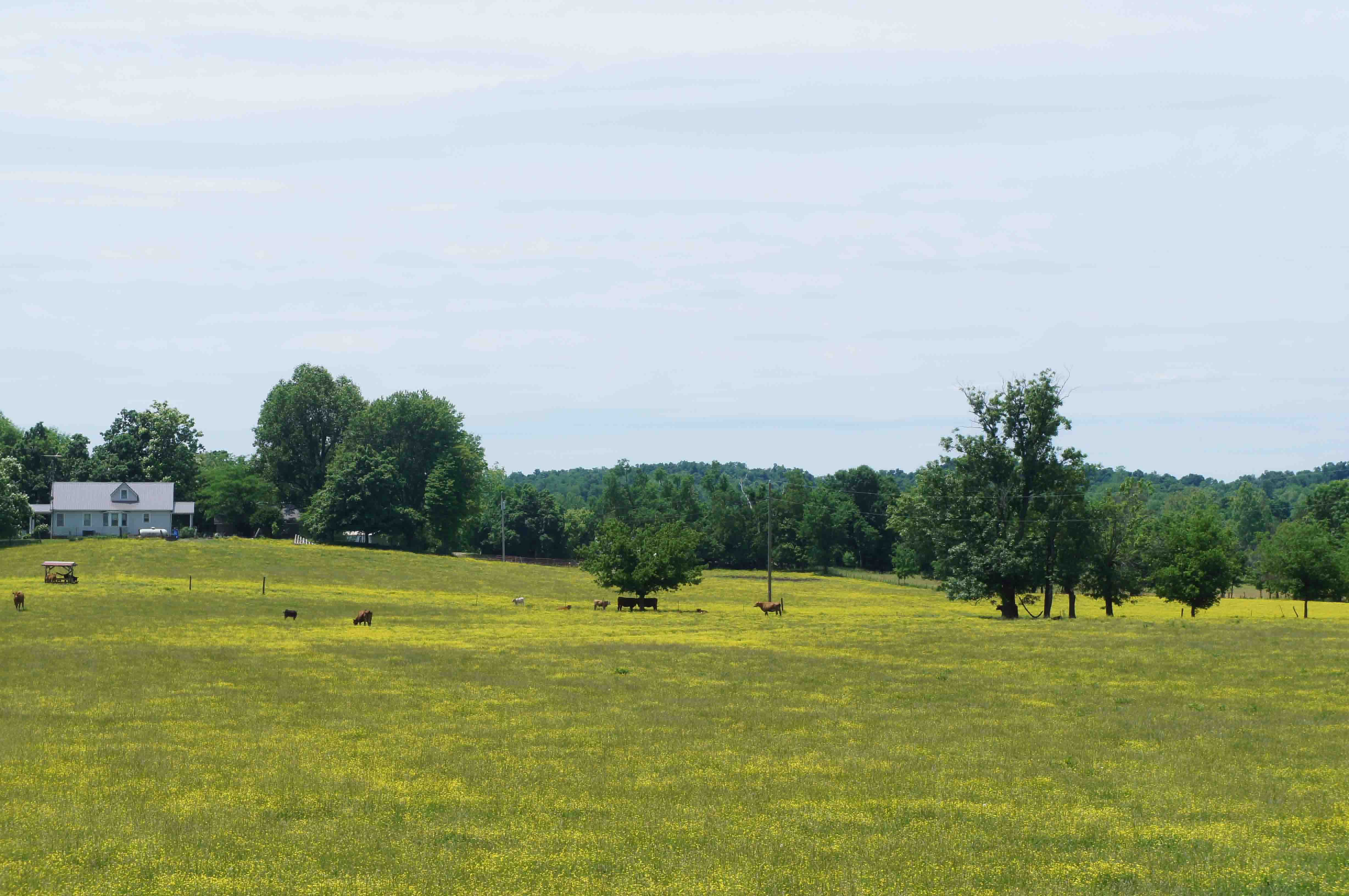
Sunday March 26, 2013: Old Shawneetown, IN to Birdville, KY.
I wake up at 6am and talk a short walk around what is left of Old Shawneetown. The
huge limestone Shawneetown Bank
building gives you an idea of how prosperous this town was before the powerful Ohio River brought it to
its knees and mercilessly pushed it up the hill. The nearly empty town site is somber with defeat and retreat.
The bank building, though, is shining in the early morning sun...a reminder of a glorious past.
The sky this morning is clear, blue, and sunny. When we are packed,
Jack and I pedal up the hill to New Shawneetown, where we have
a big breakfast, and then south on a back road "confirmed" by one of the locals
in the cafe. Spring envelops us. This morning the trees are bursting
with leaves and overflowing with spring growth. Ah...the endorphins must have finally
kicked in. We follow Illinois Rte. 1 (which is a little hilly) along the river to Cave-in-Rock,
arriving about 11am. We wander around the Cave-in-Rock State Park, where men up to no good lived
and raided passing boats.
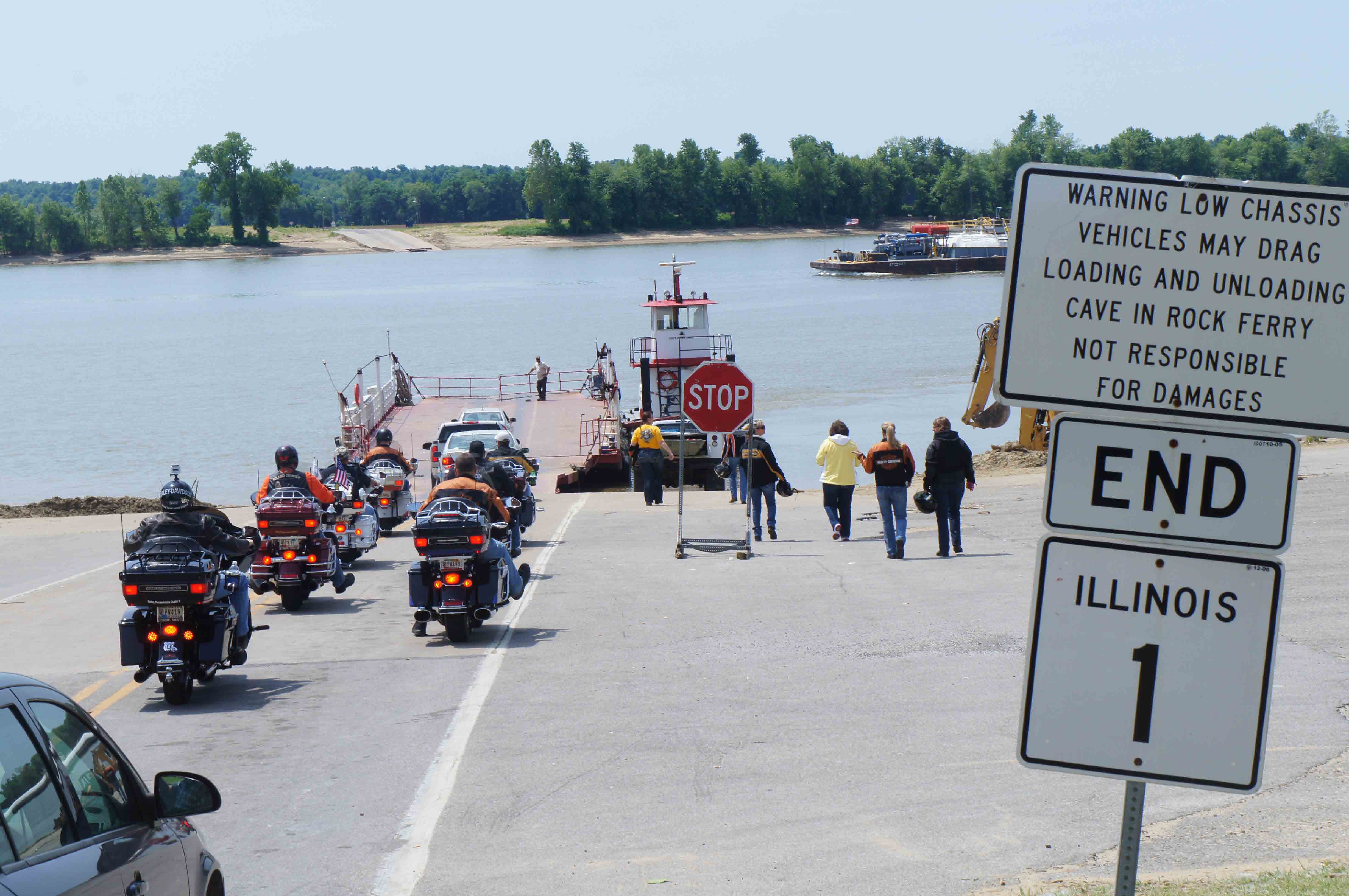
Cave-in-Rock Ferry between Illinois and Kentucky.
I've a predilection for small ferries, so
finding the Cave-in-Rock ferry set one point on the route as soon as I noticed it. We are
two bicycles, along with many motorcycles and a few cars, that are on the ferry.
It is an enjoyable trip over to Kentucky.
View of the Ohio River at Cave-In-Rock, IL.
Heaven.
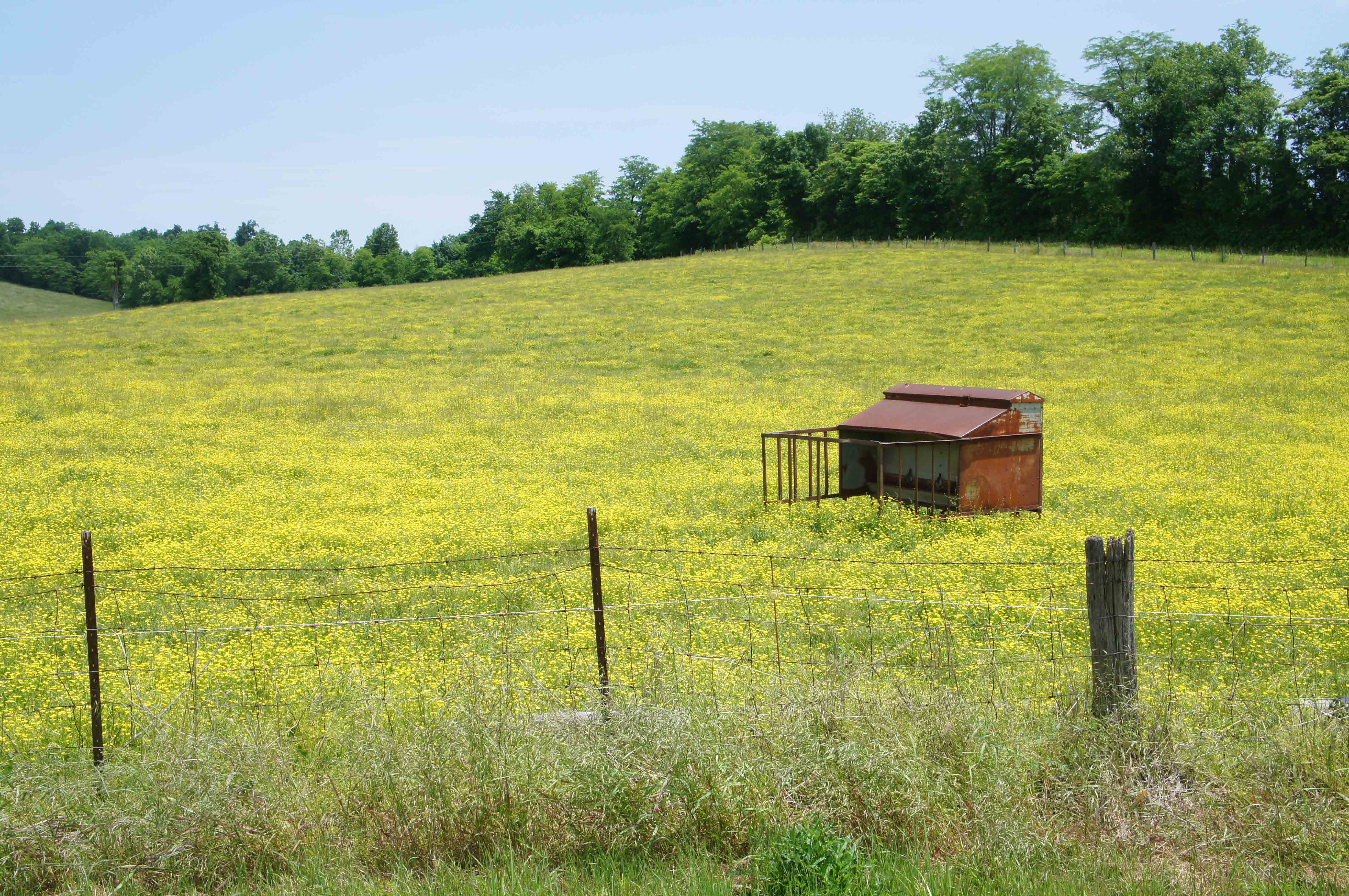
On the Kentucky side, we pass through some of the most beautiful country I can remember seeing.
The land is rich green and yellow; buttercup filled fields, horses, hay bales, and farm houses
envelop us. It just does not get better than this.
Heaven, Part 2.
I notice, during our ride this afternoon, that whoever runs the local electric coop
(the local residents must be involved) has the good sense to jump their power
lines to the other side of the road to avoid big old trees. How easy, and thoughtful.
No butchered trees under and along the power lines.
Hay and Ohio.
The afternoon is cloudy and warm, the warmest day yet on this trip.
We lunch in dowtown Tulo, which consists of a bench leaning against the
volunteer fire department station and a soft drink machine nearby. It is a very
pleasant place to sit. A woman drives up in her Jeep and says, "Boys, this is about
as exciting as this place gets." She was wrong. Soon thereafter, we see a dad drive
up in his car, get out, and buy 3 soda's from the machine across the street, for himself
and for his two kids in the back seat.
Our next rest stop is in Carrsville. I am suffering from my lack of training today.
My legs are tired. Jack on the other hand looks like he could easily do
50 more miles (as he did the entire trip)! My map shows a good hill southwest
of Carrsville, as we cut across a river bend, so I'm dreading a painful climb. It turned
out to be easy; I just didn't read the map correctly.
We pass over one branch of the Trail of Tears, the one that went through Golconda, IL.
The last ten miles into Birdville are flat, with plenty of river views. We have plenty of daylight
left, it's only 4:30pm, but today I (but probably not Jack) need to rest, so we pull in early,
relax, do laundry, and enjoy our riverfront campsite.
59 miles today; 272 miles total.
Monday March 27, 2013: Birdville, KY to Wickliffe, KY via Paducah, KY.
We are lucky this morning because the bridge over the Tennessee River on Rte. 60
is in such poor shape that it is load limited at 3 tons. No heavy truck traffic to worry
about. We have a flat and easy roll to the Bridge.
Once over, we take old business route 60 into Paducah. We have it all to ourselves.
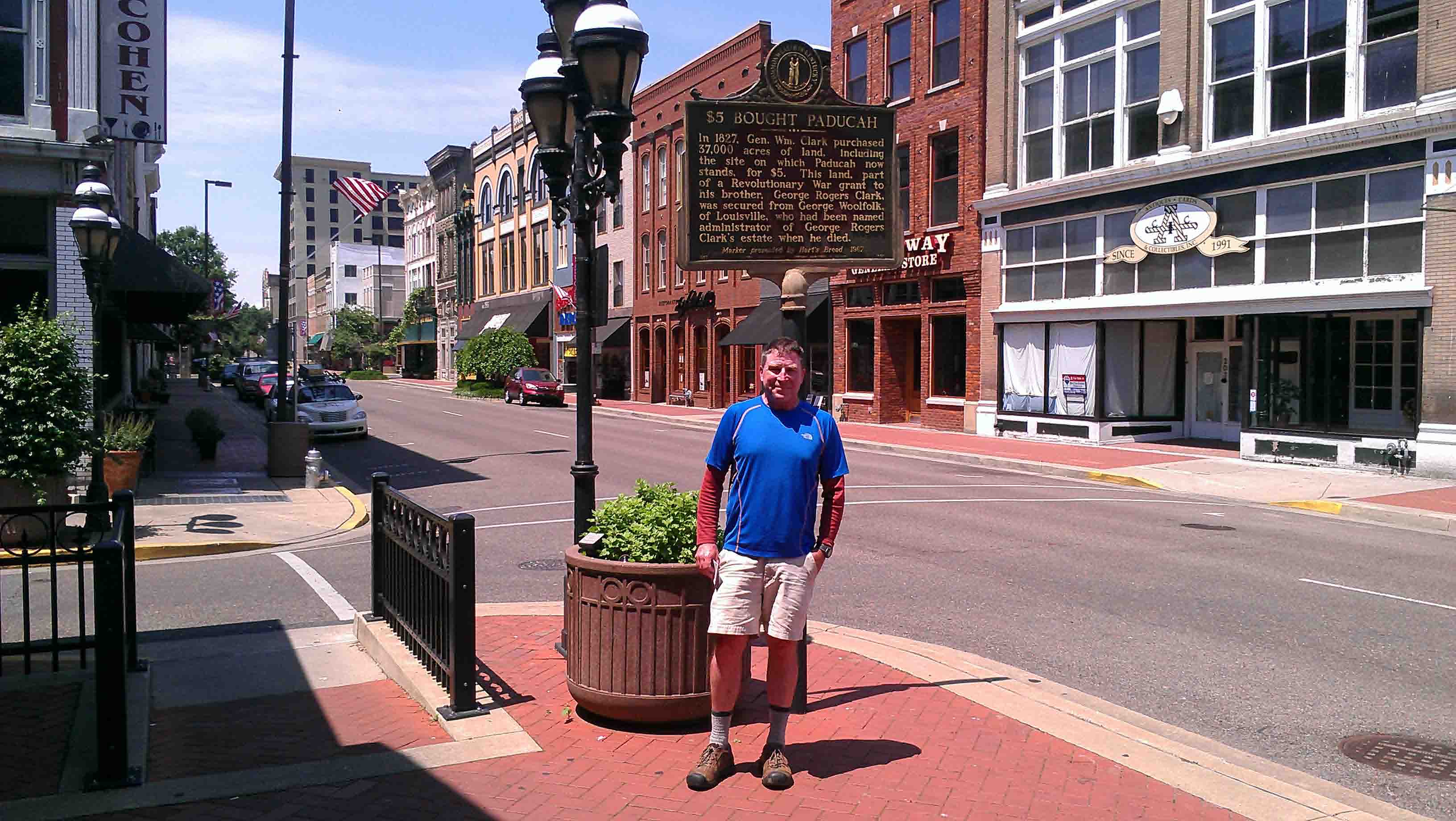
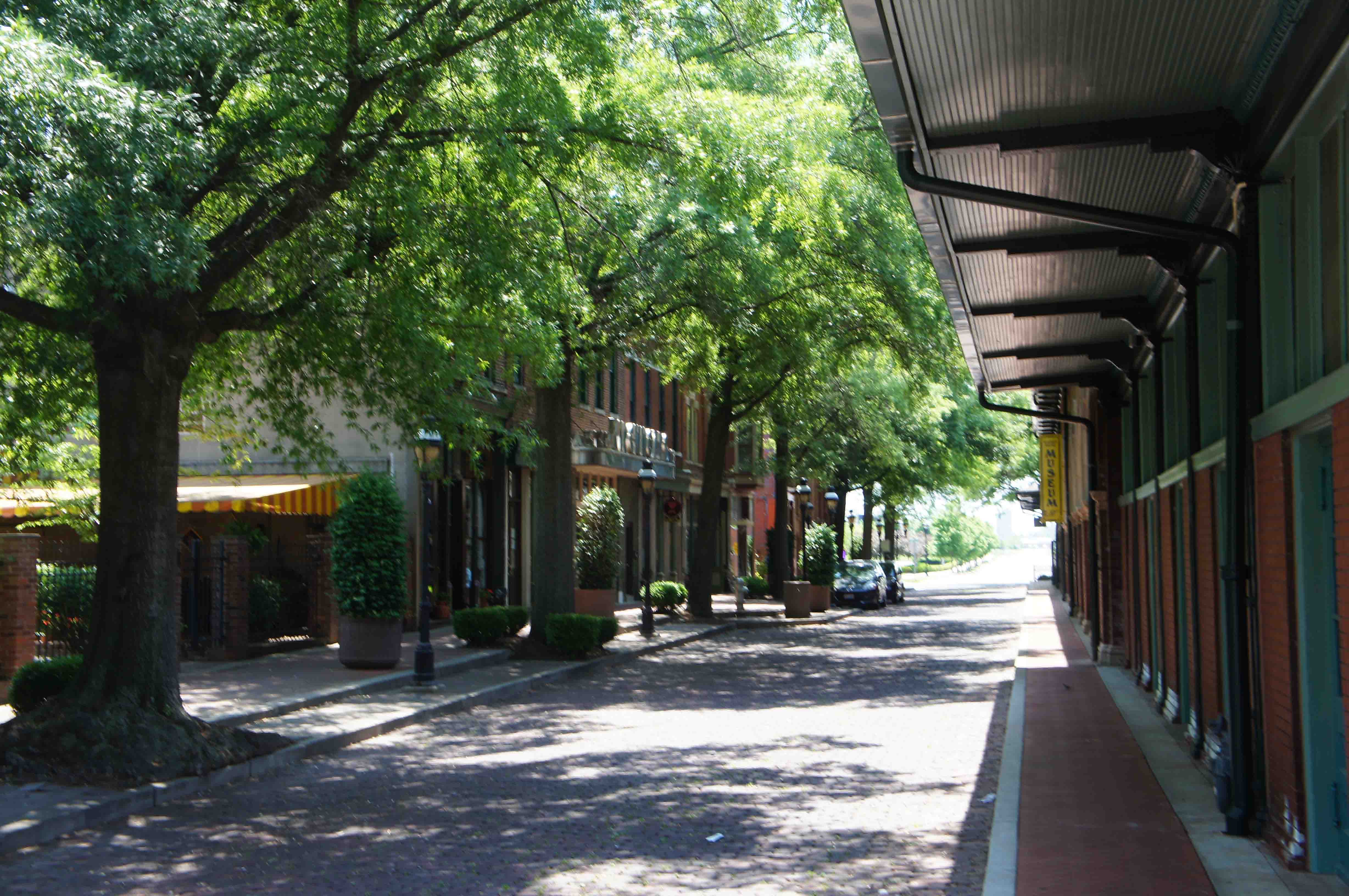
Downtown Paducah.
Today is Memorial Day. We arrive in downtown Paducah at about 10am - before
anything is open or anyone is moving around. Paducah has worked hard to restore
and re-use its old "Market House" and the immediate retail blocks around it. They
look good, even if they are closed. It is another beautiful clear spring day.
We learn of a coffee house nearby, in the Lower Town neighborhood. We find
it and settle in the garden out front with our coffee and food. We return downtown
to see the floodwall
murals, and spend some time resting on the benches on the riverside of the wall.
(I am still feeling tired out. I'm pretty sure Jack is fine.)
The Old Market Place.
At 1:15 pm we head west out of Paducah on Rte. 60. This turns out to be a bad choice.
I have a local road option between Paducah and Wickliffe mapped out and in
my bag. But at least in Paducah, the roads are empty and quiet, so we head out of town on Rte. 60.
This choice is a MISTAKE, fortunately,
only a seriously annoying one. Once past the airport the four lane road narrows down to a two lane road. A
"no-paved-shoulder" highway. A "no-unpaved-shoulder-either" highway. It is road or ditch. It is like many roads back
home in Virginia. We have the added thrill of riding on a "drunk bump" highway. The bumps
ground into the pavement are designed for the dual purpose of 1) keeping sleepy (drunk?) drivers
from running off the road and 2) forcing bicyclers to ride in the travel lanes. There is no way to
ride on the bumps nor is there enough room to ride to the right of the white painted line.
This is an old highway, too, so it has
numerous short hills which eliminate any long sight distances and prevent cars from
passing slower cars and bikes. There is
heavy traffic. Drivers are frustrated. We are uncomfortable. Drivers are angry. We are
riding across beautiful farm country, but there is no chance to enjoy it. Our eyes focus
on the white line and we concentrate on riding straight and steady. Drivers and passengers are yelling.
I heard more yelling and honking coming from cars in this one short eleven mile stretch than I
heard over the entire length of my cross country trip combined.
The folks out in western Kentucky certainly let you know what you think, which
is also distracting to a biker.
I find a small paved driveway lip (that serves a gravel farm field entrance). It is
wide enough to provide a safe pull off. I pull off. I am not going to start riding again.
I feel like kicking a can...or anything else I might find. I feel like just sitting.
I am fuming with frustration.
It WAS an unpleasant stretch.
Salvation. A short hop up the road, we are rescued, in the nick of time, in Barlow, KY.
Eric, a college senior majoring
in exercise science, pulls up alongside us on his bike and introduces himself. He is
in school nearby, out riding a 70 mile loop. He stopped by to see his sister in Barlow,
who mentioned she saw some bikers go by. Eric says there are not many cyclists out this way, so he
came out to find us.
Eric literally serves as our wing man as we take the last few miles in to Wickliffe, KY.
He is riding mid-lane some of the time and seems to know everyone in the passing cars.
No one honks at him. Other times he takes the lead and lets us draft behind him.
I'm tired, but squeeze out the last bit of energy I have to keep up with him. I don't want
to ride any
further without protection. Without Eric, I (and I don't want to use "we" and speak for Jack because I'm sure he
is in fine shape !)
would not have made it to Wickliffe, KY. Wickliffe is the last town in Kentucky before
the confluence of the Ohio and Mississippi Rivers.
Many thanks Eric.
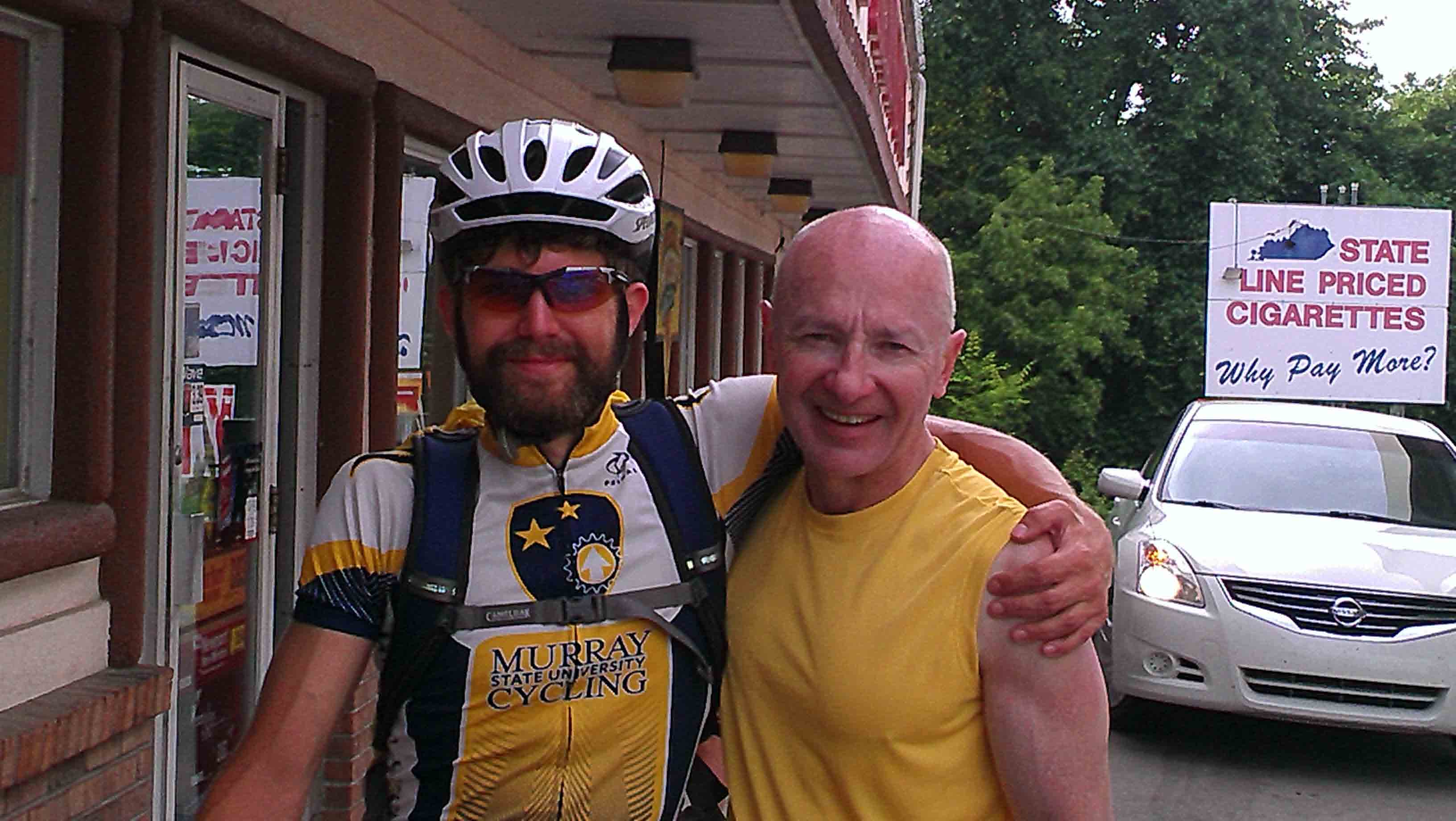
Eric and Jack in Wickliffe, KY.
After saying our farewells to Eric, we have to decide where to spend the night.
Folks at the Gas-and-Go say that Cairo is "dangerous"...something I heard on our
rafting trip down the Mississippi several years ago. We check out the state park
across the road...but it is for day use only. We turn and head over to the
Wyckliffe Hotel. It looks like the Bates Hotel really. The couple who run it are
seriously old. The rooms are clean though...so it works out well.
Hot showers and warm comfortable beds end the day.
58 miles today; 330 miles total.
Tuesday March 28, 2013: Wickliffe, KY to the Confluence and Cairo, IL to Grand Tower, IL.
Up early, we have a big breakfast in Wickliffe, KY and then head out along
two lane Rte. 60 across the Kentucky bottom lands to the bridge over to the skinny southern tip of Illinois
and the "confluence" of the Ohio and the Mississippi Rivers. It is 68 degrees this morning and sunny.
I have a sense of anticipation and good karma. I will be returning to the Confluence, where Lewis and Clark camped
for almost a week with their keelboat from Pittsburgh before heading up the Mississippi
in the fall of 1803. It is a stunningly huge expanse of inland water. It is where
I camped as part of a Mississippi River raft trip in Sep/Oct 2009.
Confluence of the Ohio and Mississippi Rivers.
I will finally get to see, first hand, the "villainy" of Cairo, of which I have heard so much about
over the years. I will also get to see the what was so important about this city that it was
saved by blowing the Bird Point levee. And,
though I still feel sluggish and tired, we will begin the home stretch of our trip - the last 200
miles of easy floodplain riding up the Mississippi River valley to St. Louis.
After paying our respects to the Confluence and that remote and endlessly watery expanse of open space that
silently represents the crossroads of America, we head on to Cairo, IL.
Cairo is interesting, and still, and more than half empty. We ride between old industrial
land and a river floodwall. Near the center of downtown Cairo, we pause and look
at and then ride around a large sinkhole in the street. The downtown historic district
takes up 3/4 of one block.
Cairo is not dirty. It is not cluttered. It is not creaky. Much of what was abandoned was
cleared and removed long ago. It is a lonely place. We ride past some of
the landmarks that represent its busy heyday, when Cairo was "the" railroad freight transshipment
hub of the Mid-West: the beautiful library, the impressive federal courthouse and the substantial post office.
Construction of railroad and motor vehicle bridges drained this town
of its livelihood and its people. It is hard to believe there are enough people left
for this to be a dangerous town. Folks must remember the town when it was on the skids
before it emptied out.
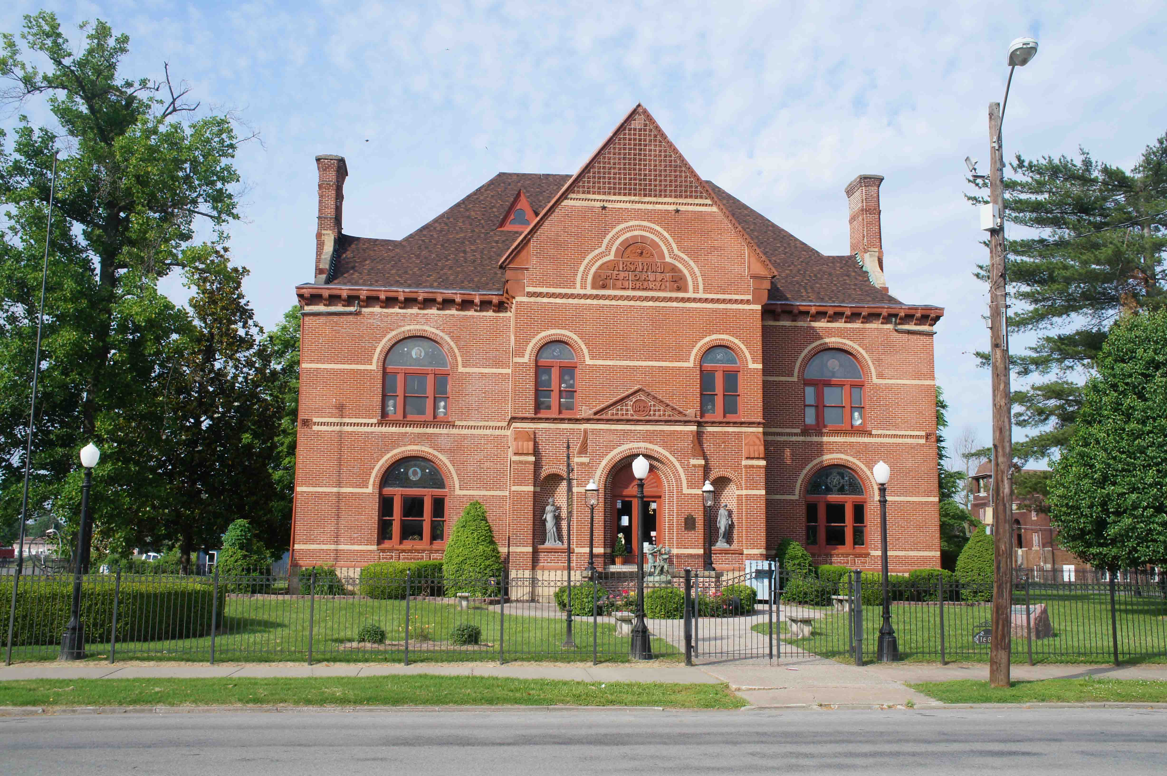
Library, Cairo, Illinois.
Magnolia Mansion, Cairo, Illinois.
The Subway Gate. Cairo, Illinois.
What is interesting is the lengths that the town folks went to, to protect what
they had in Cairo when they had it. In addition to the levees and floodwalls, there is the "subway gate",
a huge metal floodgate build on the north side of the city to keep the floodwaters from
coming in around the back way. It made Cairo a safe harbor in a sea of flood water.
The Gate was built in 1911. So, obviously there was once something more visible
and tangible and viscerally important to save in Cairo than is apparent today. A community. A way of life.
That sounds harsher that I would prefer.
We did ride past the "Magnolia Mansion" and another equally beautiful mansion on our way out.
Cairo is a visible question mark about how our society deals with the impacts of a changing economy
on a community or a region. Be it Cairo, or East St. Louis, or Detroit, or anywhere.
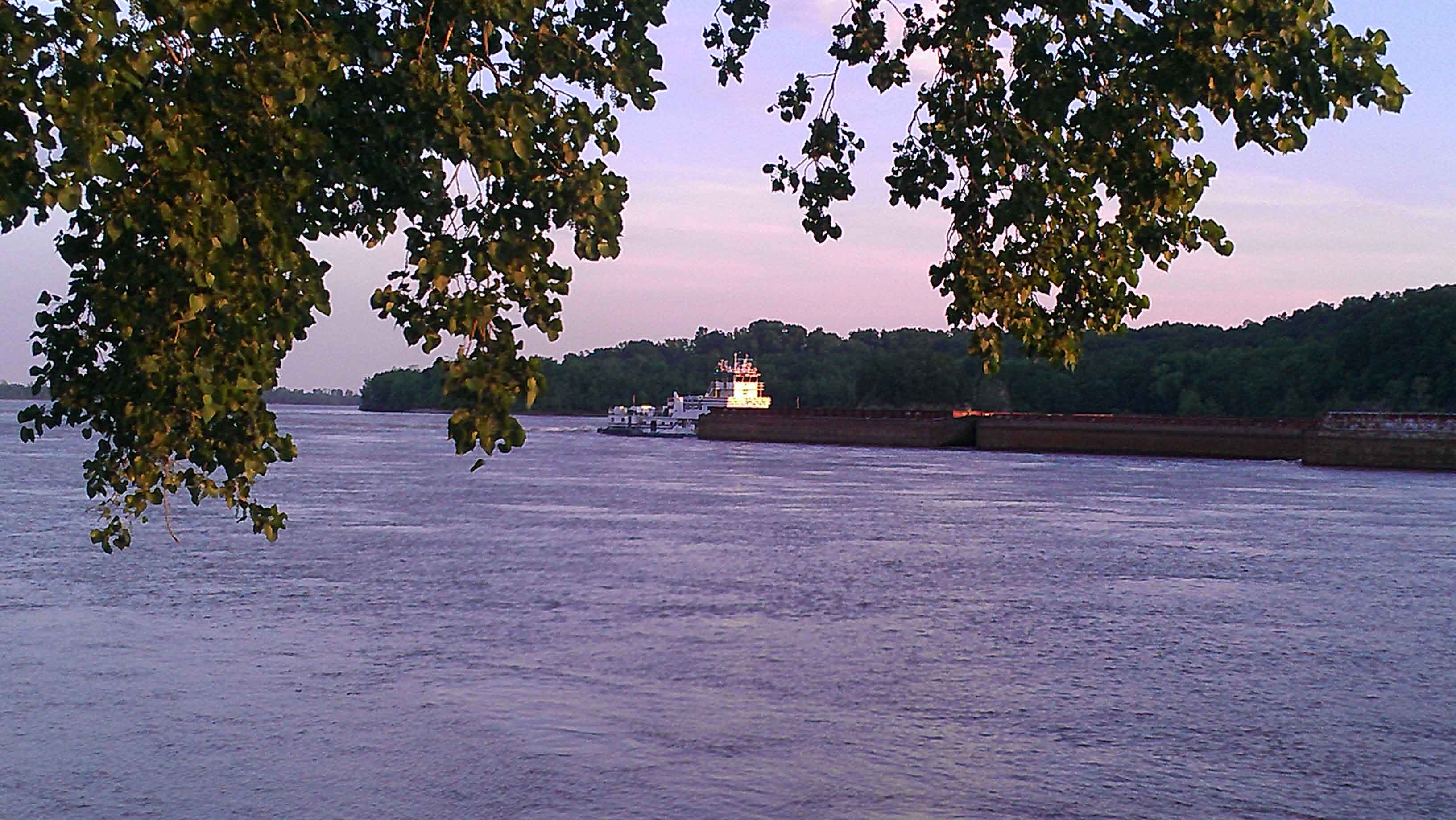
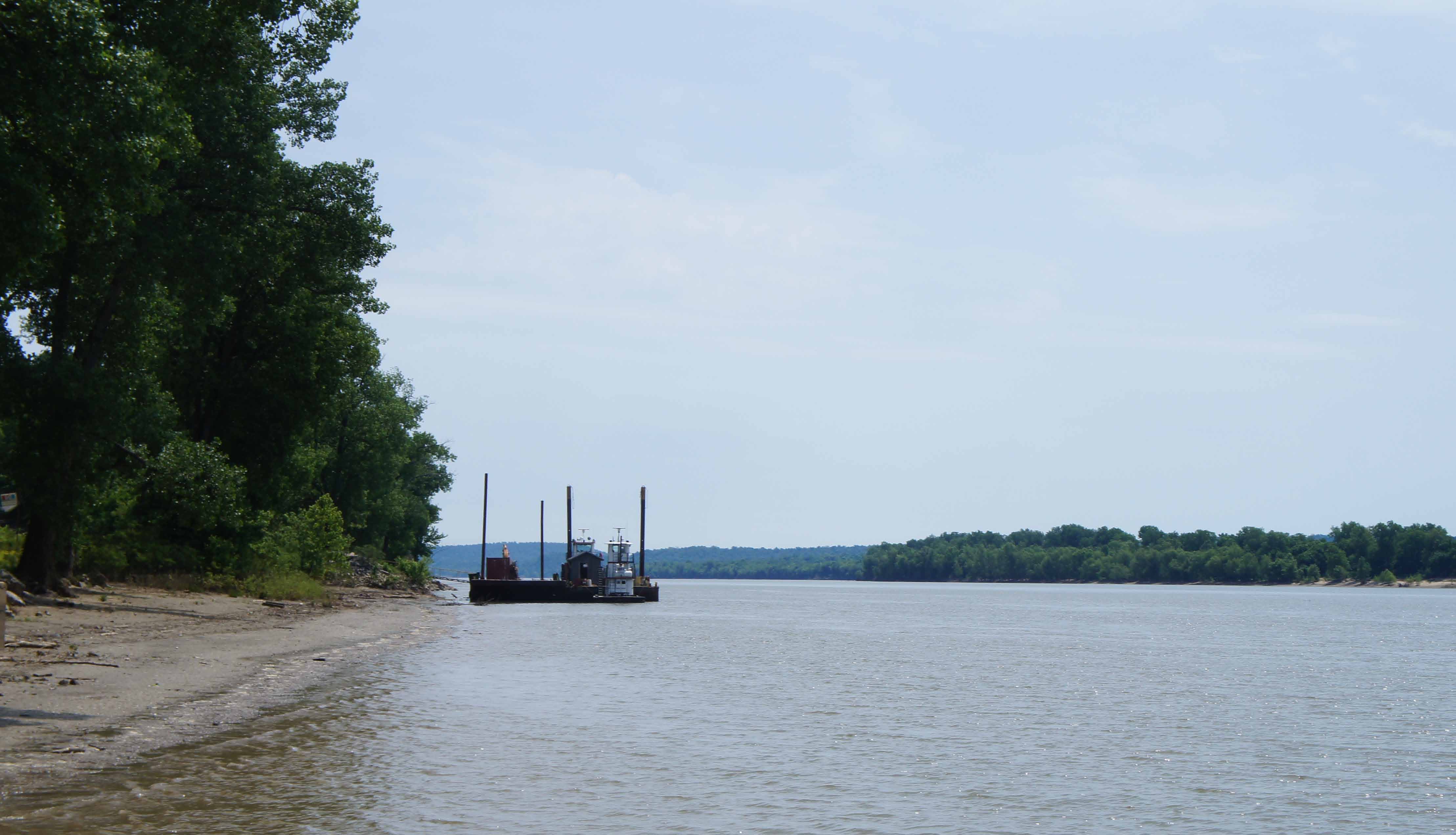
Barge Tow heading North on the Mississippi River at Grand Tower.
Heading north out of Cairo, we meet two riders heading south. They are biking,
in separate trips,
the Mississippi River from St. Paul-Minneapolis south.
This trip is from St. Louis to Memphis. Safe travels guys.
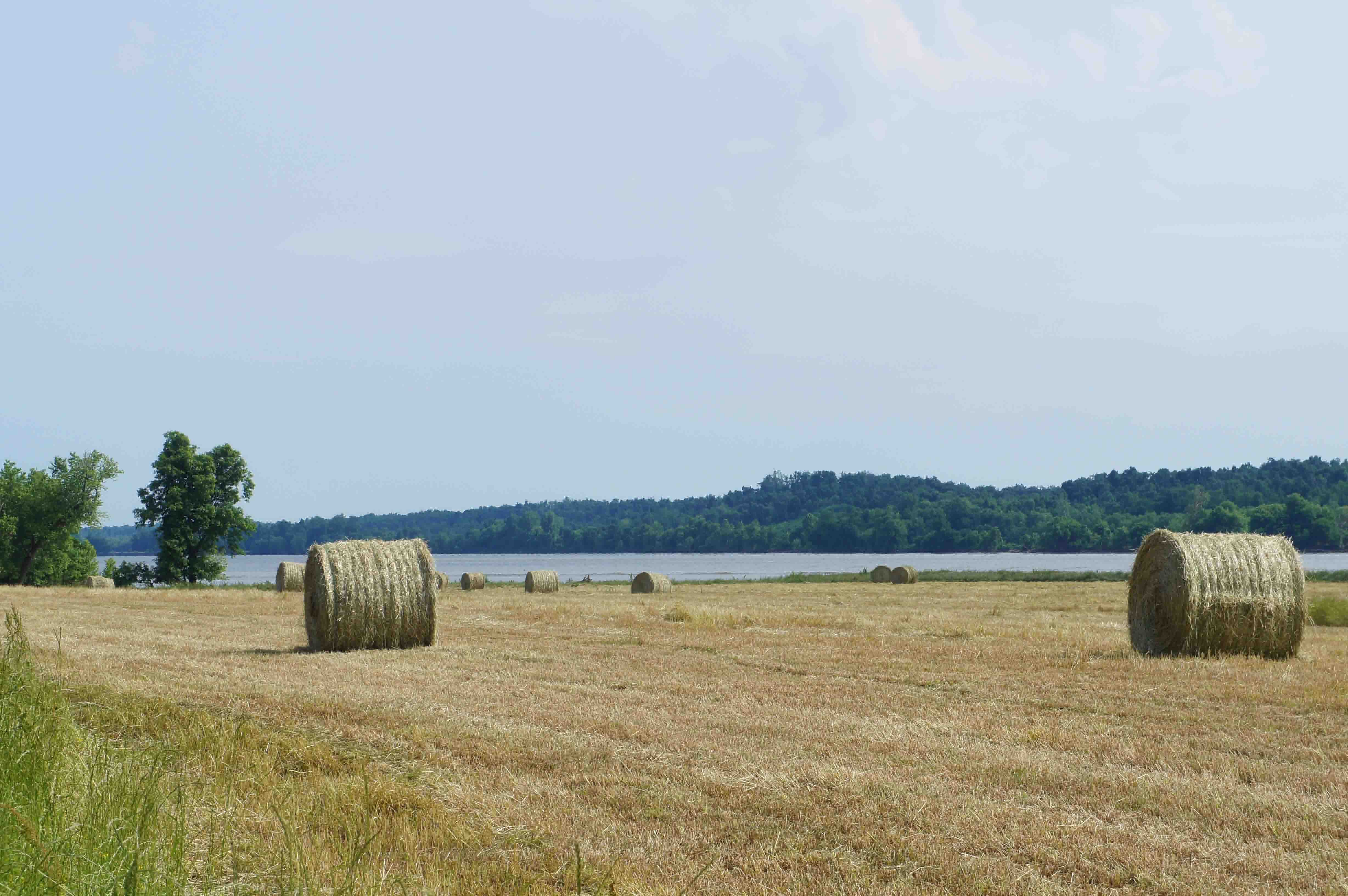
We generally are on wooded or farmed floodplain and the riding is pretty easy.
Near Thebes, we do come down a slight hill, which gives us a fantastic view of
the muddy brown Mississippi River, churning and covered in white caps, in all its
impressive mightiness.
We have lunch at a pizza restaurant in McClure, opposite Cape Girardeau, a town
I know from my Mississippi River raft trip. I am soooo hungry that the iceberg
lettuce explodes in my mouth with flavor! It is tasting verrry gooooood. We see
box turtles and cypress trees frequently today as we are crossing the bottoms.
The weather forecast said it was coming, but finally 20+ mph winds kicked up from the South.
This is good wind as we are heading north. We traverse 25 miles quickly and pull
into Grand Tower, and find a spot in Devil's Backbone State Park. It's only 3pm.
A seemingly short day - a rest day of sorts. Hot showers. We learn about 50 amp RV
campsites (my house only has 150 amp service) and the competition to have "pushouts"
in your travel trailer rig - six seems to be the minimum for a noticeably nice rig.
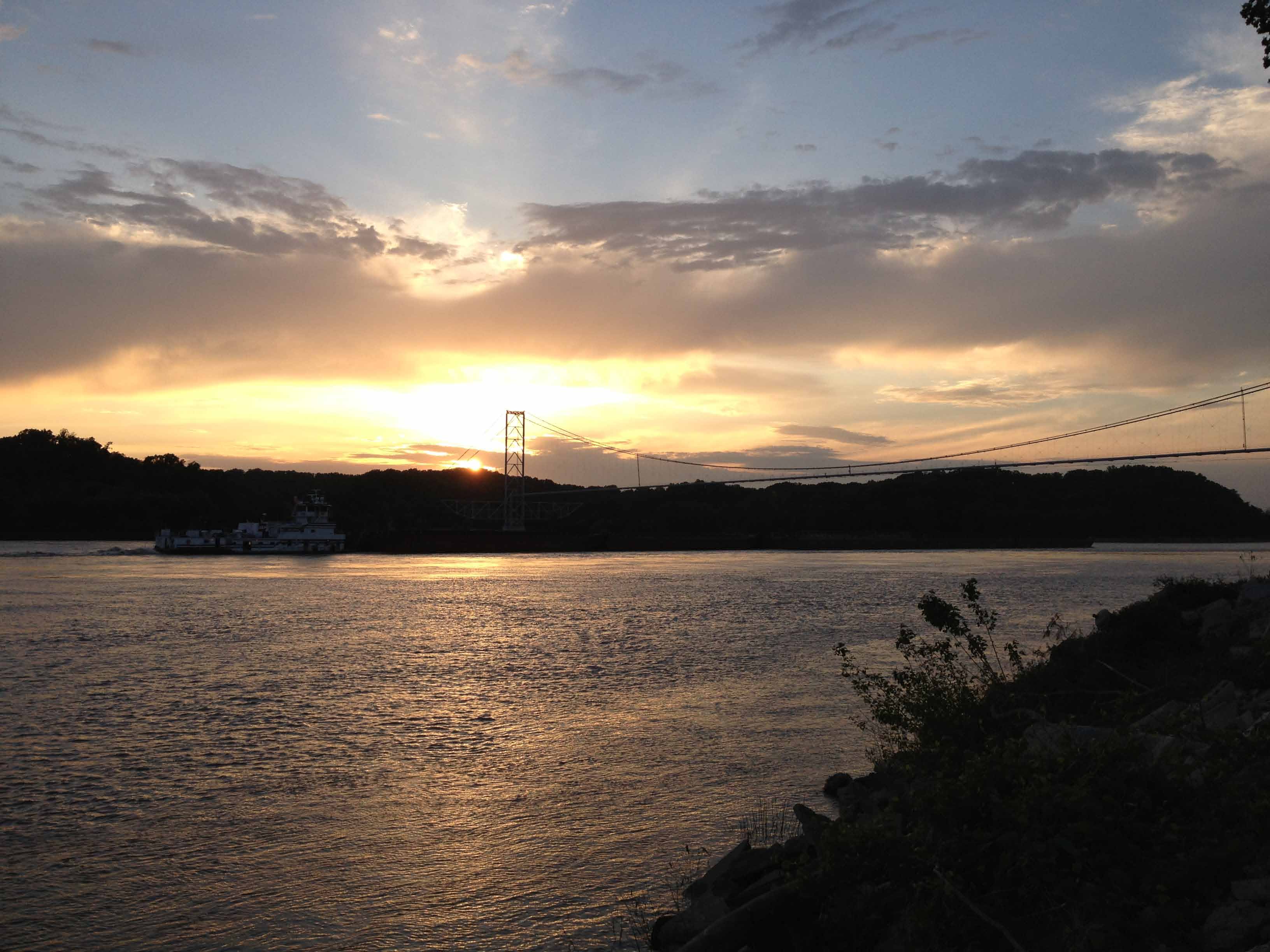
Sunset, looking west from Grand Tower.
From our campsite, we can see the Missouri bluffs up against the river, the
Illinois bottom lands and the Illinois bluffs back behind us. The end of the
day is warm (85 degrees) and the gusting wind takes its time dying down at the end of the day.
65 miles today. 395 miles total.
Wednesday March 29, 2013: Grand Tower, IL to St. Genevieve, MO.
We will be entering the heart of the French Country today.
Most American's don't know that the French had settlements in the "Illinois Country", an area included
in what ocassionally was called
"Upper Louisiana". The
Illinois Country provided wheat to the always food short French settlements
along the St. Lawrence River, including Montreal, and the Atlantic Provinces of what is now Canada.
It's heart was the middle Mississippi River and the Illinois River. There were a number
of french settlements on other midwestern rivers, too, that were considered part of the Illinois Country.
From the Mississippi River, just north and west of St. Louis, the Illinois river heads NNE. At
the headwaters of the
Illinois River, a short portage leads to the Chicago River, the Great Lakes, and the St. Lawrence River.
This was all french fur trapper and voyageur country and was one of the reasons Lewis and Clark could recruit
voyageurs, woodsmen of the rivers, in St. Louis. The French lost their claim to the land north of the
Ohio River and east of the Mississippi after the French and Indian War (1762), and sold their rights to the
lands west of the Mississippi - Louisiana - to the United States in 1803. The French are why there
is a St. Louis, a Ste. Genevieve, a Prairie de Roche, a Fort Chartres, a Cahokia, and a scent of french
culture in the middle of Ameica.
As we ride out from our campground and along the front street in Grand Tower, we hear a woman
simultaneously wail out of an open window and lament: "Why did you wait until this morning to
tell me you were leaving ... ??" A sad and difficult way to start the day.
Our day starts out and stays much better than her day. We are on flat terrain and make
good time up north past Gorham almost all the way to Chester. We are on a road set at the bottom
of the bluffs, with the fields and the River to our left. The weather is good. There is no traffic. The
forecast says windy; it will
be a tailwind, but nothing yet. About 25 miles in and about 5 miles outside of Chester,
the road starts a slow climb out of the floodplain. This ascent begins at an barge/dock complex on the River.
Asphalt is being unloaded into trucks and being hauled into downtown Chester.
The hills into Chester and the noise from the trucks make the last five miles into town a little irritating.
Noise or not, those truckers are respectful of us; never a concern about being sideswiped or honked at by
any of them. The residential area we pass by before downtown is pretty enough, but downtown is un-remarkable
and hard to define. It generally appears to be around a multi-block food processing plant which is the
middle of town; that's about it. We grab lunch before heading north and west.
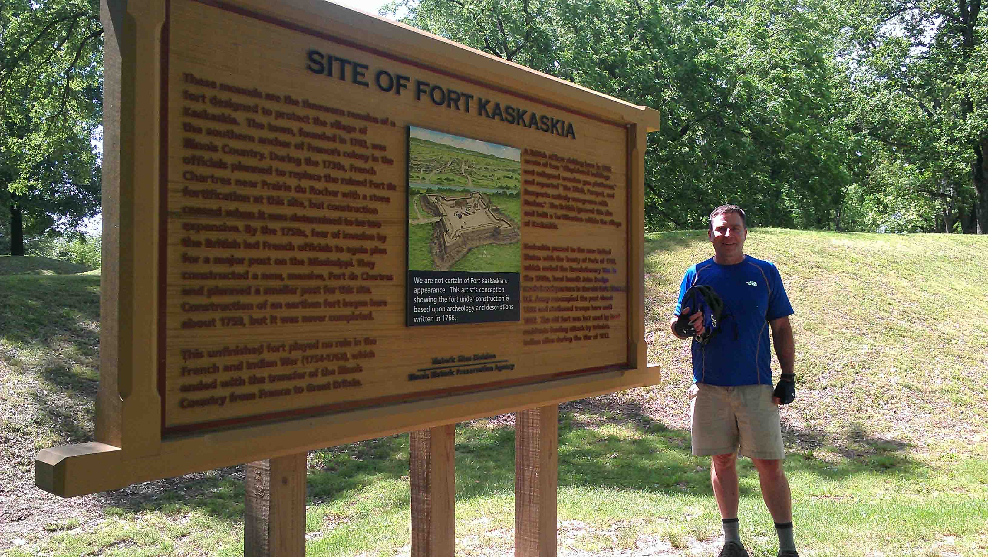
Fort Kaskaskia, Illinois.
Our first stops are the Pierre Menard House and Fort Kaskaskia State Historic Site
about 8 miles north and west of Chester. We are riding hills out of Chester, but once
we turn left off Rte. 3 towards the River, the fort and the Menard House, I feel like
the little dog in the "Grinch that Stole Christmas". I am sitting on top of a mountain of toys on
a sleigh as it zooms back into Whoville. We are rocketing downhill and I am wagging my tail
all the way down.
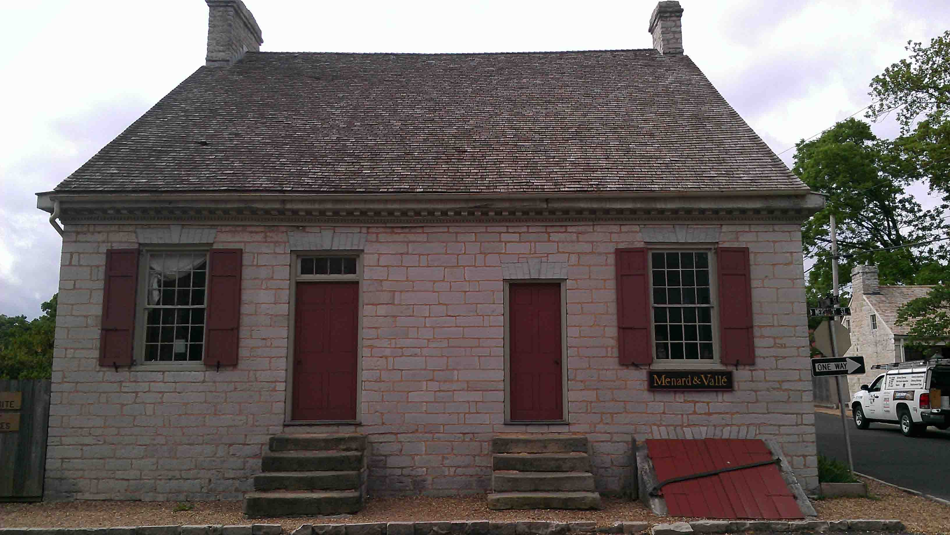
The Pierre Menard House is our first hard evidence of the French presence in the area.
It is a lovely restored house, with a broad front porch. It doesn't get many visitors,
so we receive individual attention from the park ranger as we walk through the house. A
map in the basement showing the 50 largest cities in the U.S. in 1850 includes Cairo, IL and
Henderson, KY. The house is set very pleasantly also. After Pierre Menard House,
Jack bikes (I hoof it) up to the hill behind the house, where the French established
Fort Kaskaskia. The fort, though never large or much more than ditches, wooden palisades,
and earth mounds, had a commanding view of the Mississippi. The original French settlement
of Kaskaskia is now on an island just to the west and south of us. It was physcially split from
the rest of Illinois when the Mississippi cut off an oxbow;
it is now only accessible from Missouri.
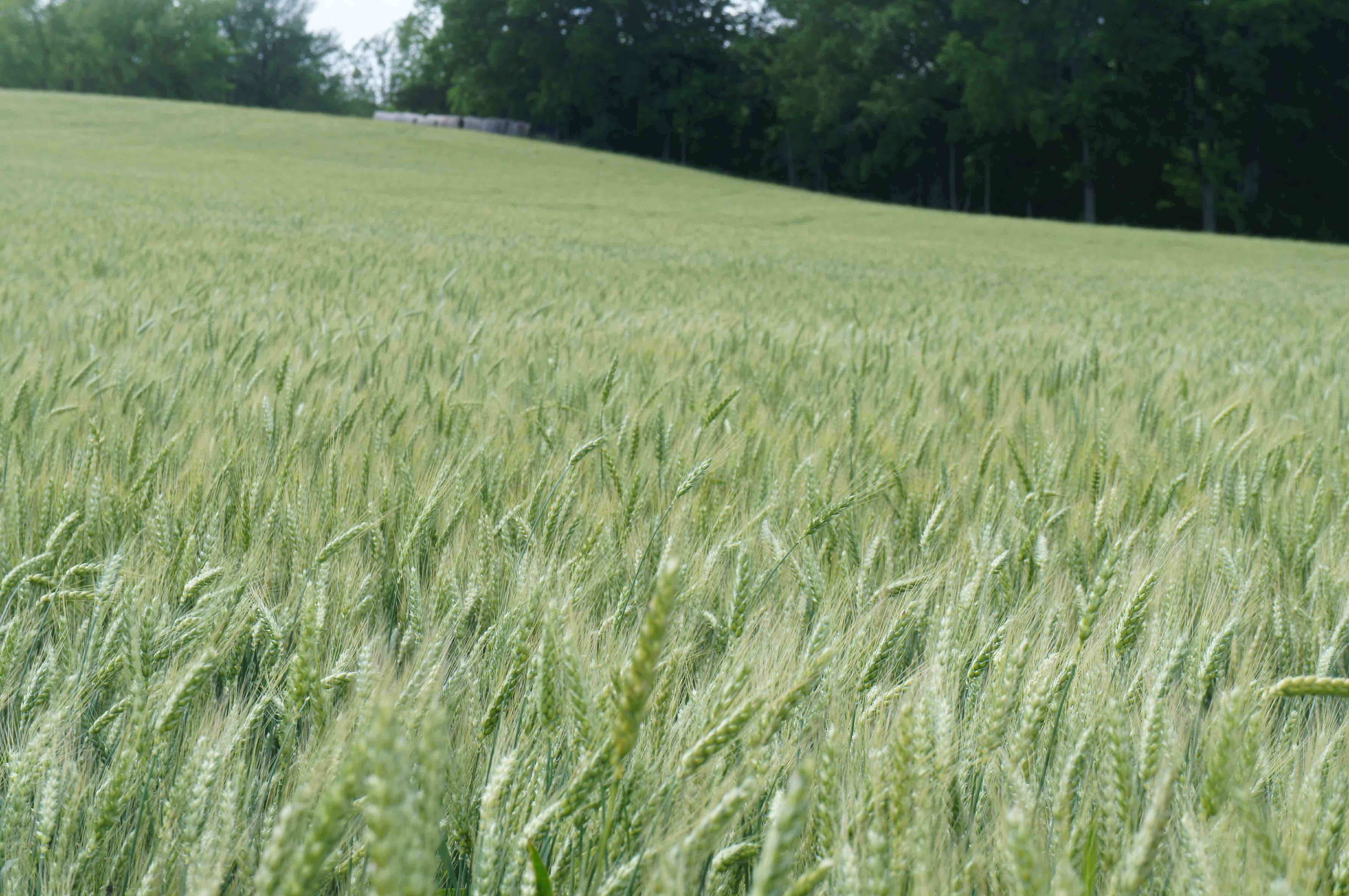
Illinois wheat field.
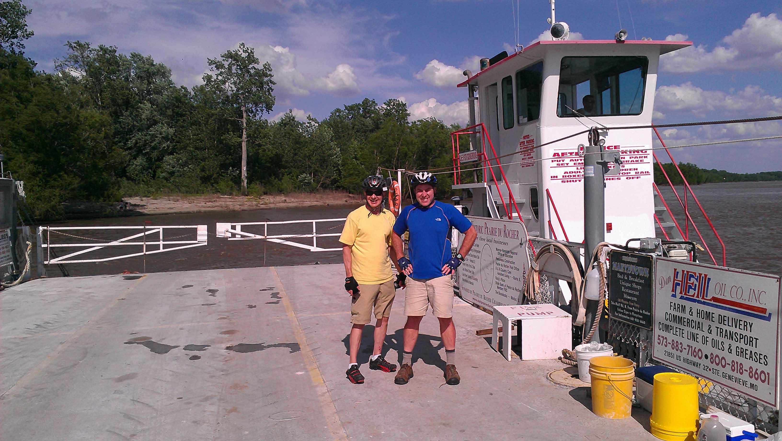
On the Modoc - Ste. Genevieve Ferry.
From Fort Kaskaskia, we follow the river a bit before we climb back onto
the bluff, travel through Ellis Grove, head west across the Kaskaskia River, and then return
to bottoms lands, picking up "Bluff Road" to Modoc. There is a very strong wind from the SSW,
which doesn't bother us until we turn southwest onto Modoc Ferry Road to get to the ferry to
Ste. Genevieve, MO. Bam... We slow to about 1/4 mph in the wind. It is a hard ride, but we persevere.
The farm road turns to dirt which then merges with a dirt
road on top of the river levee. No sign of a ferry dock. This causes momentary concern until
we sight the ferry landing past the trees. Now, we just have a fun ferry ride across and need to find a place for the night in Ste. Gen.
Our trip over on the River was interesting. Lots of rain up north on the Mississippi had
river levels rising. Lots of trees were rushing by. Rain is in the forecast for tomorrow.
I have been to Ste. Genevieve twice before. Once in the mid 1990's
when I first started exploring the Mid-West. On that trip, my short excursion on the small
ferry was unexpectedly exciting. A strong wind kicked up. Big white caps frothed the width
of the Mississippi and pushed the ferry around a bit. It was a memorable crossing. My next visit
took place in 2009, when our river trip from St. Louis to Memphis stopped here. The state park
ranger at Ste. Gen. had been so helpful to us when we wandered into town from our boats that hot
summer day. This time, I am hoping to show off some of the French colonial architecture to Jack,
and to see if the same ranger is still at the state park visitor center. Unfortunately,
we arrive too late. The state park
has closed for the day.
Ste. Genevieve is a little farther from the ferry dock that I remember, but we finally arrive at the
center of town. Jack and I find a B and B. We look at some of
the old French homes that remain and dine at a restaurant housed in an old saloon. Given the
picnic tables, campgrounds, and the Wickliffe Motel that made up our previous accommodations,
I slept warmly, comfortably and well.
67 miles today. 462 miles total.
Thursday March 30, 2013: St. Genevieve, MO to St. Louis, MO via East St. Louis, IL.
There is always the anticipation of finishing your ride and getting to you destination.
Knowing the
French Illinois Country history we will see today and the extremely good cream cheese filled "french"
toast breakfast we were served at the B and B also point to a good day.
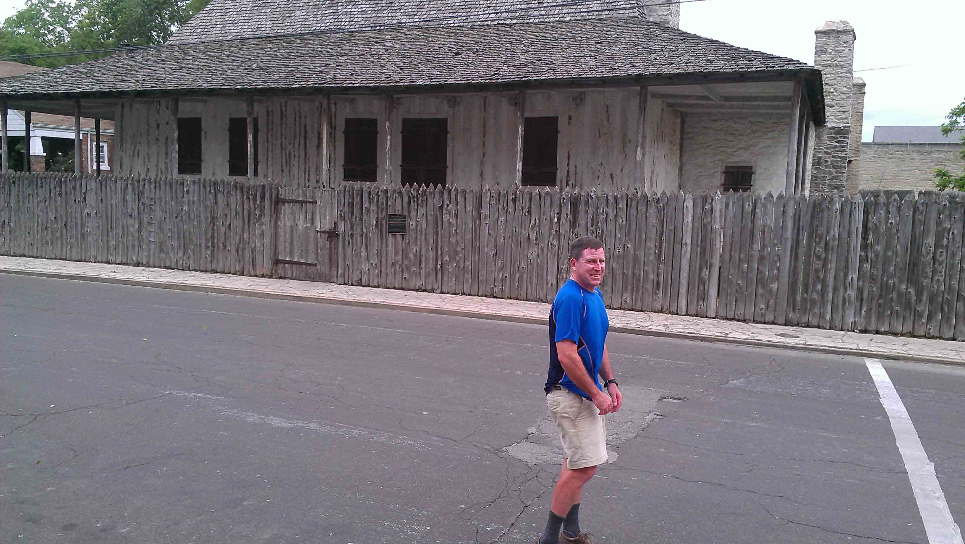
Louis Bolduc House. "Poteaux sur solle" home. Ste. Genevieve, Missouri.
We have a little bit more time to explore Ste. Genevieve and the French "poteaux en terre" and
"poteaux sur solle" homes. Ste. Gen. has one of the largest extant collections of old French colonial
architecture
between the St. Lawrence River and New Orleans. The town was founded in 1740 and moved to higher
ground about 1785.
Though France ceded its lands west of the
Mississippi to Spain after the French and Indian War in 1762,
the Spanish were probably even worse than the French at colonization, and don't appear to have
left as much of a legacy here
as the French.
The French inhabitants continued on with their lives, albeit, allegedly as Spanish
citizens, and
continued to dominate the cultural and economic life of the area.
Menard Valle House, Sainte Genevieve, MO.
Back at the ferry, heading over to the Illinois shore, the ferrymen point out the River is up
two feet from yesterday afternoon, and that the forecast is for a three foot rise today.
They expect the ferry will be closed by the weekend.
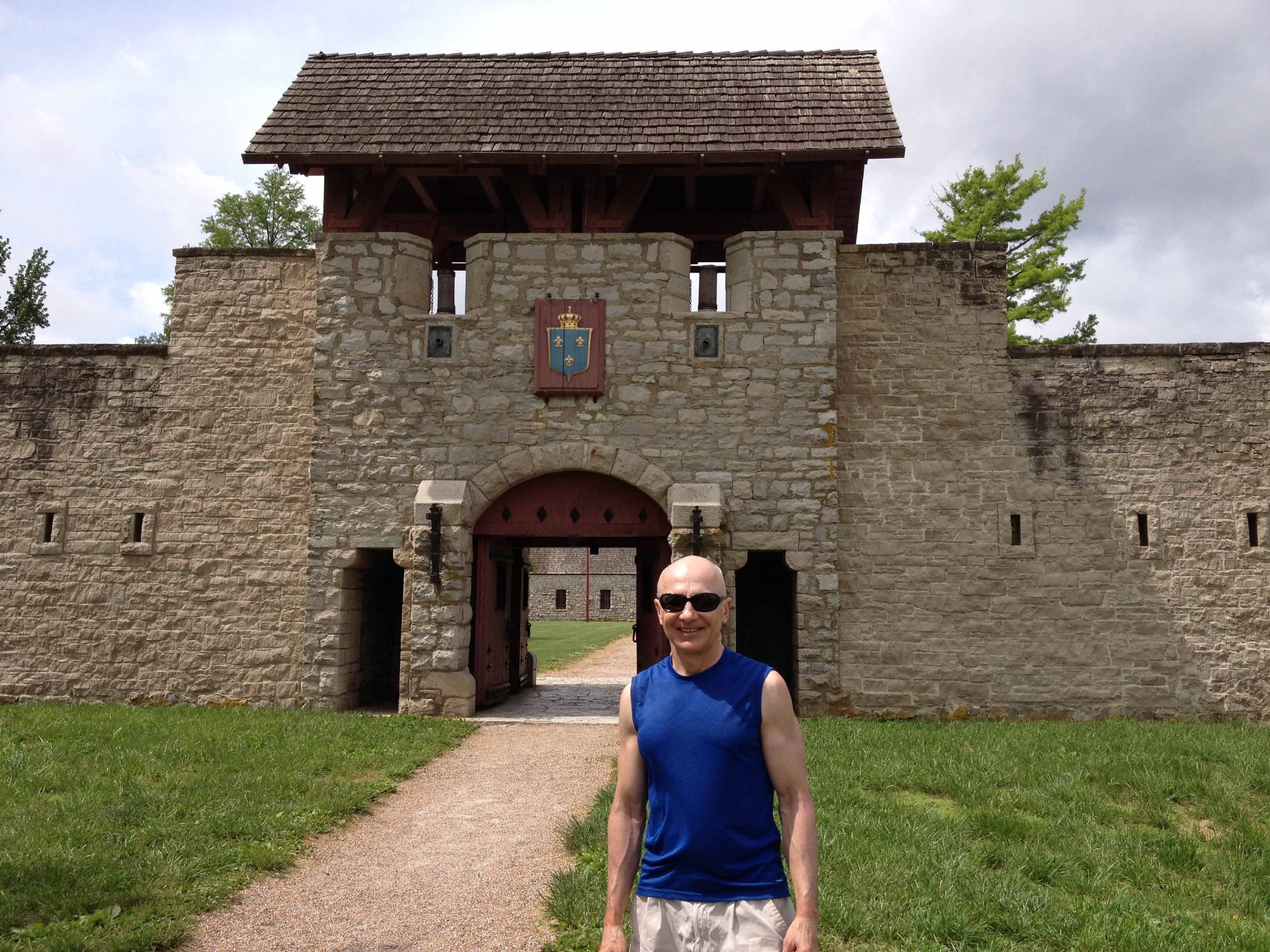
Fort Chartres, Illinois.
From the Illinois landing, we bike back to Modoc, turn north on Bluff Road to Prairie
Du Rocher, and head west back towards the river to Fort Chartres. Now, for the un-informed,
Fort Chartres is a real head scratcher: a large masonry fort seemingly in the middle
of nowhere. It is nowhere by today's standards, but back when it was built, it
commanded the Mississippi River and anchored France's Illinois Country settlements.
While earlier wooden forts occupied the site, the French got serious in the 1740s,
and built this stone structure. We happen to arrive the day before the
annual Rondez Vous, where visitors, re-enactors, and vendors show up to celebrate
Fort Chartres history. We enjoy the fort and the museum.
Rain and No Rain, Fort Chartres, Illinois.
The clouds at our
arrival turn into a torrential downpour after our museum visit, but the rain only
lasts a half an hour and we head north toward
Cahokia and St. Louis with only the puddles in the road to worry about.
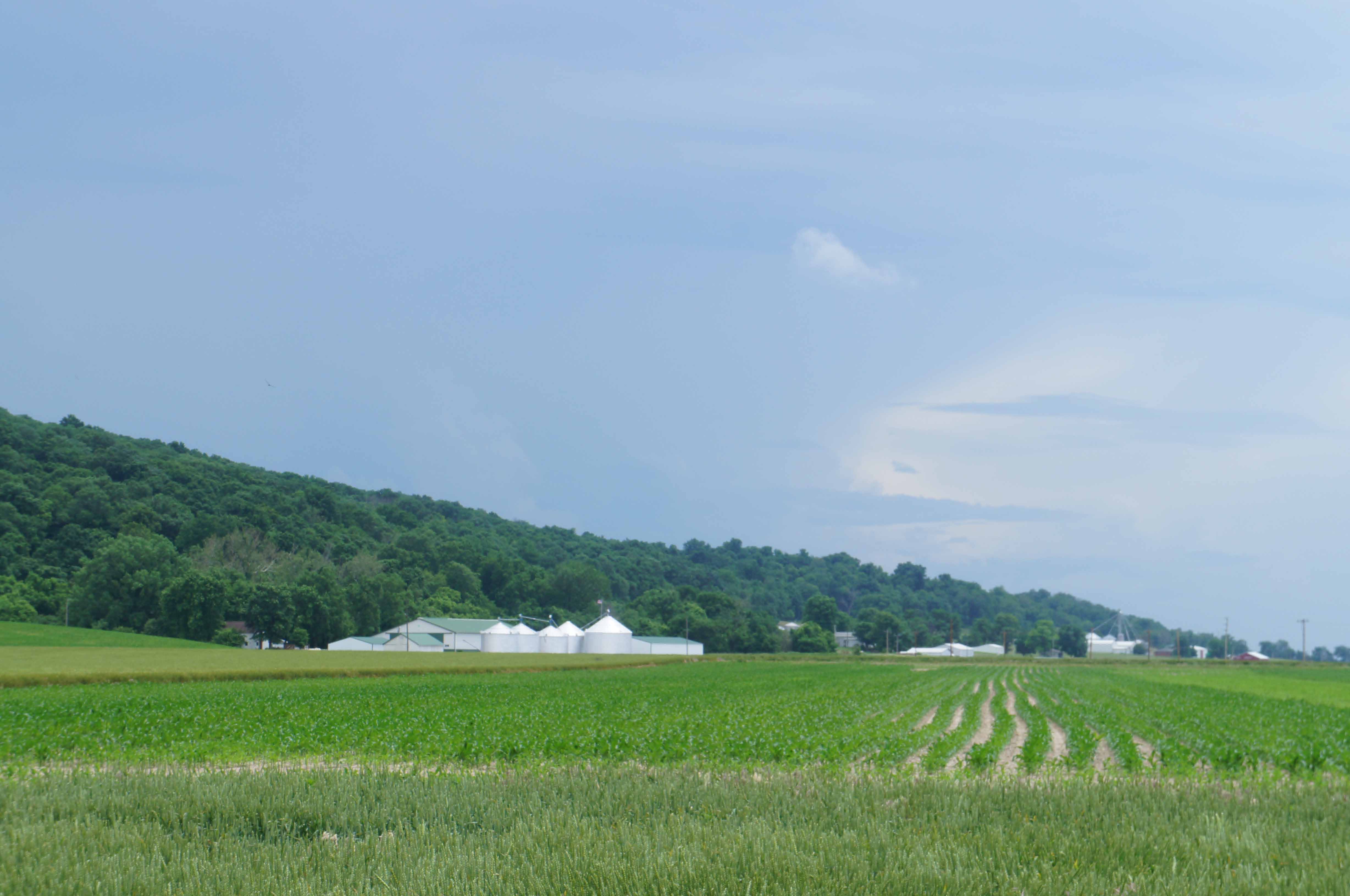
Farmland up to the Bluffs north of Fort Chartres.
We are again on the "Bluff Road", skimming along the east edge of the floodplain and the western base
of the bluffs. We stop at Old Valmeyer and then chug up to New Valmeyer for lunch, and then
ride on to St. Louis.
We are making excellent time, in good weather, on good, flat, low traffic roads. We hit the outer
suburban ring of the St. Louis metropolitan area, and start picking our way along old roads into
East St. Louis, trying to avoid the extensive network of interstates and limited access
highways that make up what seems to be 95% of the road network here. We successfully steer through
Cahokia, which is pretty quiet, then through an industrial/rail yard area that is so characteristic
of these floodplain communities, and enter East St. Louis.
East St. Louis is hard for us to understand and navigate. It is so foreign to us in its
appearance, poor and so empty one would describe it as abandoned; build around a checkerboard
of marshes, high ground, industry, rail lines, and interstate highways that seemly carry traffic over
and through, rather than to, East St. Louis. We are constantly checking our maps and our
location to make sure we are supposed to be where we are, and we generally are.
We are searching for signs (signs in the broader sense, though we are looking for highway signs, too)
that we are approaching downtown East St. Louis, but aren't offered any visual clues. No skyline,
no increase in density or activity, no directional signs. 9 out of 10 houses are gone.
The only retail establishments we see have small handmade signs and are folks selling convenience
goods out of their front doors. Residents sit on chairs in the green space between the sidewalks and the
curb in the "good" neighborhoods; in some neighborhoods, the
chairs don't get out beyond the front of their houses. We pass a burned out high school
(there is a new high school somewhere, but the ruins
of the old high school send a strong message.) I finally see the silhouette of a tall gothic building;
we are approaching downtown. Then I notice the windows in this ten story building are broken out
and I can see through the building. It is tragic. East St. Louis is something we like to pretend
does not exist,
because I don't think we know how to fix something like this. We make the last few maneuvers
and guesses to the get to the Meigs Bridge, one of the few bridges that allows bikes
in the St. Louis area, and land safely in downtown St. Louis, MO. That is, until I almost kill Jack
by crossing a busy intersection against the light. Pause. Breath. Regroup.
We find our hotel a few blocks away, and it is new, clean, pleasant, and safe. Whew.
A good way to put to rest the confusion of the last 10 miles in. It starts raining again,
just as we check in so we have dinner in the hotel.
63 miles today, 525 miles total.
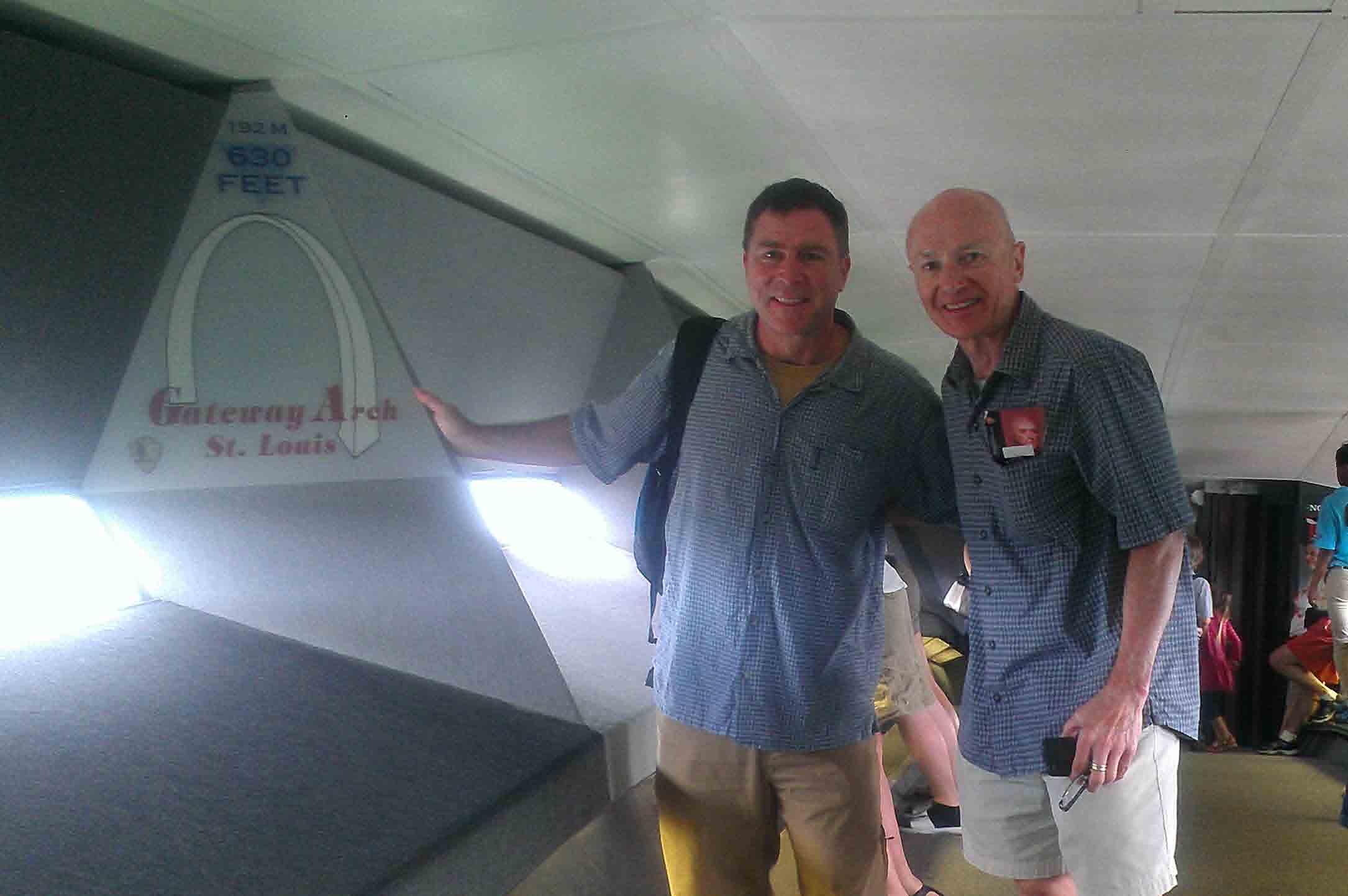
Friday March 31, 2013: St. Louis, MO
After cleaning up, a good meal, and a comfortable sleep, Jack and I have a full day to explore St. Louis,
a city I love.
Top of the Arch, St. Louis, Missouri.
The structure itself represents an amazing design and an amazing construction feat. The museum
of Western Expansion in its base is excellent for any budding or knowledgeable western american
history buff. The bookstore is a good source for finding western american history books.
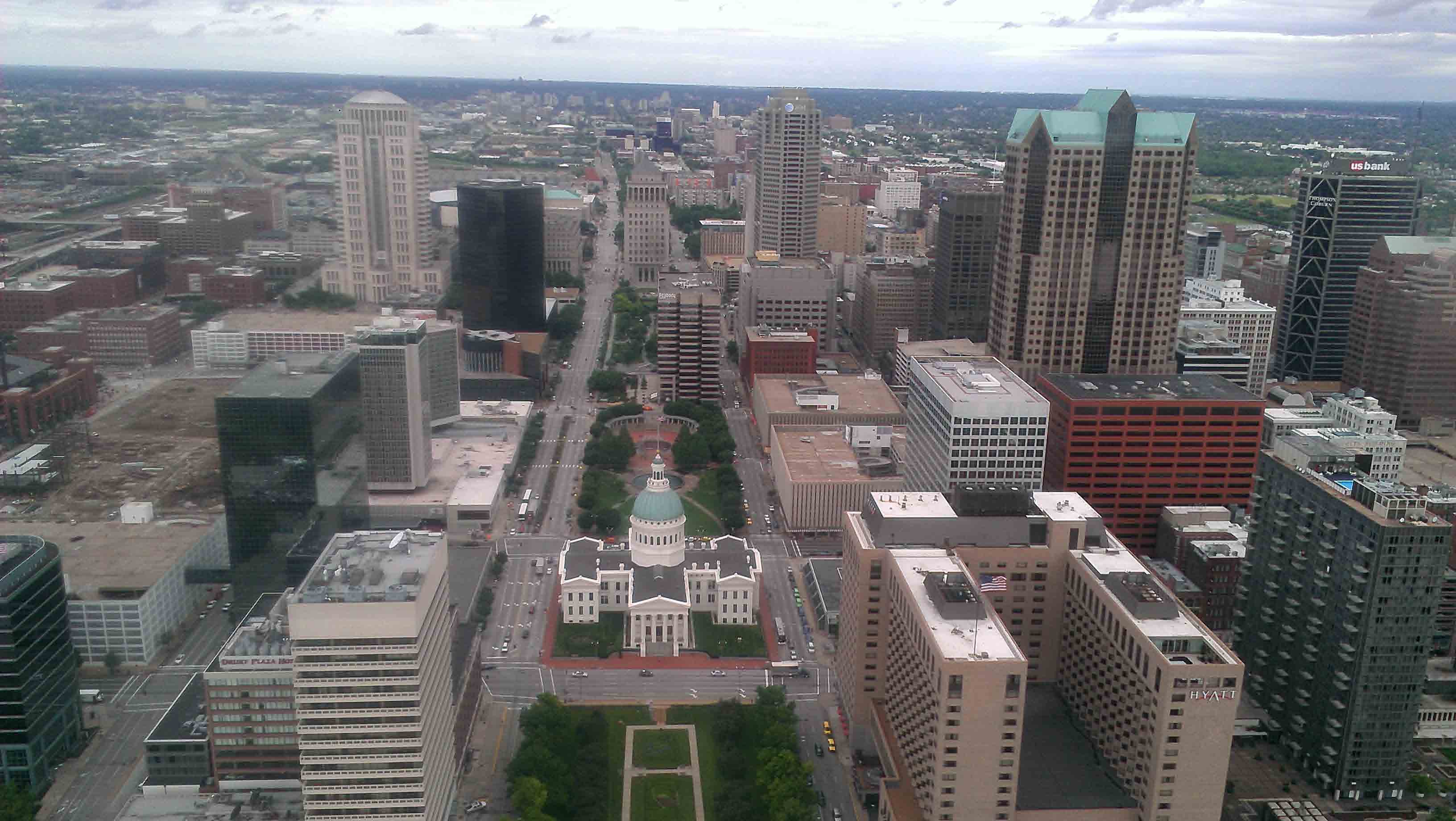
View of downtown St. Louis west of the Arch.
From the top of the Arch, you get views that not only highlight St. Louis to the west but the St. Louis
riverfront. It also gives you a good idea of the industrial uses of the Mississippi River and
how the river and floodplain geography influenced
the history and prosperity of East St. Louis.
During the era of urban renewal, when folks did what they thought was best to stem
America's flight from its cities, the site of the Arch, as well as huge swaths of old St. Louis
were cleared. Some old pictures of the area around the site of the Arch show busy, dense, and worn
brick residential and commercial structures. One can imagine if those structures were not torn
down, and stayed or were put back into use.
For some additional information on St. Louis urban renewal history, see .....
Kansas City to St. Louis, MO
— Trip # 29 - Finishing the Lewis and Clark Trail.
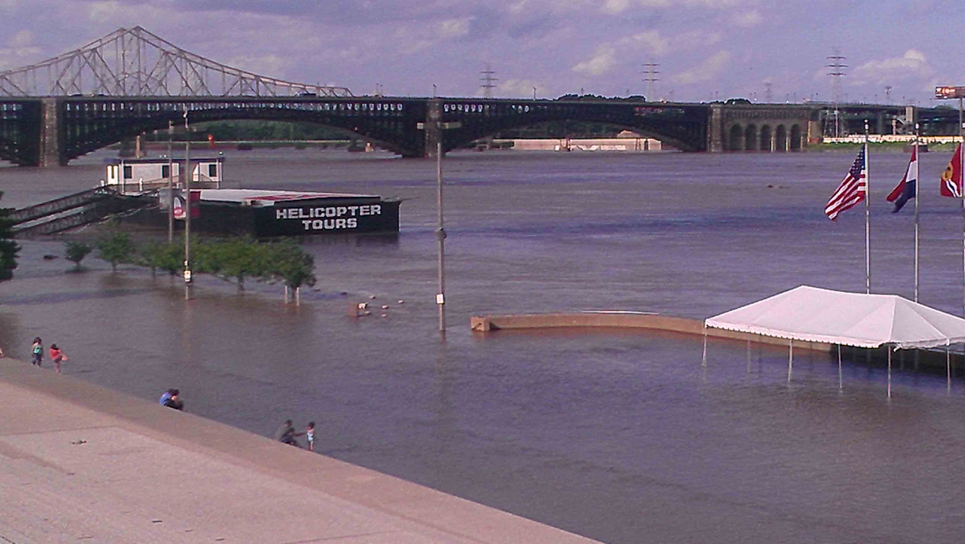
St. Louis riverfront from the St. Louis Arch looking north towards the Meigs Bridge.
Note the high water, which
we saw signs of when we were crossing the Mississippi at Ste. Genevieve. The water continued to
rise during our entire stay in St. Louis.
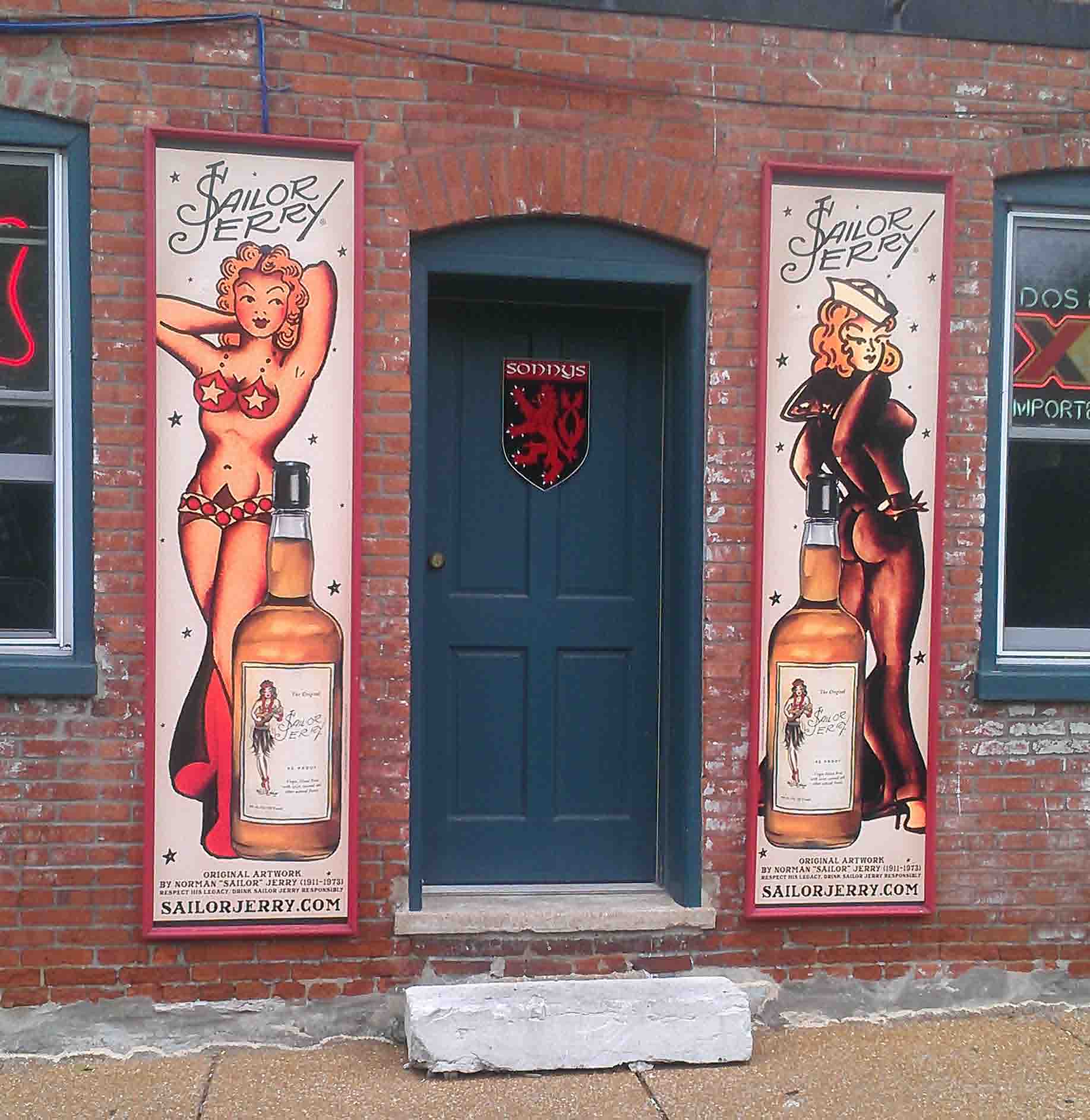
Bar Entrance in Soulard.
Soulard is an older neighborhood south of downtown that survived much of the urban renewal and removal that
occurred in St. Louis. There is an old market there that serves as the center of the neighborhood. As
you can tell, the neighborhood has a lot of charm.
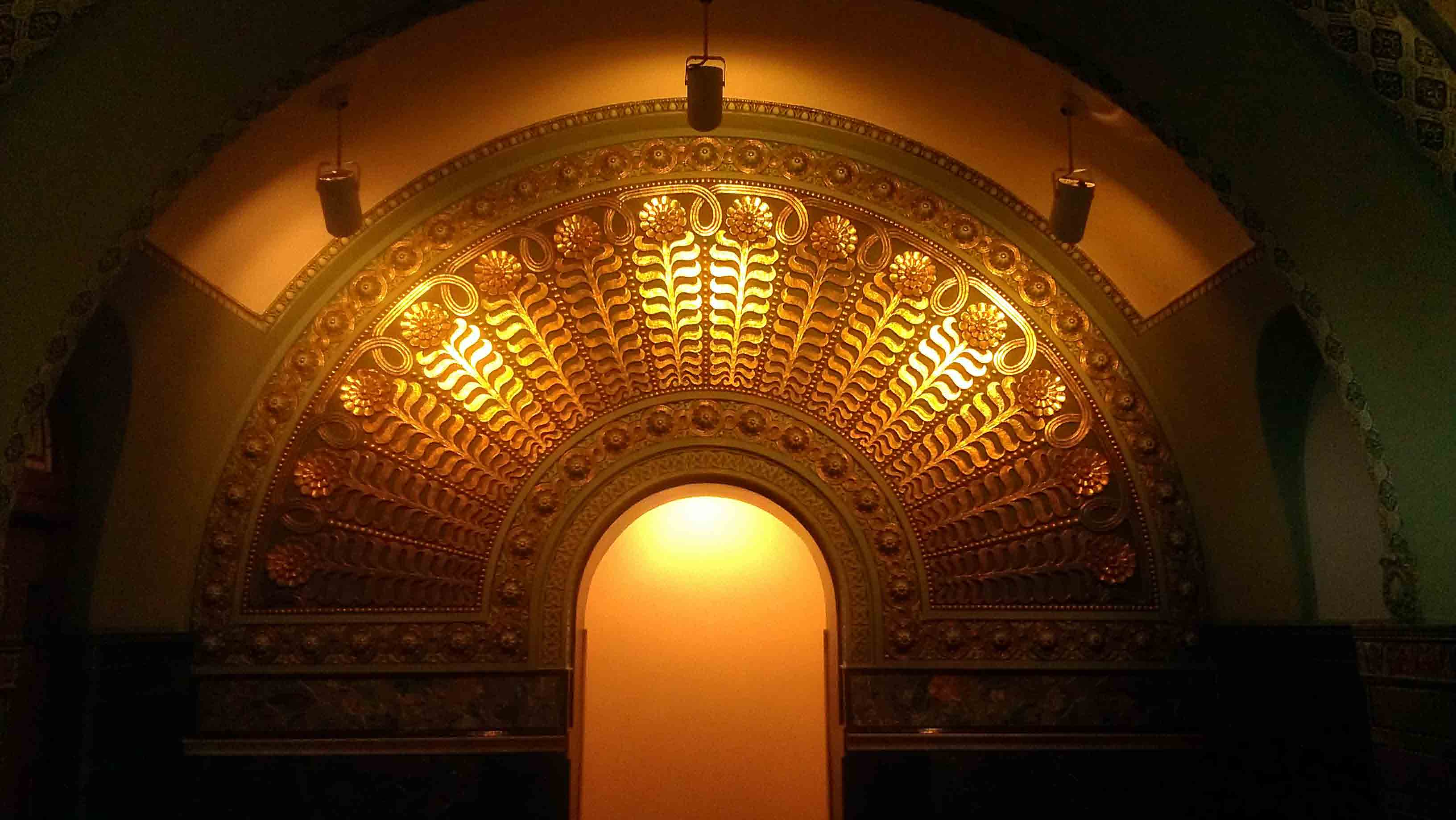
Detail inside the restored St. Louis Union Station.
Efforts at urban preservation in St. Louis seem to have centered, in part, on maintaining a downtown and keeping
that downtown connected with the west end of the city. Union Station is mid-way between the two. Union Station,
obviously is a magnificent building, and is still a key link between downtown and the west end.
Epilogue
I am extremely happy to have had Jack P. join me on this trip. It is rare to have someone volunteer to make
a 525 mile bike trip, particularly through a mostly rural country, and to put up with the eccentricities of
someone who has
his own, well-established biking routines. As this is a key trip towards my finish line, it was
particularly gratifying
to have good company. And it was good for me to bike with someone that was in much better condition than I was, and who
never complained. Many thanks, Jack, for sharing this trip with me and making in so much more enjoyable.
Background on the Lewis and Clark Expedition
For some background on the story of Lewis and Clark from their meeting in Clarksville, IN, across the
Ohio River from Louisville, KY, to the Confluence and on to St. Louis. See:
Lewis and Clark 1803: Louisville
to St. Louis and Camp Dubois
Last Update: December 29, 2013.